Ihringen
Ihringen is a town in the district of Breisgau-Hochschwarzwald in Baden-Württemberg in Germany, just east of Breisach am Rhein and west of Freiburg im Breisgau at the southern end of the Kaiserstuhl. It is known for its wine.
Ihringen | |
|---|---|
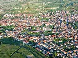 Aerial view | |
 Coat of arms | |
Location of Ihringen within Breisgau-Hochschwarzwald district 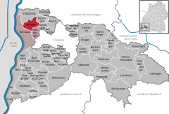  | |
 Ihringen 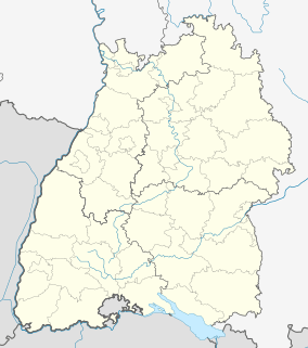 Ihringen | |
| Coordinates: 48°3′N 7°39′E | |
| Country | Germany |
| State | Baden-Württemberg |
| Admin. region | Freiburg |
| District | Breisgau-Hochschwarzwald |
| Subdivisions | 2 |
| Government | |
| • Mayor | Benedikt Eckerle (Ind.) |
| Area | |
| • Total | 23.00 km2 (8.88 sq mi) |
| Elevation | 202 m (663 ft) |
| Population (2018-12-31)[1] | |
| • Total | 6,088 |
| • Density | 260/km2 (690/sq mi) |
| Time zone | CET/CEST (UTC+1/+2) |
| Postal codes | 79241 |
| Dialling codes | 07668 |
| Vehicle registration | FR |
| Website | www.ihringen.de |
Climate
By some sources, it is the warmest place in Germany. [2]
Under the Köppen system, Ihringen closely borders an incredibly rare 48°N humid subtropical climate (Cfa), with mildly cold winters and long, hot summers. The city is close to the Kaiserstuhl, a range of hills of volcanic origin located a few miles away which is considered to be one of the warmest places of Germany and therefore considered as a viticultural area.
Climate types
| Climate data for Ihringen (Emmendingen (Mundingen) 2000-2008) | |||||||||||||
|---|---|---|---|---|---|---|---|---|---|---|---|---|---|
| Month | Jan | Feb | Mar | Apr | May | Jun | Jul | Aug | Sep | Oct | Nov | Dec | Year |
| Average high °C (°F) | 5.9 (42.6) |
7.9 (46.2) |
11.8 (53.2) |
16.5 (61.7) |
21.3 (70.3) |
25.5 (77.9) |
26.0 (78.8) |
25.4 (77.7) |
20.9 (69.6) |
16.5 (61.7) |
9.9 (49.8) |
5.9 (42.6) |
16.1 (61.0) |
| Daily mean °C (°F) | 3.4 (38.1) |
4.8 (40.6) |
7.9 (46.2) |
11.5 (52.7) |
16.4 (61.5) |
20.3 (68.5) |
21.1 (70.0) |
20.6 (69.1) |
16.4 (61.5) |
12.8 (55.0) |
7.1 (44.8) |
3.7 (38.7) |
12.2 (54.0) |
| Average low °C (°F) | 1.0 (33.8) |
1.6 (34.9) |
4.0 (39.2) |
6.7 (44.1) |
11.6 (52.9) |
15.0 (59.0) |
16.2 (61.2) |
15.7 (60.3) |
11.9 (53.4) |
9.1 (48.4) |
4.4 (39.9) |
1.4 (34.5) |
8.2 (46.8) |
| Average precipitation mm (inches) | 43.7 (1.72) |
42.8 (1.69) |
68.0 (2.68) |
68.3 (2.69) |
105.5 (4.15) |
77.8 (3.06) |
93.0 (3.66) |
92.2 (3.63) |
79.5 (3.13) |
101.0 (3.98) |
71.7 (2.82) |
42.1 (1.66) |
885.5 (34.86) |
| Average precipitation days (≥ 0.2 mm) | 14.9 | 13.4 | 16.0 | 13.0 | 15.1 | 12.3 | 15.1 | 14.8 | 11.7 | 15.7 | 16.7 | 15.3 | 173.9 |
| Average rainy days (≥ 0.2 mm) | 13 | 10 | 15 | 14 | 17 | 16 | 12 | 13 | 11 | 14 | 14 | 14 | 163 |
| Average snowy days (≥ 0.2 cm) | 3.4 | 0.8 | 0.4 | 0.2 | 0 | 0 | 0 | 0 | 0 | 0 | 0.4 | 3.0 | 8.2 |
| Mean monthly sunshine hours | 71.7 | 96.3 | 136.3 | 167.5 | 199.5 | 249.6 | 238.9 | 219.9 | 165.9 | 117.3 | 70.6 | 60.3 | 1,793.8 |
| Source: Weather-Online[3] | |||||||||||||
| Climate data for Ihringen (Freiburg 2015–2020, sunshine 2015–2020, extremes 1949–present) | |||||||||||||
|---|---|---|---|---|---|---|---|---|---|---|---|---|---|
| Month | Jan | Feb | Mar | Apr | May | Jun | Jul | Aug | Sep | Oct | Nov | Dec | Year |
| Record high °C (°F) | 18.8 (65.8) |
21.9 (71.4) |
25.7 (78.3) |
29.4 (84.9) |
33.7 (92.7) |
36.5 (97.7) |
38.3 (100.9) |
40.2 (104.4) |
33.9 (93.0) |
30.8 (87.4) |
23.2 (73.8) |
21.7 (71.1) |
40.2 (104.4) |
| Average high °C (°F) | 5.7 (42.3) |
7.9 (46.2) |
12.6 (54.7) |
16.7 (62.1) |
20.3 (68.5) |
25.0 (77.0) |
27.8 (82.0) |
27.5 (81.5) |
22.3 (72.1) |
16.2 (61.2) |
10.2 (50.4) |
7.9 (46.2) |
16.7 (62.1) |
| Daily mean °C (°F) | 2.8 (37.0) |
4.0 (39.2) |
7.2 (45.0) |
10.6 (51.1) |
14.5 (58.1) |
19.0 (66.2) |
21.3 (70.3) |
21.0 (69.8) |
16.1 (61.0) |
11.4 (52.5) |
6.7 (44.1) |
4.6 (40.3) |
11.6 (52.9) |
| Average low °C (°F) | 0.0 (32.0) |
0.1 (32.2) |
1.9 (35.4) |
4.6 (40.3) |
8.8 (47.8) |
13.8 (56.8) |
14.8 (58.6) |
14.4 (57.9) |
10.0 (50.0) |
6.6 (43.9) |
3.1 (37.6) |
1.3 (34.3) |
6.6 (43.9) |
| Record low °C (°F) | −18 (0) |
−21.6 (−6.9) |
−11.9 (10.6) |
−5.2 (22.6) |
−1.4 (29.5) |
3.2 (37.8) |
5.3 (41.5) |
4.5 (40.1) |
0.6 (33.1) |
−5.9 (21.4) |
−10.4 (13.3) |
−19.9 (−3.8) |
−21.6 (−6.9) |
| Average precipitation mm (inches) | 44.5 (1.75) |
42.9 (1.69) |
36.7 (1.44) |
77 (3.0) |
96.2 (3.79) |
76.3 (3.00) |
52.5 (2.07) |
53.4 (2.10) |
45.4 (1.79) |
49.0 (1.93) |
66.2 (2.61) |
35.9 (1.41) |
676.1 (26.62) |
| Average rainy days (≥ 0.2 mm) | 19.7 | 11.9 | 13.9 | 14.5 | 13.2 | 12.9 | 11.8 | 11.4 | 10.3 | 12.9 | 13.9 | 13.5 | 159.8 |
| Mean monthly sunshine hours | 29.2 | 93.4 | 150.0 | 184.1 | 204.2 | 241.7 | 263.2 | 190.8 | 187.3 | 110.7 | 61.1 | 68.2 | 1,784.1 |
| Source 1: Weatheronline.de[4] | |||||||||||||
| Source 2: Meteociel.fr[5] | |||||||||||||
References
- "Bevölkerung nach Nationalität und Geschlecht am 31. Dezember 2018". Statistisches Landesamt Baden-Württemberg (in German). July 2019.
- http://www.spektrum.de/quiz/wo-ist-deutschlands-waermster-ort/895125
- "Temperature Emmendingen - Climate Robot". Principal Station Data. Weather-Online. Retrieved 3 January 2020.
- "Freiburg/Breisgau historic weather averages" (in German). weatheronline.de. Retrieved 22 June 2014.
- "Freiburg/Breisgau historic extremes" (in French). Meteociel.fr. Retrieved 6 November 2015.
| Authority control |
|
|---|
This article is issued from Wikipedia. The text is licensed under Creative Commons - Attribution - Sharealike. Additional terms may apply for the media files.