Humboldt, Nebraska
Humboldt is a city in Richardson County, Nebraska, United States. The population was 877 at the 2010 census.
Humboldt, Nebraska | |
|---|---|
 Downtown Humboldt: east side of town square | |
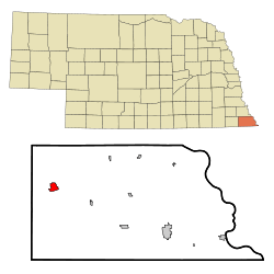 Location of Humboldt, Nebraska | |
| Coordinates: 40°9′54″N 95°56′45″W | |
| Country | United States |
| State | Nebraska |
| County | Richardson |
| Area | |
| • Total | 1.33 sq mi (3.46 km2) |
| • Land | 1.33 sq mi (3.46 km2) |
| • Water | 0.00 sq mi (0.00 km2) |
| Elevation | 1,024 ft (312 m) |
| Population | |
| • Total | 877 |
| • Estimate (2018)[3] | 821 |
| • Density | 609.45/sq mi (235.26/km2) |
| Time zone | UTC-6 (Central (CST)) |
| • Summer (DST) | UTC-5 (CDT) |
| ZIP code | 68376 |
| Area code(s) | 402 |
| FIPS code | 31-23445[4] |
| GNIS feature ID | 0830195[5] |
History
.jpg)
Humboldt was platted in 1868.[6] It was named after Humboldt, Tennessee, where an early settler had stayed while fighting in the Civil War.[7]
In December 1993, Humboldt was the site of a triple murder, including the rape and murder of Brandon Teena, a transgender man.[8]
Geography
According to the United States Census Bureau, the city has a total area of 1.33 square miles (3.44 km2), all of it land.[9]
Demographics
| Historical population | |||
|---|---|---|---|
| Census | Pop. | %± | |
| 1880 | 917 | — | |
| 1890 | 1,114 | 21.5% | |
| 1900 | 1,218 | 9.3% | |
| 1910 | 1,176 | −3.4% | |
| 1920 | 1,277 | 8.6% | |
| 1930 | 1,435 | 12.4% | |
| 1940 | 1,386 | −3.4% | |
| 1950 | 1,404 | 1.3% | |
| 1960 | 1,322 | −5.8% | |
| 1970 | 1,194 | −9.7% | |
| 1980 | 1,176 | −1.5% | |
| 1990 | 1,003 | −14.7% | |
| 2000 | 941 | −6.2% | |
| 2010 | 877 | −6.8% | |
| Est. 2018 | 821 | [3] | −6.4% |
| U.S. Decennial Census[10] | |||
2010 census
As of the census[2] of 2010, there were 877 people, 385 households, and 213 families living in the city. The population density was 659.4 inhabitants per square mile (254.6/km2). There were 470 housing units at an average density of 353.4 per square mile (136.4/km2). The racial makeup of the city was 97.1% White, 0.5% African American, 1.7% Native American, 0.2% from other races, and 0.5% from two or more races. Hispanic or Latino people of any race were 1.4% of the population.
There were 385 households of which 23.1% had children under the age of 18 living with them, 45.2% were married couples living together, 7.3% had a female householder with no husband present, 2.9% had a male householder with no wife present, and 44.7% were non-families. 40.8% of all households were made up of individuals and 19% had someone living alone who was 65 years of age or older. The average household size was 2.15 and the average family size was 2.87.
The median age in the city was 48.6 years. 21.4% of residents were under the age of 18; 5.1% were between the ages of 18 and 24; 18.8% were from 25 to 44; 26.3% were from 45 to 64; and 28.5% were 65 years of age or older. The gender makeup of the city was 47.1% male and 52.9% female.
2000 census
As of the census[4] of 2000, there were 941 people, 427 households, and 239 families living in the city. The population density was 703.5 people per square mile (271.1/km²). There were 508 housing units at an average density of 379.8 per square mile (146.4/km²). The racial makeup of the city was 96.17% White, 0.64% African American, 2.02% Native American, 0.11% Asian, 0.21% from other races, and 0.85% from two or more races. Hispanic or Latino people of any race were 1.81% of the population.
There were 427 households out of which 23.0% had children under the age of 18 living with them, 44.7% were married couples living together, 7.5% had a female householder with no husband present, and 44.0% were non-families. 40.3% of all households were made up of individuals and 25.8% had someone living alone who was 65 years of age or older. The average household size was 2.10 and the average family size was 2.79.
In the city, the population was spread out with 21.1% under the age of 18, 4.8% from 18 to 24, 20.2% from 25 to 44, 21.6% from 45 to 64, and 32.3% who were 65 years of age or older. The median age was 48 years. For every 100 females, there were 86.3 males. For every 100 females age 18 and over, there were 83.7 males.
As of 2000 the median income for a household in the city was $27,672, and the median income for a family was $37,692. Males had a median income of $25,650 versus $20,909 for females. The per capita income for the city was $16,968. About 8.7% of families and 13.6% of the population were below the poverty line, including 23.1% of those under age 18 and 9.0% of those age 65 or over.
Education
Humboldt is served by Humboldt Table Rock Steinauer School District #70.
See also
References
- "2017 U.S. Gazetteer Files". United States Census Bureau. Retrieved Jan 12, 2019.
- "U.S. Census website". United States Census Bureau. Retrieved 2012-06-24.
- "Population and Housing Unit Estimates". Retrieved February 25, 2020.
- "U.S. Census website". United States Census Bureau. Retrieved 2008-01-31.
- "US Board on Geographic Names". United States Geological Survey. 2007-10-25. Retrieved 2008-01-31.
- Fitzpatrick, Lillian L. (1960). Nebraska Place-Names. University of Nebraska Press. p. 119. ISBN 0-8032-5060-6. A 1925 edition is available for download at University of Nebraska—Lincoln Digital Commons.
- Edwards, Lewis Clifford (1917). History of Richardson County, Nebraska: Its People, Industries and Institutions : with Biographical Sketches of Representative Citizens and Genealogical Records of the Old Families. Unigraphic. p. 542.
- Dunne, John Gregory (January 13, 1997). "The Humboldt Murders". The New Yorker. Retrieved January 18, 2017.
- "US Gazetteer files 2010". United States Census Bureau. Archived from the original on July 2, 2012. Retrieved 2012-06-24.
- "Census of Population and Housing". Census.gov. Retrieved June 4, 2015.
Municipalities and communities of Richardson County, Nebraska, United States | ||
|---|---|---|
| Cities | Map of Nebraska highlighting Richardson County | |
| Villages | ||
| Unincorporated communities | ||
| Indian reservations | ||
| Footnotes | ‡This populated place also has portions in an adjacent county or counties | |