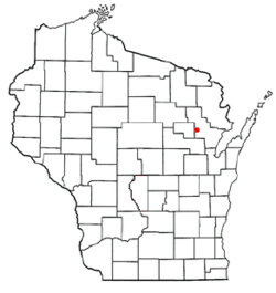
How, Wisconsin
How is a town in Oconto County, Wisconsin, United States. The population was 563 at the 2000 census. The unincorporated community of Hayes is located in the town. The town is named for Calvin F. How, Jr., an insurance and banking executive.[3]
How, Wisconsin | |
|---|---|
 Location of How, Wisconsin | |
| Coordinates: 44°59′58″N 88°25′38″W | |
| Country | |
| State | |
| County | Oconto |
| Area | |
| • Total | 35.1 sq mi (90.8 km2) |
| • Land | 34.9 sq mi (90.5 km2) |
| • Water | 0.1 sq mi (0.3 km2) |
| Elevation | 840 ft (256 m) |
| Population (2000) | |
| • Total | 563 |
| • Density | 16.1/sq mi (6.2/km2) |
| Time zone | UTC-6 (Central (CST)) |
| • Summer (DST) | UTC-5 (CDT) |
| FIPS code | 55-35925[2] |
| GNIS feature ID | 1582284[1] |
Geography
According to the United States Census Bureau, the town has a total area of 35.1 square miles (90.8 km²), of which, 34.9 square miles (90.5 km²) of it is land and 0.1 square miles (0.3 km²) of it (0.34%) is water.
Demographics
At the 2000 census there were 563 people in 207 households, including 152 families, in the town. The population density was 16.1 people per square mile (6.2/km²). There were 229 housing units at an average density of 6.6 per square mile (2.5/km²). The racial makeup of the town was 94.85% White, 4.44% Native American, and 0.71% from two or more races. Hispanic or Latino of any race were 1.07%.[2]
Of the 207 households 32.4% had children under the age of 18 living with them, 68.6% were married couples living together, 2.9% had a female householder with no husband present, and 26.1% were non-families. 22.2% of households were one person and 9.2% were one person aged 65 or older. The average household size was 2.72 and the average family size was 3.24.
The age distribution was 28.4% under the age of 18, 6.2% from 18 to 24, 27.5% from 25 to 44, 24.7% from 45 to 64, and 13.1% 65 or older. The median age was 39 years. For every 100 females, there were 114.1 males. For every 100 females age 18 and over, there were 111.0 males.
The median household income was $39,167 and the median family income was $44,125. Males had a median income of $28,393 versus $20,521 for females. The per capita income for the town was $15,447. About 3.8% of families and 7.7% of the population were below the poverty line, including 13.2% of those under age 18 and 6.8% of those age 65 or over.
References
- "US Board on Geographic Names". United States Geological Survey. 2007-10-25. Retrieved 2008-01-31.
- "U.S. Census website". United States Census Bureau. Retrieved 2008-01-31.
- Callary, Edward. Place Names of Wisconsin. Madison, WI: University of Wisconsin Press. p. 125. ISBN 978-0-299-30964-0.
Municipalities and communities of Oconto County, Wisconsin, United States | ||
|---|---|---|
| Cities | 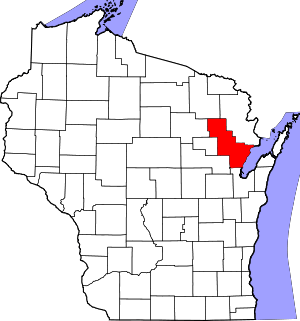 | |
| Villages | ||
| Towns | ||
| CDPs | ||
| Unincorporated communities | ||
| Indian reservation | ||
| Ghost town/neighborhood |
| |
| Footnotes | ‡This populated place also has portions in an adjacent county or counties | |