Hornell, New York
Hornell is a city in Steuben County, New York, United States. The population was 8,563 at the 2010 census. The city is named after the Hornell family, early settlers.
Hornell | |
|---|---|
 Downtown Hornell | |
| Nickname(s): Maple City, H-Town, Alstomtown | |
 Hornell Location within the state of New York | |
| Coordinates: 42°19′N 77°40′W | |
| Country | United States |
| State | New York |
| County | Steuben |
| First settled | 1790 |
| Incorporated (Town of Hornellsville) | 1820 |
| Incorporated (Village of Hornellsville) | 1852 |
| Incorporated (City of Hornellsville/Hornell) | 1888/1906 |
| Government | |
| • Type | (Mayor-Council) |
| • Mayor | John Buckley (R) |
| • City Council | Members' List
|
| Area | |
| • Total | 2.83 sq mi (7.34 km2) |
| • Land | 2.83 sq mi (7.34 km2) |
| • Water | 0.00 sq mi (0.00 km2) |
| Elevation | 1,161 ft (354 m) |
| Population (2010) | |
| • Total | 8,563 |
| • Estimate (2018)[2] | 8,349 |
| • Density | 2,914.99/sq mi (1,125.53/km2) |
| Time zone | UTC-5 (Eastern (EST)) |
| • Summer (DST) | UTC-4 (EDT) |
| ZIP code | 14843 |
| Area code(s) | 607 |
| FIPS code | 36-35672 |
| GNIS feature ID | 0975771 |
| Website | City website |
The City of Hornell is surrounded by Town of Hornellsville. Hornell is about 55 miles (89 km) south of Rochester and is near the western edge of Steuben County.
Hornell is nicknamed the "Maple City" after the large maple trees that once grew throughout the town and covered the surrounding hills of the Canisteo Valley. Hornell has the largest Saint Patrick's Day parade and celebration in the area, bringing many out to welcome spring and show their green. Hornell prides itself in its ever-growing and thriving business district.
Hornell Municipal Airport (KHTF) is located a few miles north of the city on Route 36. The airport has a hard surface runway capable of landing small jets, a rotating beacon and fuel.
History

What is now Hornell was first settled in 1790 under the name "Upper Canisteo", to distinguish it from the community of Canisteo, then known as "Lower Canisteo". The family of Benjamin Crosby were the first settlers in what is now Hornell. The area was incorporated as a town in 1820, as "Hornellsville." The name comes from early settler George Hornell Jr, who built the first gristmill here.

The City of Hornell was chartered in 1888 as the "City of Hornellsville," (having been first organized as the "Village of Hornellsville" in 1852). The name was changed to Hornell in 1906.
Major flooding in 1936 put parts of the city under water, prompting the creation of a system of levees to prevent future serious flooding issues.
The former city park, Union Park, was destroyed by the urban renewal of the 1970s.
In 1950, Hornell had a population near 16,000 people. It had two radio stations, WWHG and WLEA, and three movie theaters, the Steuben and the Majestic, located on Broadway, and the Hornell, located on Main Street.
The current mayor of Hornell is Republican John Buckley.
In 2009 Kirk W. House produced Around Hornell, a historic photo book in Arcadia Publishing's "Images of America" series. Around Hornell also includes the surrounding rural communities of Canisteo, Dansville, Fremont, Hartsville, Hornellsville, and Howard.
The Hornell Armory, Hornell Public Library, Adsit House, Lincoln School, St. Ann's Federation Building, and United States Post Office are listed on the National Register of Historic Places.[3][4]
Railroads and Hornell

Hornell had four rail lines, though the companies operating the railroads often changed names, routes, and ownership:
- The main Erie Railroad line, connecting New York City (terminal in Hoboken, New Jersey) and Dunkirk, New York.
- Erie's Buffalo line. This began as the Attica and Hornellsville Railroad (1845–1851), which became part of the Buffalo and New York City Railroad, which extended the line to Buffalo and operated it from 1852 to 1861, when it was acquired by Erie. Hornell was the junction and transfer point for the two main branches of the Erie.
- A line running to the northeast, from a separate depot on Seneca St. near Adsit,[5] connecting Hornell via Wayland with Geneva. The company was the Geneva Southwestern and Hornellsville Railway (1872–1875), then the Geneva and Hornellsville Railway (1875–1876), and the Geneva, Hornellsville and Pine Creek Railway (1876–1879), and the Rochester, Hornellsville and Lackawanna Railroad (1886–1889), then the Delaware, Lackawanna, and Western, or Lackawanna for short. Later the Pittsburg, Shawmut and Northern Railroad ran on this route one train in each direction per day, connecting Hornell with Angelica to the west and Wayland to the north.
- The Hornellsville Electric Railway Company and Hornellsville & Canisteo Railway Company, consolidated in 1909 as the Hornell Traction Company, provided service to North Hornell, Canisteo, and within the city, linking the Lackawanna and Erie depots, from 1892 until 1926.
Some grading was done in 1872–1873 for a proposed but unbuilt Rochester, Hornellsville, and Pine Creek railroad.[6][7]
The most important railroad in Hornell was of course the New York and Erie Railroad, or Erie for short. It arrived in Hornell in 1850 and began public service on May 14, 1851. President Millard Fillmore, from western New York, and Secretary of State Daniel Webster rode through Hornell on the inaugural train.[8]
Hornell was the center of the Erie Railway; so its repair yards were located there. According to an 1882 traveler's guide to the Erie Railroad, in Hornell "There are an immense amount of side-tracks, ample engine-houses, repair-shops, and other railroad structures, as the village is the dividing-point of the Susquehanna and Western Divisions, and the point of junction of the Buffalo Division of the Erie Railway.... It has banks, newspapers, a nourishing library association, which maintains a course of popular lectures, and is one of the most efficient and attractive institutions of the kind in the interior of the State. There are churches of various denominations, and a population of about 9,000. The cars destined for Buffalo, Niagara Falls, etc., are here detached from those going west via Salamanca or Dunkirk. At the station is a spacious dining-saloon, where meals are served to travelers at regular hours."[9] In other words, trains stopped in Hornell for travelers and crew to eat.
In 1895 the Erie built in Hornell, "at the foot of Pine Street... an immense stock barn", for the large number of cattle being shipped east on its trains.[10]
Hornell during the railroad period (1860–1960)
For the next hundred years Hornell enjoyed prosperity, with its steam engine shop doing the repairs for the entire Erie railroad line. The most important point in town was the train station, which survives and is since 2005 the Hornell Erie Depot Museum. Next to it were the police station and fire department, at the beginning of Broadway, a wide street with stores, a luncheonette, and the Steuben and Majestic Theaters. Heading south, Broadway ended at Canisteo Street just before it passed under the tracks, a route served for some decades by a trolley. The underpass was closed, save for a pedestrian passage, when the Route 36 arterial was built.
At the five-way intersection just north of the underpass, where Broadway began, Canisteo Street ran northwestward. Near its southern end (now covered by the Route 36 arterial), was Hornell's largest hotel, the New Sherwood, the offices of the Hornell Evening Tribune and above it those of its radio station WWHG. On the east side was a storefront Greyhound station (service Elmira – Corning – Bath – Hornell – Batavia – Buffalo, no direct service to Rochester); on the west side was Hornell's main park, Union Park, with the city's high school (middle school after new high school built), containing the city's largest auditorium, and other businesses. Main Street, with the Hornell Theater, WLEA's studios, Koskie's music store, and other businesses, connected the two now-separated streets (Broadway and Canisteo/Seneca ). Main St. extended east to Hornell's Carnegie Library (Hornell Public Library), Hornell's largest grocery store, Loblaw's, the YMCA, with the only public swimming pool in the city, various medical and dental offices, and finally (turning south and crossing the Canisteo River), the Erie Repair Shops. North of Main Street the downtown area extended another block with the city's pharmacy, Jacobson's shoe store, the United States Post Office (both now [2009] vacant), and the Steuben Trust Company (bank). In the block north of Main Street, Church Street had Hornell's synagogue, Temple Beth-El (closed), and at the intersection with Genesee Street four churches, one on each corner; two survive today (2017). Further north on Seneca Street were Hornell's best restaurant, the Big Elms, Hornell's baseball field (from 1942 to 1957 Hornell had a minor-league team), and car dealers. The current high school is adjacent to the baseball field. The city ended at the Canisteo River, where a bridge led to the village of North Hornell.
Hornell in the post-railroad period (1960–present)
In October 1960 the Erie merged with the Lackawanna. Diesel engines, replacing older steam engines, required less maintenance.[8] The Hornell repair shop was closed, as was Erie's accounting office,[8] and operations were consolidated at the Lackawanna's Scranton facility. The railroad then came upon hard times as trucking picked up more and more of the freight business. In 1972, the company filed for bankruptcy just a few days after floods from Hurricane Agnes destroyed about 200 miles (320 km) of roadbed along the Canisteo River, removing all hope of reoperating the railroad line east of Hornell.

Passenger service, in severe decline, ended completely by 1960. The former station has been refurbished and since 2006 is the Hornell Erie Depot Museum.
Hornell has today (2018) less than half the population it had in 1960, and it is still dropping. As the population dropped businesses closed; civic institutions such as churches were also affected.
Hornell has struggled to regain its former prosperity. The former Erie shops are now Alstom's main North American assembly and manufacturing site for the production of AC traction motors, railway cars, and passenger locomotives. Car bodies are shipped disassembled from São Paulo, Brazil and assembly into cars takes place in Hornell. Prior to Alstom, the shops were operated by Morrison-Knudsen. After a difficult period Alstom won a contract worth US$194 million to execute the complete overhaul of PATCO Speedline's light rail fleet, beginning in 2011.[11] In 2013, the Alstom facility was contracted to build 34 light rail vehicles for delivery to Ottawa by 2018.[12] In 2019, Acela Express cars for Amtrak are being built at the plant.[13]
Highway construction
Route 36 Arterial
Hornell's central layout changed significantly when the New York Route 36 arterial was built about 1972. Prior to that, Route 36, Hornell's main north–south highway, was routed along Seneca Street (to the north) and Canisteo Street (to the south). Neither of these streets was adequate for the increased automobile and truck traffic which accompanied the decline of the railroad, and they could not be easily expanded; Canisteo Street also had a significant bottleneck (originally the "Canisteo Subway" on the Hornell-Canisteo trolley, pictured on a postcard) where the route went under the Erie Railroad tracks, just south of downtown. Route 36 between Hornell and Canisteo, also inadequate, could not be expanded due to the adjacent Canisteo River.
The decision was made to replace the route with an arterial, west of Seneca Street on the north side, crossing the downtown and exiting Hornell east of Canisteo Street on the south side. "The highway required the demolition of 245 houses and many commercial buildings, split the city in half, and sacrificed Hornell's Union Park."[8] The four-lane route was continued to Canisteo, at a higher and geographically better location than the old route. Unconnected fragments of the former Route 36 from Hornell to Canisteo survive; in Hornell it starts from East Avenue, east of the river, and heading north from the Village of Canisteo it is today Dineen/McBurney Road.
The impact of the relocation of Route 36 on central Hornell was profound. Much of the south end of the downtown was destroyed, either physically or economically. Seneca Street and Broadway, formerly important commercial streets, became deserted side streets. (See United States Post Office (Hornell, New York).) It is not fondly remembered, and it was something wanted by the trucking industry and its customers, not the local working class.
The Southern Tier Expressway (New York Route 17, now Interstate 86)
When the decision was made in the 1960s to upgrade the western portion of New York Route 17 to expressway status, it was decided to route the expressway through the Hornell area, as it was considered to have more prospects for development than Greenwood and Jasper, along the old route (now New York Route 417). Interstate 86 crosses Route 36 between Hornell and Arkport. It is today Hornell's main highway.
Geography
Hornell is located at 42°19′N 77°40′W (42.3244, -77.6603).[14] Hornell is at an altitude of 1,160 feet (354 meters) above sea level.
According to the United States Census Bureau, the city has a total area of 2.7 square miles (7.0 km2), all of it land.

Hornell is on the Canisteo River and surrounded by the foothills of the Allegheny Mountains.
New York State Route 21 conjoined with New York State Route 36 passes through the city, which is just south of the Southern Tier Expressway (Interstate 86 / New York State Route 17). County Roads 65, 68 and 109 also lead into the city.
The City is served by two railroads - it is on the Norfolk Southern's Buffalo-East Coast mainline and is the eastern terminus of the mainline of the Western New York and Pennsylvania Railroad.
Demographics
| Historical population | |||
|---|---|---|---|
| Census | Pop. | %± | |
| 1870 | 4,552 | — | |
| 1880 | 8,195 | 80.0% | |
| 1890 | 10,996 | 34.2% | |
| 1900 | 11,918 | 8.4% | |
| 1910 | 13,617 | 14.3% | |
| 1920 | 15,025 | 10.3% | |
| 1930 | 16,250 | 8.2% | |
| 1940 | 15,649 | −3.7% | |
| 1950 | 15,049 | −3.8% | |
| 1960 | 13,907 | −7.6% | |
| 1970 | 12,144 | −12.7% | |
| 1980 | 10,234 | −15.7% | |
| 1990 | 9,877 | −3.5% | |
| 2000 | 9,019 | −8.7% | |
| 2010 | 8,563 | −5.1% | |
| Est. 2018 | 8,349 | [2] | −2.5% |
| U.S. Decennial Census[15] | |||
As of the census[16] of 2000, there were 9,019 people, 3,596 households, and 2,218 families residing in the city. The population density was 3,309.0 people per square mile (1,275.6/km²). There were 4,100 housing units at an average density of 1,504.2 per square mile (579.9/km²). The racial makeup of the city was 95.73% White, 2.38% African American, 0.23% Native American, 0.57% Asian, 0.04% Pacific Islander, 0.38% from other races, and 0.67% from two or more races. Hispanic or Latino of any race were 1.29% of the population.
There were 3,596 households out of which 32.4% had children under the age of 18 living with them, 40.9% were married couples living together, 16.1% had a female householder with no husband present, and 38.3% were non-families. 32.0% of all households were made up of individuals and 14.3% had someone living alone who was 65 years of age or older. The average household size was 2.44 and the average family size was 3.07.
In the city, the population was spread out with 27.7% under the age of 18, 9.7% from 18 to 24, 27.0% from 25 to 44, 19.7% from 45 to 64, and 16.0% who were 65 years of age or older. The median age was 35 years. For every 100 females, there were 89.0 males. For every 100 females age 18 and over, there were 82.9 males.
The median income for a household in the city was $28,184, and the median income for a family was $35,000. Males had a median income of $31,727 versus $18,854 for females. The per capita income for the city was $14,419. About 18.7% of families and 21.4% of the population were below the poverty line, including 32.1% of those under age 18 and 6.6% of those age 65 or over.
Parks and recreation
There are several parks in the city of Hornell including:
- Maple City Park is adjacent to the Hornell High School and is maintained by both the school district and the city. It includes tennis courts, a baseball field, softball field, multiple half-basketball courts, a playground, a 6-lane rubber track, and a turf field (football and soccer). It is the home of the Hornell Dodgers NYCBL baseball team and the Hornell Red Raider athletic teams. Hornell's annual "Music Under the Stars" drum and bugle corps event also takes place on the turf field at this site.
- Prior to the construction of the high school, the park was the home of the minor league baseball team Hornell Dodgers (1942–1957).
- Veterans Memorial Park at James Street (formerly known as simply James St. Park) has many sports fields, pavilions, the city pool, and several playgrounds. Fourth of July celebrations, including fireworks, are located at this park.
- Michael C. Fucci Memorial Park at Shawmut is where the Hornell skate park is located. Many youth football and baseball games are also played on the fields. There was, at one time, an effort for Rails to Trails to create a bike/hike trail from this park northwestward.
Education
There are five public schools and one private school located in Hornell.
Public schools include:
- Hornell High School (grades 7–12)
- Intermediate School (grades 4–6)
- Bryant School (grades 2–3)
- North Hornell School (grades PK–1)
- Columbian School (Admin. Office & HeadStart)
(The North Hornell School is physically located in the village of North Hornell, but is still a part of the Hornell City School District).
Private Schools:
- St. Ann's Academy is an independent Catholic school serving grades PreK–6. It opened in 2012 after St. Ann's School was closed by the Diocese of Rochester.
- St. Anns Catholic School (grades K–8) [now closed]
The current Superintendent of Schools is Douglas Wyant Jr. In June 2007 the Hornell Evening Tribune newspaper announced that a school planning committee is proposing a $100 million project to re-organize the schools and improve assessment results.

Transportation
Hornell is served by buses operated by Hornell Area Transit.[17]
Notable people
- John William Barber (1920–2007), jazz tubist
- Gene Burns (1940–2013), talk radio host
- Bob Crane (1928–1978), actor
- Bill Dugan (born 1959), professional football player
- Frank Kelly Freas (1922–2005), science fiction artist
- John Keel (1930–2009), author
- Bob Morton (1934–2015), Washington state legislator
- Thomas Murphy (1915–2006), CEO of General Motors (1974-1980)
- Bill Pullman (born 1953), actor
- Vice Adm. Lyndon Spencer (1898–1981), U.S. Coast Guard officer
- M. Louise Stowell (1861–1930) artist
- Mike Waufle (born 1954), professional football coach
- James A. Wetmore (1863–1940), US acting Supervising Architect
Media
- The Evening Tribune
- Radio
References
- "2016 U.S. Gazetteer Files". United States Census Bureau. Retrieved Jul 5, 2017.
- "Population and Housing Unit Estimates". Retrieved August 23, 2019.
- "National Register Information System". National Register of Historic Places. National Park Service. March 13, 2009.
- "National Register of Historic Places Listings". Weekly List of Actions Taken on Properties: 11/16/15 through 11/20/15. National Park Service. 2015-11-27.
- "It's a Go! The Street Railway Contract All Finished. - It Will Be a First-Class Road and Equipments—Cars Every 10 Minutes. The Contractor Here". Hornellsville Weekly Tribune (Hornellsville, New York). April 8, 1892. p. 3.
- "States Items". Buffalo Weekly Courier. June 25, 1873. p. 4.
- "Steuben". Democrat and Chronicle. November 25, 1887. p. 3.
- Cornish, Collette (2015). "Time Line History of Hornell, New York" (PDF). Author is City of Hornell Historian. Retrieved May 20, 2019.
- Mott, E. H. [Edward Harold] (1882). The Erie route: a guide to the New York, Lake Erie & Western Railway and its branches, with Sketches of the Cities, Villages, Scenery and Objects of Interest along the Route, and Railroad, Steamboat and Stage Connections. Map and Illustrations. The author is identified as "Of the General Passenger Department of the New York, Lake Erie & Western Railroad". Taintor Brothers. p. 42.
- "The Erie Establishes a Feeding Station at Hornellsville". Buffalo Courier. February 14, 1895. p. 9.
- "PATCO's entire metro fleet to be modernised between Philadelphia and Southern New Jersey" (Press release). Alstom. June 2, 2011. Retrieved 2013-06-16.
- Vantuono, William C. (February 14, 2013). "Alstom finalizes Ottawa LRT contract". Railway Age. Simmons-Boardman Publishing Inc.
- Mann, Ted (May 13, 2019). "Amtrak puts $2 billion On the Line". Wall Street Journal. p. A3.
- "US Gazetteer files: 2010, 2000, and 1990". United States Census Bureau. 2011-02-12. Retrieved 2011-04-23.
- "Census of Population and Housing". Census.gov. Retrieved June 4, 2015.
- "U.S. Census website". United States Census Bureau. Retrieved 2008-01-31.
- http://www.hatrides.com/
Further reading
- Near, Irvin W. (1890). The early history of Hornellsville, Steuben County. An Address made at the Centennial of the First Settlement of Hornellsville, on September 25th, 1890. Hornellsville, New York.
External links
| Wikisource has the text of the 1911 Encyclopædia Britannica article Hornell. |
| Wikimedia Commons has media related to Hornell, New York. |
Municipalities and communities of Steuben County, New York, United States | ||
|---|---|---|
| Cities | 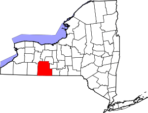 | |
| Towns | ||
| Villages | ||
| CDPs |
| |
| Hamlets |
| |
| Footnotes | ‡This populated place also has portions in an adjacent county or counties | |
| Authority control |
|
|---|