Hooper Bay, Alaska
Hooper Bay (Central Yupik: Naparyaarmiut) is a city in Kusilvak Census Area, Alaska, United States. At the 2010 census the population was 1,093, up from 1,014 in 2000.
Hooper Bay Naparyaarmiut | |
|---|---|
City | |
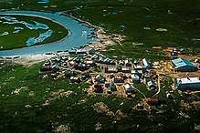
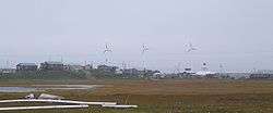 Hooper Bay with wind turbines in background. | |
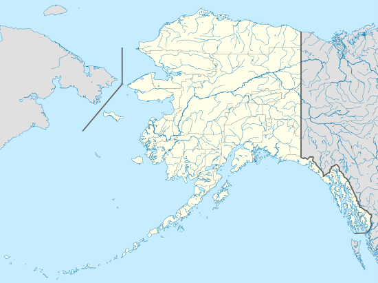 Hooper Bay Location in Alaska | |
| Coordinates: 61°31′44″N 166°05′46″W | |
| Country | United States |
| State | Alaska |
| Census Area | Kusilvak |
| Incorporated | February 7, 1966[1] |
| Government | |
| • Mayor | Joseph Bell[2] |
| • State senator | Donald Olson (D) |
| • State rep. | Neal Foster (D) |
| Area | |
| • Total | 7.53 sq mi (19.50 km2) |
| • Land | 7.50 sq mi (19.42 km2) |
| • Water | 0.03 sq mi (0.08 km2) |
| Elevation | 26 ft (8 m) |
| Population (2010) | |
| • Total | 1,093 |
| • Estimate (2018)[4] | 1,225 |
| • Density | 163.40/sq mi (63.09/km2) |
| Time zone | UTC-9 (Alaska (AKST)) |
| • Summer (DST) | UTC-8 (AKDT) |
| ZIP code | 99604 |
| Area code | 907 |
| FIPS code | 02-33470 |
| GNIS feature ID | 1403493 |
On August 3, 2006, a major fire destroyed approximately fifteen acres of the city including thirty-five structures, twelve homes, the elementary school, middle school, high school, teacher housing complex, stores, offices and storage shelters, leaving 70 people homeless.[5][6][7]
Geography
Hooper Bay is located at 61°31′44″N 166°5′46″W (61.528980, -166.096196),[8] 20 miles (32 km) south of Cape Romanzof and 25 miles (40 km) south of Scammon Bay in the Yukon-Kuskokwim Delta. The city is separated into two sections: a heavily built-up townsite located on gently rolling hills, and a newer section in the lowlands.
According to the United States Census Bureau, the city has a total area of 8.8 square miles (23 km2), of which 8.7 square miles (23 km2) is land and 0.1 square miles (0.26 km2) (0.91%) is water. The climate in Hooper Bay is maritime. The mean annual snowfall is 75 inches (1,900 mm), with a total precipitation of 16 inches (410 mm). Temperatures range between -26° and 79 °F.
Climate
Hooper Bay is located within the polar climate zone (Köppen ET), because the hottest month is only 49.1 °F (9.5 °C).
| Climate data for Cape Romanzof, Alaska | |||||||||||||
|---|---|---|---|---|---|---|---|---|---|---|---|---|---|
| Month | Jan | Feb | Mar | Apr | May | Jun | Jul | Aug | Sep | Oct | Nov | Dec | Year |
| Record high °F (°C) | 49 (9) |
48 (9) |
46 (8) |
60 (16) |
71 (22) |
72 (22) |
79 (26) |
73 (23) |
63 (17) |
60 (16) |
45 (7) |
48 (9) |
79 (26) |
| Average high °F (°C) | 18.3 (−7.6) |
14.9 (−9.5) |
20.3 (−6.5) |
25.9 (−3.4) |
39.3 (4.1) |
48.3 (9.1) |
53.0 (11.7) |
52.3 (11.3) |
46.8 (8.2) |
34.3 (1.3) |
26.9 (−2.8) |
18.1 (−7.7) |
33.2 (0.7) |
| Daily mean °F (°C) | 13.3 (−10.4) |
9.8 (−12.3) |
14.9 (−9.5) |
21.0 (−6.1) |
35.0 (1.7) |
43.8 (6.6) |
49.1 (9.5) |
49.0 (9.4) |
43.6 (6.4) |
31.3 (−0.4) |
23.0 (−5.0) |
13.4 (−10.3) |
28.9 (−1.7) |
| Average low °F (°C) | 8.3 (−13.2) |
4.6 (−15.2) |
9.5 (−12.5) |
16.1 (−8.8) |
30.7 (−0.7) |
39.2 (4.0) |
45.1 (7.3) |
45.6 (7.6) |
40.3 (4.6) |
28.2 (−2.1) |
19.1 (−7.2) |
8.7 (−12.9) |
24.6 (−4.1) |
| Record low °F (°C) | −23 (−31) |
−26 (−32) |
−26 (−32) |
−15 (−26) |
3 (−16) |
25 (−4) |
31 (−1) |
33 (1) |
23 (−5) |
4 (−16) |
−15 (−26) |
−23 (−31) |
−26 (−32) |
| Average precipitation inches (mm) | 1.15 (29) |
0.98 (25) |
1.25 (32) |
0.93 (24) |
1.34 (34) |
2.19 (56) |
2.93 (74) |
5.02 (128) |
4.62 (117) |
2.37 (60) |
1.52 (39) |
1.17 (30) |
25.48 (647) |
| Average snowfall inches (cm) | 9.1 (23) |
6.9 (18) |
10.4 (26) |
7.3 (19) |
3.7 (9.4) |
1.4 (3.6) |
0.0 (0.0) |
0.1 (0.25) |
0.7 (1.8) |
9.2 (23) |
10.0 (25) |
9.4 (24) |
68.2 (173) |
| Source: WRCC [9] | |||||||||||||
Demographics
| Historical population | |||
|---|---|---|---|
| Census | Pop. | %± | |
| 1880 | 175 | — | |
| 1890 | 138 | −21.1% | |
| 1930 | 209 | — | |
| 1940 | 299 | 43.1% | |
| 1950 | 307 | 2.7% | |
| 1960 | 460 | 49.8% | |
| 1970 | 490 | 6.5% | |
| 1980 | 627 | 28.0% | |
| 1990 | 845 | 34.8% | |
| 2000 | 1,014 | 20.0% | |
| 2010 | 1,093 | 7.8% | |
| Est. 2018 | 1,225 | [4] | 12.1% |
| U.S. Decennial Census[10] | |||
Hooper Bay first appeared on the 1880 U.S. Census as an Yup'ik settlement of Askinuk.[11] On the 1890 census, it returned as Askinaghamiut. It did not appear again until 1930, when it was first returned as Hooper Bay. It formally incorporated in 1966.
As of the census[12] of 2000, there were 1,014 people, 227 households, and 187 families residing in the city. The population density was 116.8 people per square mile (45.1/km²). There were 239 housing units at an average density of 27.5 per square mile (10.6/km²). The racial makeup of the city was 4.24% White, 93.69% Native American, and 2.07% from two or more races. 0.10% of the population were Hispanic or Latino of any race.
There were 227 households out of which 61.7% had children under the age of 18 living with them, 34.4% were married couples living together, 30.0% had a female householder with no husband present, and 17.6% were non-families. 15.4% of all households were made up of individuals and 0.9% had someone living alone who was 65 years of age or older. The average household size was 4.47 and the average family size was 4.97.
In the city, the age distribution of the population shows 49.2% under the age of 18, 9.0% from 18 to 24, 24.5% from 25 to 44, 11.5% from 45 to 64, and 5.8% who were 65 years of age or older. The median age was 18 years. For every 100 females, there were 98.8 males. For every 100 females age 18 and over, there were 116.4 males.
The median income for a household in the city was $26,667, and the median income for a family was $27,500. Males had a median income of $31,250 versus $32,083 for females. The per capita income for the city was $7,841. About 28.4% of families and 27.9% of the population were below the poverty line, including 30.1% of those under age 18 and 31.6% of those age 65 or over.
Education
Students in pre-kindergarten through twelfth grade attend Hooper Bay School, also known as Naparyarmiut Elicarviat, administered by the Lower Yukon School District.[13] It is a bilingual school with a Yup'ik language immersion program in kindergarten through third grade, the first program of its kind in the district.[14] High school students have the option of the state's public boarding schools, Nenana Student Living Center and Mt. Edgecumbe High School.[15]
References
- 1996 Alaska Municipal Officials Directory. Juneau: Alaska Municipal League/Alaska Department of Community and Regional Affairs. January 1996. p. 67.
- 2015 Alaska Municipal Officials Directory. Juneau: Alaska Municipal League. 2015. p. 73.
- "2018 U.S. Gazetteer Files". United States Census Bureau. Retrieved Jul 1, 2019.
- "Population and Housing Unit Estimates". Retrieved June 4, 2019.
- "Hundreds Evacuate, Structures Destroyed in Hooper Bay Fire". ABC Alaska News. August 4, 2006. Archived from the original on January 16, 2013. Retrieved 2008-10-22.
- deMarban, Alex (August 15, 2006). "Children faulted in Hooper Bay fire". Anchorage Daily News. Archived from the original on October 15, 2008. Retrieved 2008-10-22.
- http://juneauempire.com/stories/080606/sta_20060806022.shtml#.WBkBO-ErLMU
- "US Gazetteer files: 2010, 2000, and 1990". United States Census Bureau. 2011-02-12. Retrieved 2011-04-23.
- Cape Romanzof, Alaska - Period of Record : 5/1/1953 to 2/24/1985 Archived 2017-05-25 at the Wayback Machine. Retrieved November 1, 2019.
- "Census of Population and Housing". Census.gov. Retrieved June 4, 2015.
- "Geological Survey Professional Paper". 1949.
- "U.S. Census website". United States Census Bureau. Retrieved 2008-01-31.
- "Low test scores don't deter Hooper Bay School leaders". Anchorage Daily News. 15 March 2015. Retrieved 29 July 2019.
- Dillon, R.A. (May 18, 2002). "School Reaches Out to Embrace Native Roots". www.turtletrack.org. Canku Ota. Retrieved 29 July 2019.
- Brown, Cathy (27 June 2004). "Alaska Boarding Schools Make a Comeback". Washington Post. Retrieved 29 July 2019.
Further reading
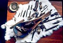
- Gillham, Charles E., and Chanimun. Medicine Men of Hooper Bay: Or, The Eskimo's Arabian Nights. London: Batchworth Press, 1955.
Photographs
 Hooper Bay, Alaska. Looking south through the town in 1969. |
 |
 |
|---|---|---|
Berms near airport and ocean.
|
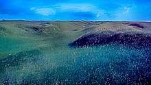
Alaskan tundra outside of Hooper Bay.
|
 |
 |

Looking south over Hooper Bay, 1968.
|
 |
 |
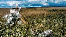
Eskimo kids label artifacts that they find as "Old Timers".
|

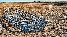
Hooper Bay has been known for high quality baskets for many decades.
|
Municipalities and communities of Kusilvak Census Area, Alaska, United States | ||
|---|---|---|
| Cities |  Kusilvak Census Area map | |
| CDP | ||
| Unincorporated communities | ||
| Authority control |
|
|---|