Hjelset
Hjelset is a village in Molde Municipality in Møre og Romsdal county, Norway. It is located on the north shore of the Fannefjorden, about 8 kilometres (5.0 mi) west of the village of Kleive and about 16 kilometres (9.9 mi) east of the town of Molde. The European route E39 highway runs through the village on its way northeast from the town of Molde to the village of Batnfjordsøra in Gjemnes Municipality.
Hjelset | |
|---|---|
Village | |
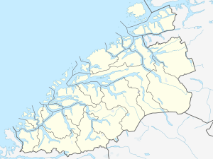 Hjelset Location in Møre og Romsdal  Hjelset Hjelset (Norway) | |
| Coordinates: 62.7805°N 7.4928°E | |
| Country | Norway |
| Region | Western Norway |
| County | Møre og Romsdal |
| District | Romsdal |
| Municipality | Molde Municipality |
| Area | |
| • Total | 0.88 km2 (0.34 sq mi) |
| Elevation | 10 m (30 ft) |
| Population (2018)[1] | |
| • Total | 963 |
| • Density | 1,094/km2 (2,830/sq mi) |
| Time zone | UTC+01:00 (CET) |
| • Summer (DST) | UTC+02:00 (CEST) |
| Post Code | 6450 Hjelset |
The 0.88-square-kilometre (220-acre) village has a population (2018) of 963 and a population density of 1,094 inhabitants per square kilometre (2,830/sq mi).[1]
References
- Statistisk sentralbyrå (1 January 2018). "Urban settlements. Population and area, by municipality".
- "Hjelset, Molde (Møre og Romsdal)". yr.no. Retrieved 2019-06-28.
This article is issued from Wikipedia. The text is licensed under Creative Commons - Attribution - Sharealike. Additional terms may apply for the media files.