Hillview, Kentucky
Hillview is a home rule-class city[2] in Bullitt County, Kentucky, in the United States. The population was 8,172 at the 2010 census.[3] The primary road through the area is Kentucky Route 61 (the Preston Highway).
Hillview, Kentucky | |
|---|---|
City | |
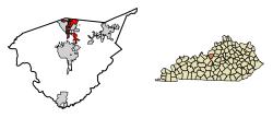 Location of Hillview in Bullitt County, Kentucky. | |
| Coordinates: 38°4′11″N 85°41′8″W | |
| Country | United States |
| State | Kentucky |
| County | Bullitt |
| Incorporated | March 28, 1974 |
| Government | |
| • Type | Mayor-Council |
| • Mayor | James Eadens |
| Area | |
| • Total | 3.3 sq mi (8.6 km2) |
| • Land | 3.3 sq mi (8.5 km2) |
| • Water | 0.04 sq mi (0.1 km2) |
| Elevation | 541 ft (165 m) |
| Population (2010) | |
| • Total | 8,172 |
| • Estimate (2018)[1] | 9,148 |
| • Density | 2,492/sq mi (962.0/km2) |
| Time zone | UTC-5 (Eastern (EST)) |
| • Summer (DST) | UTC-4 (EDT) |
| ZIP code | 40229 |
| Area code(s) | 502 |
| FIPS code | 21-36982 |
| GNIS feature ID | 1699788 |
| Website | www |
Long a rural farming community, Hillview was connected to what became Interstate 65 in 1954 and grew in the 1950s and 1960s as a suburb of Louisville. Its larger subdivisions included Maryville, Overdale, and Lone Acres, and they incorporated in 1974 to form the present city.
Geography
Hillview is located in northern Bullitt County at 38°4′11″N 85°41′8″W (38.069786, -85.685619),[4] 15 miles (24 km) south of downtown Louisville. The northern border of Hillview is the southern border of Louisville-Jefferson County. Hillview is bordered to the east by Pioneer Village, and other nearby cities include Hunters Hollow to the west, Hebron Estates to the southeast, and Fox Chase to the south. The unincorporated community of Brooks is to the west across I-65.
According to the United States Census Bureau, the city has a total area of 3.3 square miles (8.6 km2), of which 0.027 square miles (0.07 km2), or 0.86%, is water.[3]
Demographics
As of the census[5] of 2000, there were 7,037 people, 2,411 households, and 2,013 families residing in the city. The population density was 1,689.7 people per square mile (653.1/km²). There were 2,460 housing units at an average density of 590.7 per square mile (228.3/km²). The racial makeup of the city was 97.90% White, 0.37% African American, 0.47% Native American, 0.28% Asian, 0.11% from other races, and 0.87% from two or more races. Hispanic or Latino of any race were 0.70% of the population.
There were 2,411 households out of which 41.6% had children under the age of 18 living with them, 66.6% were married couples living together, 11.5% had a female householder with no husband present, and 16.5% were non-families. 13.1% of all households were made up of individuals and 3.2% had someone living alone who was 65 years of age or older. The average household size was 2.92 and the average family size was 3.16.
| Historical population | |||
|---|---|---|---|
| Census | Pop. | %± | |
| 1980 | 5,196 | — | |
| 1990 | 6,119 | 17.8% | |
| 2000 | 7,870 | 28.6% | |
| 2010 | 8,172 | 3.8% | |
| Est. 2018 | 9,148 | [1] | 11.9% |
| U.S. Decennial Census[6] | |||
In the city, the population was spread out with 28.7% under the age of 18, 8.6% from 18 to 24, 34.9% from 25 to 44, 22.3% from 45 to 64, and 5.5% who were 65 years of age or older. The median age was 32 years. For every 100 females, there were 100.2 males. For every 100 females age 18 and over, there were 98.1 males.
The median income for a household in the city was $42,743, and the median income for a family was $45,594. Males had a median income of $33,962 versus $22,027 for females. The per capita income for the city was $15,832. About 5.3% of families and 7.1% of the population were below the poverty line, including 9.0% of those under age 18 and 9.3% of those age 65 or over.
Education
Hillview has a public library, a branch of the Bullitt County Public Library.[7]
References
- "Population and Housing Unit Estimates". Retrieved August 25, 2019.
- "Summary and Reference Guide to House Bill 331 City Classification Reform" (PDF). Kentucky League of Cities. Retrieved December 30, 2014.
- "Geographic Identifiers: 2010 Demographic Profile Data (G001): Hillview city, Kentucky". U.S. Census Bureau, American Factfinder. Archived from the original on February 12, 2020. Retrieved November 25, 2013.
- "US Gazetteer files: 2010, 2000, and 1990". United States Census Bureau. 2011-02-12. Retrieved 2011-04-23.
- "U.S. Census website". United States Census Bureau. Retrieved 2008-01-31.
- "Census of Population and Housing". Census.gov. Retrieved June 4, 2015.
- "Kentucky Public Library Directory". Kentucky Department for Libraries and Archives. Archived from the original on 11 January 2019. Retrieved 5 June 2019.
External links
- City of Hillview official website
- "Hillview: Land of Cornfields Became a Kind of Battlefield as Growth Spurred Efforts by Some to Incorporate" — Article by Joseph Gerth of The Courier-Journal
Municipalities and communities of Bullitt County, Kentucky, United States | ||
|---|---|---|
| Cities | 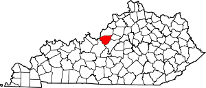 Location of Bullitt County, Kentucky | |
| CDP | ||
| Unincorporated communities | ||
| Authority control |
|
|---|