Highland, Maryland
Highland is an unincorporated community and census-designated place in Howard County, Maryland, United States. As of the 2010 census it had a population of 1,034.[1] It uses the 20777 zip code.
Highland, Maryland | |
|---|---|
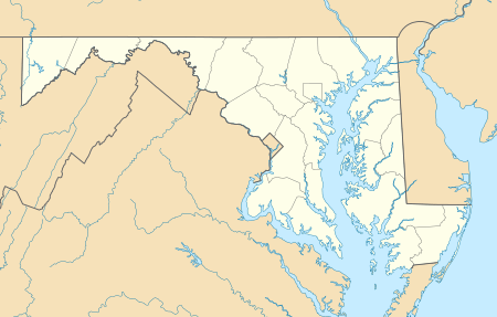 Highland Location in Maryland | |
| Coordinates: 39°10′44.7″N 76°57′27.7″W | |
| Country | |
| State | |
| County | |
| Area | |
| • Total | 6.27 km2 (2.42 sq mi) |
| • Land | 6.23 km2 (2.41 sq mi) |
| • Water | 0.04 km2 (0.02 sq mi) |
| Elevation | 160 m (520 ft) |
| Population (2010) | |
| • Total | 1,034 |
| • Density | 165.9/km2 (430/sq mi) |
| Time zone | UTC-5 (EST) |
| • Summer (DST) | UTC-4 (EDT) |
Geography
The community is located in southern Howard County at the junction of Highland Road, Maryland Route 216 and Maryland Route 108, and is still heavily influenced by its agrarian history; farms and horse fields are common in the area. The crossroads itself has a small-town feel, with a few shops that share in the rich history. Clarksville is 2 miles (3 km) to the north on MD 108, Laurel is 9 miles (14 km) to the southeast on MD 216, and Olney is 7 miles (11 km) to the west on MD 108. The center of Columbia is 8 miles (13 km) to the northeast.
The crossroads
As a rural crossroads, many of its community members took it upon themselves to maintain the historical sites and feel of the hamlet by founding the Greater Highland Crossroads Association (GHCA) in 2002.[2] In 2014, the Crossroads were placed on the Preserve Howard top ten most endangered list due to current DPZ plans.[3] They are marked by four signs.
History
The majority of the downtown Highland district is situated within the 418-acre (169 ha) land grant named "Hickory Ridge". The Rouse Company borrowed the land grant name for one of its nearby villages of Columbia, built in 1974. The "White Hall" or "Hickory Ridge" slave plantation property was owned by the Ridgley, Hopkins and Disney families.[4] One of the earliest businesses at the crossroads was Well's tavern, founded by Richard Wells in 1759. This was replaced with a wheelwright's shop by Joshua B. Disney in 1842. The same year, William Wall opened a general store and post office, giving the crossroads the short-lived name of "Walls Crossroads" before another name change of the post office on December 2, 1878 to "Highland" to reflect the town's elevation in Howard County.[5][6][7] The County Commissioners added Hall Shop Road on the Southern side of the community in 1877.[8] The town did not receive direct rail service, but was only nine miles away from the B&O railroad in Laurel, Maryland using the rolling road now known as Route 216.[9]
Highland played several important roles in U.S. history. The town housed meetings that affected the events of the Boston Tea Party. Well's Tavern (now the Kitty Bed and Breakfast) was the primary meeting place of a group of Northern sympathizers in the Civil War.
The Virginia Hardy Boarding School provided classes for students during the turn of the century.[10]
In 2015, the group Preservation Howard County placed the crossroads on its top 10 most endangered site list.[11]
References
- "Geographic Identifiers: 2010 Demographic Profile Data (G001): Highland CDP, Maryland". U.S. Census Bureau, American Factfinder. Archived from the original on February 12, 2020. Retrieved August 12, 2014.
- "Highland, MD 20777". Greater Highland Crossroads Association. Retrieved September 13, 2007.
- "Top 10 endangered historical sites in Howard County". The Baltimore Sun. July 11, 2014.
- James A Clark Jr. Jim Clark Soldier Farmer Legislator. p. 5.
- GHCA (2013). Historic Downtown Highland.
- "Smithsonian Postal Museum" (PDF). Archived from the original (PDF) on May 18, 2014. Retrieved July 13, 2014.
- Seeking Freedom The History of the Underground Railroad in Howard County. p. 76.
- "Examiner's notice". The Ellicott City Times. February 1877.
- Barbara Feaga. Howard's roads to the past. p. 62.
- Howard County Historical Society. Images of America Howard County. p. 64.
- Amanda Yeager (26 May 2015). "Former school tops Howard County's endangered sites list". The Baltimore Sun.
Municipalities and communities of Howard County, Maryland, United States | ||
|---|---|---|
| CDPs | 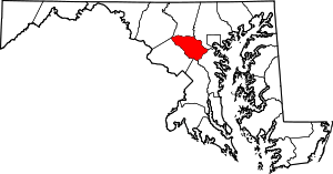 | |
| Villages | ||
| Unincorporated communities |
| |
| Footnotes | ‡This populated place also has portions in an adjacent county or counties | |