Hermosa, South Dakota
Hermosa (Lakota: okíčhize wakpá otȟúŋwahe;[7] "battle river village") is a town in near the northern edge of Custer County, South Dakota, United States. The population was 398 at the 2010 census.
Hermosa, South Dakota okíčhize wakpá otȟúŋwahe | |
|---|---|
 Location in Custer County and the state of South Dakota | |
| Coordinates: 43°50′20″N 103°11′38″W | |
| Country | United States |
| State | South Dakota |
| County | Custer |
| Founded | 1886[1] |
| Area | |
| • Total | 0.48 sq mi (1.24 km2) |
| • Land | 0.48 sq mi (1.24 km2) |
| • Water | 0.00 sq mi (0.00 km2) |
| Elevation | 3,327 ft (1,014 m) |
| Population | |
| • Total | 398 |
| • Estimate (2018)[4] | 400 |
| • Density | 831.60/sq mi (321.40/km2) |
| Time zone | UTC-7 (MST) |
| • Summer (DST) | UTC-6 (MDT) |
| Zip Code | 57744 |
| Area code(s) | 605 |
| FIPS code | 46-28300[5] |
| GNIS feature ID | 1265246[6] |
History
Hermosa was platted in 1886.[8] The name Hermosa is of Spanish origin meaning "beautiful".[8] A post office has been in operation in Hermosa since 1886.[9]
Geography
Hermosa is located at 43°50′20″N 103°11′38″W (43.838786, -103.193978).[10]
According to the United States Census Bureau, the town has a total area of 0.48 square miles (1.24 km2), all of it land.[11]
Hermosa has been assigned the ZIP code 57744 and the FIPS place code 28300.
Demographics
| Historical population | |||
|---|---|---|---|
| Census | Pop. | %± | |
| 1890 | 172 | — | |
| 1900 | 77 | −55.2% | |
| 1910 | 114 | 48.1% | |
| 1920 | 74 | −35.1% | |
| 1930 | 128 | 73.0% | |
| 1940 | 121 | −5.5% | |
| 1950 | 123 | 1.7% | |
| 1960 | 126 | 2.4% | |
| 1970 | 150 | 19.0% | |
| 1980 | 251 | 67.3% | |
| 1990 | 242 | −3.6% | |
| 2000 | 315 | 30.2% | |
| 2010 | 398 | 26.3% | |
| Est. 2018 | 400 | [4] | 0.5% |
| U.S. Decennial Census[12] | |||
2010 census
As of the census[3] of 2010, there were 398 people, 158 households, and 110 families living in the town. The population density was 829.2 inhabitants per square mile (320.2/km2). There were 183 housing units at an average density of 381.3 per square mile (147.2/km2). The racial makeup of the town was 88.7% White, 3.8% Native American, 1.0% Asian, 0.3% Pacific Islander, 0.5% from other races, and 5.8% from two or more races. Hispanic or Latino of any race were 5.3% of the population.
There were 158 households of which 33.5% had children under the age of 18 living with them, 51.9% were married couples living together, 10.8% had a female householder with no husband present, 7.0% had a male householder with no wife present, and 30.4% were non-families. 20.9% of all households were made up of individuals and 8.3% had someone living alone who was 65 years of age or older. The average household size was 2.52 and the average family size was 2.93.
The median age in the town was 36.8 years. 25.9% of residents were under the age of 18; 7.8% were between the ages of 18 and 24; 25.3% were from 25 to 44; 29.3% were from 45 to 64; and 11.6% were 65 years of age or older. The gender makeup of the town was 50.3% male and 49.7% female.
2000 census
As of the census[5] of 2000, there were 315 people, 130 households, and 82 families living in the town. The population density was 809.8 people per square mile (311.9/km²). There were 139 housing units at an average density of 357.3 per square mile (137.6/km²). The racial makeup of the town was 92.38% White, 1.59% African American, 3.81% Native American, 0.32% from other races, and 1.90% from two or more races. Hispanic or Latino of any race were 2.86% of the population.
There were 130 households out of which 30.8% had children under the age of 18 living with them, 50.0% were married couples living together, 8.5% had a female householder with no husband present, and 36.2% were non-families. 28.5% of all households were made up of individuals and 13.1% had someone living alone who was 65 years of age or older. The average household size was 2.42 and the average family size was 2.98.
In the town, the population was spread out with 26.0% under the age of 18, 7.0% from 18 to 24, 27.9% from 25 to 44, 26.0% from 45 to 64, and 13.0% who were 65 years of age or older. The median age was 37 years. For every 100 females, there were 93.3 males. For every 100 females age 18 and over, there were 102.6 males.
The median income for a household in the town was $35,341, and the median income for a family was $37,031. Males had a median income of $29,000 versus $16,750 for females. The per capita income for the town was $13,147. About 8.0% of families and 9.1% of the population were below the poverty line, including 11.8% of those under age 18 and 8.6% of those age 65 or over.
See also
References
- "SD Towns" (PDF). South Dakota State Historical Society. Archived from the original (PDF) on 2010-02-10. Retrieved 2010-02-13.
- "2018 U.S. Gazetteer Files". United States Census Bureau. Retrieved February 22, 2020.
- "U.S. Census website". United States Census Bureau. Retrieved 2012-06-21.
- "Population and Housing Unit Estimates". United States Census Bureau. June 27, 2019. Retrieved June 4, 2019.
- "U.S. Census website". United States Census Bureau. Retrieved 2008-01-31.
- U.S. Geological Survey Geographic Names Information System: Hermosa
- Ullrich, Jan F. (2014). New Lakota Dictionary (2nd ed.). Bloomington, IN: Lakota Language Consortium. ISBN 978-0-9761082-9-0. Archived from the original on 2016-10-18. Retrieved 2014-02-12.
- Chicago and North Western Railway Company (1908). A History of the Origin of the Place Names Connected with the Chicago & North Western and Chicago, St. Paul, Minneapolis & Omaha Railways. p. 83.
- "Custer County". Jim Forte Postal History. Retrieved 20 March 2015.
- "US Gazetteer files: 2010, 2000, and 1990". United States Census Bureau. 2011-02-12. Retrieved 2011-04-23.
- "US Gazetteer files 2010". United States Census Bureau. Archived from the original on 2012-01-25. Retrieved 2012-06-21.
- "Census of Population and Housing". Census.gov. Retrieved June 4, 2015.
External links
![]()
Municipalities and communities of Custer County, South Dakota, United States | ||
|---|---|---|
| City | 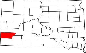 | |
| Towns | ||
| Unincorporated communities | ||
| Ghost towns | ||