Haven, Kansas
Haven is a city in Reno County, Kansas, United States. As of the 2010 census, the city population was 1,237.[6]
Haven, Kansas | |
|---|---|
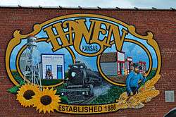 Haven mural (2015) | |
 Location within Reno County and Kansas | |
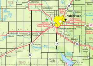 KDOT map of Reno County (legend) | |
| Coordinates: 37°54′8″N 97°46′51″W | |
| Country | United States |
| State | Kansas |
| County | Reno |
| Founded | 1880s |
| Platted | 1886 |
| Incorporated | 1901 |
| Area | |
| • Total | 0.63 sq mi (1.63 km2) |
| • Land | 0.63 sq mi (1.63 km2) |
| • Water | 0 sq mi (0 km2) |
| Elevation | 1,480 ft (450 m) |
| Population | |
| • Total | 1,237 |
| • Estimate (2018)[3] | 1,196 |
| • Density | 2,000/sq mi (760/km2) |
| Time zone | UTC-6 (CST) |
| • Summer (DST) | UTC-5 (CDT) |
| ZIP code | 67543 |
| Area code | 620 |
| FIPS code | 20-30725 [4] |
| GNIS ID | 0473651 [5] |
| Website | havencityhall.org |
History
Haven was laid out in 1886, and incorporated as a city in 1901.[7] The first post office in Haven was established in 1873.[8]
The local high school football team was on the winning side of a lopsided football game against another school from across the county in Sylvia.[9] Played in 1927 with a final score of 256–0, the game produced multiple national and state high school records. As of 2016, the state records include: Total points scored, points by both teams, widest margin, widest shutout, most touchdowns (38), and most rushing touchdowns (30). Also, Haven student Elvin McCoy holds state records for both individual points per game with 90 and individual touchdowns scored per game with 13.[10]
Geography
Haven is located at 37°54′8″N 97°46′51″W (37.902306, -97.780957).[11] According to the United States Census Bureau, the city has a total area of 0.63 square miles (1.63 km2), all of it land.[1]
Area events
- Haven Fall Festival, held on the second weekend of October each year.
Demographics
| Historical population | |||
|---|---|---|---|
| Census | Pop. | %± | |
| 1910 | 528 | — | |
| 1920 | 1,301 | 146.4% | |
| 1930 | 553 | −57.5% | |
| 1940 | 653 | 18.1% | |
| 1950 | 720 | 10.3% | |
| 1960 | 982 | 36.4% | |
| 1970 | 1,146 | 16.7% | |
| 1980 | 1,125 | −1.8% | |
| 1990 | 1,198 | 6.5% | |
| 2000 | 1,175 | −1.9% | |
| 2010 | 1,237 | 5.3% | |
| Est. 2018 | 1,196 | [3] | −3.3% |
| U.S. Decennial Census | |||
2010 census
As of the census[2] of 2010, there were 1,237 people, 492 households, and 337 families residing in the city. The population density was 1,963.5 inhabitants per square mile (758.1/km2). There were 526 housing units at an average density of 834.9 per square mile (322.4/km2). The racial makeup of the city was 94.5% White, 0.7% African American, 1.7% Native American, 0.2% Asian, 0.2% from other races, and 2.7% from two or more races. Hispanic or Latino of any race were 2.7% of the population.
There were 492 households of which 33.1% had children under the age of 18 living with them, 55.5% were married couples living together, 8.5% had a female householder with no husband present, 4.5% had a male householder with no wife present, and 31.5% were non-families. 28.3% of all households were made up of individuals and 11.6% had someone living alone who was 65 years of age or older. The average household size was 2.51 and the average family size was 3.07.
The median age in the city was 37.1 years. 26.9% of residents were under the age of 18; 8.3% were between the ages of 18 and 24; 22.2% were from 25 to 44; 28.2% were from 45 to 64; and 14.4% were 65 years of age or older. The gender makeup of the city was 47.8% male and 52.2% female.
2000 census
As of the census[4] of 2000, there were 1,175 people, 463 households, and 325 families residing in the city. The population density was 2,152.5 people per square mile (824.9/km²). There were 498 housing units at an average density of 912.3 per square mile (349.6/km²). The racial makeup of the city was 97.62% White, 0.17% African American, 0.77% Native American, 0.34% from other races, and 1.11% from two or more races. Hispanic or Latino of any race were 0.94% of the population.
There were 463 households out of which 35.6% had children under the age of 18 living with them, 58.5% were married couples living together, 8.4% had a female householder with no husband present, and 29.6% were non-families. 26.6% of all households were made up of individuals and 13.6% had someone living alone who was 65 years of age or older. The average household size was 2.54 and the average family size was 3.10.
In the city, the population was spread out with 29.4% under the age of 18, 7.6% from 18 to 24, 27.6% from 25 to 44, 19.8% from 45 to 64, and 15.6% who were 65 years of age or older. The median age was 36 years. For every 100 females, there were 93.9 males. For every 100 females age 18 and over, there were 90.6 males.
The median income for a household in the city was $38,239, and the median income for a family was $45,682. Males had a median income of $34,125 versus $20,662 for females. The per capita income for the city was $16,319. About 5.6% of families and 7.0% of the population were below the poverty line, including 6.7% of those under age 18 and 8.0% of those age 65 or over.
Government
The Haven government consists of a mayor and five council members. The council meets the 1st and 3rd Monday of each month at 7PM.[12]
Education
Haven is served by Haven USD 312 public school district.
Notable people
- Andy Dirks, professional baseball player for the Detroit Tigers. He competed in the 2012 World Series.
- Flossie Page, a supercentenarian, lived 112.7 years. (1893-2006)
References
- "US Gazetteer files 2010". United States Census Bureau. Retrieved 2012-07-06.
- "U.S. Census website". United States Census Bureau. Retrieved 2012-07-06.
- "Population and Housing Unit Estimates". Retrieved February 9, 2020.
- "U.S. Census website". United States Census Bureau. Retrieved 2008-01-31.
- "US Board on Geographic Names". United States Geological Survey. 2007-10-25. Retrieved 2008-01-31.
- "2010 City Population and Housing Occupancy Status". U.S. Census Bureau. Retrieved March 27, 2011.
- Blackmar, Frank Wilson (1912). Kansas: A Cyclopedia of State History, Embracing Events, Institutions, Industries, Counties, Cities, Towns, Prominent Persons, Etc. Standard Publishing Company. pp. 830.
- "Kansas Post Offices, 1828-1961". Kansas Historical Society. Retrieved 22 June 2014.
- Staff (2011). "Haven set amazing scoring mark in 1927". National Federation of State High School Associations. Archived from the original on 25 April 2013. Retrieved 18 March 2013.
- "Football State Records (11-Man - Team Records - Single Game)". Kansas Sports Hall of Fame. Retrieved March 9, 2016.
- "US Gazetteer files: 2010, 2000, and 1990". United States Census Bureau. 2011-02-12. Retrieved 2011-04-23.
- Haven City Council
Further reading
External links
| Wikimedia Commons has media related to Haven, Kansas. |
- City
- Maps
- Haven City Map, KDOT
Municipalities and communities of Reno County, Kansas, United States | ||
|---|---|---|
| Cities | 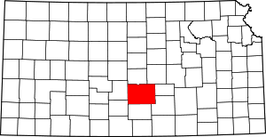 Map of Kansas highlighting Reno County | |
| CDP | ||
| Unincorporated communities | ||
| Ghost towns | ||
| Townships |
| |
| Authority control |
|
|---|