Hartman, Colorado
The Town of Hartman is a Statutory Town in Prowers County, Colorado, United States. The population was 81 according to the 2010 census. The town is located North of C-196. The town has one historic site, the old Hartman Gymnasium. The circa 1938 gymnasium is associated with New Deal programs in Prowers County. The building is the only example of Works Progress Administration construction in Hartman and one of only a few such projects in the county. Its use as a community center continues to contribute to the social history of Hartman.
Town of Hartman, Colorado | |
|---|---|
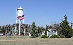 Hartman's welcome sign and water tower. | |
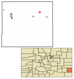 Location of Hartman in Prowers County, Colorado. | |
| Coordinates: 38°07′13″N 102°13′12″W | |
| Country | |
| State | |
| County[1] | Prowers |
| Incorporated (town) | May 14, 1910[2] |
| Government | |
| • Type | Statutory Town[1] |
| Area | |
| • Total | 0.27 sq mi (0.71 km2) |
| • Land | 0.27 sq mi (0.71 km2) |
| • Water | 0.00 sq mi (0.00 km2) |
| Elevation | 3,615 ft (1,102 m) |
| Population (2010) | |
| • Total | 81 |
| • Estimate (2018)[5] | 75 |
| • Density | 267.40/sq mi (103.41/km2) |
| Time zone | UTC-7 (MST) |
| • Summer (DST) | UTC-6 (MDT) |
| ZIP code[6] | 81043 (PO Box) |
| Area code(s) | 719 |
| FIPS code | 08-34520 |
| GNIS feature ID | 0195605 |
| Highways | none |
History
A post office called Hartman has been in operation since 1908.[7] The community was named after W. P. Hartman, a railroad official.[8]
Geography
Hartman is located at 38°07′12″N 102°13′13″W,[9]
According to the United States Census Bureau, the town has a total area of 0.3 square miles (0.78 km2), all land.
Demographics
| Historical population | |||
|---|---|---|---|
| Census | Pop. | %± | |
| 1920 | 175 | — | |
| 1930 | 269 | 53.7% | |
| 1940 | 148 | −45.0% | |
| 1950 | 181 | 22.3% | |
| 1960 | 164 | −9.4% | |
| 1970 | 129 | −21.3% | |
| 1980 | 122 | −5.4% | |
| 1990 | 108 | −11.5% | |
| 2000 | 111 | 2.8% | |
| 2010 | 81 | −27.0% | |
| Est. 2018 | 75 | [5] | −7.4% |
| U.S. Decennial Census[10] | |||
As of the census[11] of 2000, there were 111 people, 40 households, and 31 families residing in the town. The population density was 365.6 people per square mile (142.9/km²). There were 50 housing units at an average density of 164.7 per square mile (64.4/km²). The racial makeup of the town was 86.49% White, 0.90% Native American, 7.21% from other races, and 5.41% from two or more races. Hispanic or Latino of any race were 36.94% of the population.
There were 40 households out of which 42.5% had children under the age of 18 living with them, 57.5% were married couples living together, 12.5% had a female householder with no husband present, and 22.5% were non-families. 22.5% of all households were made up of individuals and 15.0% had someone living alone who was 65 years of age or older. The average household size was 2.78 and the average family size was 3.23.
In the town, the population was spread out with 34.2% under the age of 18, 9.9% from 18 to 24, 27.0% from 25 to 44, 15.3% from 45 to 64, and 13.5% who were 65 years of age or older. The median age was 33 years. For every 100 females, there were 105.6 males. For every 100 females age 18 and over, there were 92.1 males.
The median income for a household in the town was $23,750, and the median income for a family was $24,375. Males had a median income of $16,250 versus $25,417 for females. The per capita income for the town was $11,816. About 32.4% of families and 42.7% of the population were below the poverty line, including 60.5% of those under the age of 18 and 5.9% of those 65 and older.
See also
- Outline of Colorado
- State of Colorado
- Colorado cities and towns
- Colorado municipalities
- Colorado counties
- Colorado cities and towns
References
- "Active Colorado Municipalities". State of Colorado, Department of Local Affairs. Archived from the original on 2009-12-12. Retrieved 2007-09-01.
- "Colorado Municipal Incorporations". State of Colorado, Department of Personnel & Administration, Colorado State Archives. 2004-12-01. Retrieved 2007-09-02.
- "2016 U.S. Gazetteer Files". United States Census Bureau. Retrieved Jul 25, 2017.
- "US Board on Geographic Names". United States Geological Survey. 2007-10-25. Retrieved 2008-01-31.
- "Population and Housing Unit Estimates". Retrieved March 21, 2020.
- "ZIP Code Lookup". United States Postal Service. Archived from the original (JavaScript/HTML) on January 1, 2008. Retrieved September 30, 2007.
- "Post offices". Jim Forte Postal History. Retrieved 27 June 2016.
- Dawson, John Frank. Place names in Colorado: why 700 communities were so named, 150 of Spanish or Indian origin. Denver, CO: The J. Frank Dawson Publishing Co. p. 26.
- "US Gazetteer files: 2010, 2000, and 1990". United States Census Bureau. 2011-02-12. Retrieved 2011-04-23.
- "Census of Population and Housing". Census.gov. Retrieved June 4, 2015.
- "U.S. Census website". United States Census Bureau. Retrieved 2008-01-31.
External links
Municipalities and communities of Prowers County, Colorado, United States | ||
|---|---|---|
| City | 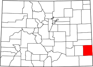 Map of Colorado highlighting Prowers County | |
| Towns | ||
| Unincorporated communities | ||