Hamlet, Indiana
Hamlet is a town in Davis and Oregon Townships, Starke County, in the U.S. state of Indiana.[6] The population was 800 at the 2010 census.
Hamlet, Indiana | |
|---|---|
.jpg) Depot in Hamlet, circa 1910 | |
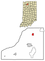 Location of Hamlet in Starke County, Indiana. | |
| Coordinates: 41°22′54″N 86°35′5″W | |
| Country | United States |
| State | Indiana |
| County | Starke |
| Township | Davis, Oregon |
| Area | |
| • Total | 0.97 sq mi (2.53 km2) |
| • Land | 0.96 sq mi (2.50 km2) |
| • Water | 0.01 sq mi (0.03 km2) |
| Elevation | 705 ft (215 m) |
| Population | |
| • Total | 800 |
| • Estimate (2018)[4] | 762 |
| • Density | 796.89/sq mi (307.61/km2) |
| Time zone | UTC-6 (CST) |
| • Summer (DST) | UTC-5 (CDT) |
| ZIP code | 46532 |
| Area code(s) | 574 and 219 |
| FIPS code | 18-30708[5] |
| GNIS feature ID | 435652 |
History
Hamlet was named after John Hamlet, who established the town in 1863.[7] The Hamlet post office has been in operation since 1864.[8]
Geography
Hamlet is now bypassed by highway US 30, about a half mile to the north. It is about 2 mi (3.2 km) east of highway US 35. The Conrail line between Chicago and Fort Wayne runs through the town.
According to the 2010 census, Hamlet has a total area of 0.98 square miles (2.54 km2), of which 0.97 square miles (2.51 km2) (or 98.98%) is land and 0.01 square miles (0.03 km2) (or 1.02%) is water.[9]
Demographics
| Historical population | |||
|---|---|---|---|
| Census | Pop. | %± | |
| 1870 | 47 | — | |
| 1900 | 432 | — | |
| 1910 | 579 | 34.0% | |
| 1920 | 480 | −17.1% | |
| 1930 | 418 | −12.9% | |
| 1940 | 519 | 24.2% | |
| 1950 | 659 | 27.0% | |
| 1960 | 688 | 4.4% | |
| 1970 | 761 | 10.6% | |
| 1980 | 738 | −3.0% | |
| 1990 | 789 | 6.9% | |
| 2000 | 820 | 3.9% | |
| 2010 | 800 | −2.4% | |
| Est. 2018 | 762 | [4] | −4.7% |
| U.S. Decennial Census[10] | |||
2010 census
As of the census[3] of 2010, there were 800 people, 299 households, and 225 families living in the town. The population density was 824.7 inhabitants per square mile (318.4/km2). There were 332 housing units at an average density of 342.3 per square mile (132.2/km2). The racial makeup of the town was 96.6% White, 1.0% Native American, 0.1% Asian, 0.6% from other races, and 1.6% from two or more races. Hispanic or Latino of any race were 2.6% of the population.
There were 299 households of which 37.1% had children under the age of 18 living with them, 48.8% were married couples living together, 18.7% had a female householder with no husband present, 7.7% had a male householder with no wife present, and 24.7% were non-families. 19.7% of all households were made up of individuals and 7.3% had someone living alone who was 65 years of age or older. The average household size was 2.68 and the average family size was 3.01.
The median age in the town was 35 years. 27.6% of residents were under the age of 18; 11.4% were between the ages of 18 and 24; 25.1% were from 25 to 44; 23.6% were from 45 to 64; and 12.6% were 65 years of age or older. The gender makeup of the town was 49.5% male and 50.5% female.
2000 census
As of the census[5] of 2000, there were 820 people, 307 households, and 225 families living in the town. The population density was 849.5 people per square mile (326.4/km²). There were 336 housing units at an average density of 348.1 per square mile (133.7/km²). The racial makeup of the town was 98.05% White, 0.12% African American, 0.37% Native American, 0.49% Pacific Islander, 0.24% from other races, and 0.73% from two or more races. Hispanic or Latino of any race were 1.34% of the population.
There were 307 households out of which 40.4% had children under the age of 18 living with them, 54.7% were married couples living together, 12.7% had a female householder with no husband present, and 26.4% were non-families. 21.2% of all households were made up of individuals and 6.2% had someone living alone who was 65 years of age or older. The average household size was 2.67 and the average family size was 3.08.
In the town, the population was spread out with 30.9% under the age of 18, 7.9% from 18 to 24, 31.8% from 25 to 44, 21.3% from 45 to 64, and 8.0% who were 65 years of age or older. The median age was 32 years. For every 100 females, there were 103.5 males. For every 100 females age 18 and over, there were 96.2 males.
The median income for a household in the town was $30,750, and the median income for a family was $36,389. Males had a median income of $28,036 versus $20,921 for females. The per capita income for the town was $12,811. About 15.4% of families and 17.3% of the population were below the poverty line, including 23.1% of those under age 18 and 15.0% of those age 65 or over.
Education
Hamlet has a public library, a branch of the Starke County Public Library System.[11]
Notes
- "2016 U.S. Gazetteer Files". United States Census Bureau. Retrieved Jul 28, 2017.
- "US Board on Geographic Names". United States Geological Survey. 2007-10-25. Retrieved 2008-01-31.
- "U.S. Census website". United States Census Bureau. Retrieved 2012-12-11.
- "Population and Housing Unit Estimates". Retrieved February 29, 2020.
- "U.S. Census website". United States Census Bureau. Retrieved 2008-01-31.
- "Hamlet, Indiana". Geographic Names Information System. United States Geological Survey. Retrieved 2016-11-05.
- Baker, Ronald L.; Marvin Carmony (1995). Indiana Place Names. Bloomington: Indiana University Press. p. 66. ISBN 0-253-28340-X.
- "Starke County". Jim Forte Postal History. Retrieved November 5, 2016.
- "G001 - Geographic Identifiers - 2010 Census Summary File 1". United States Census Bureau. Archived from the original on 2020-02-13. Retrieved 2015-07-16.
- "Census of Population and Housing". Census.gov. Retrieved June 4, 2015.
- "Hours & Locations". Starke County Public Library System. Retrieved 15 March 2018.
Municipalities and communities of Starke County, Indiana, United States | ||
|---|---|---|
| City | Map of Indiana highlighting Starke County | |
| Towns | ||
| Townships | ||
| CDPs | ||
| Other unincorporated communities | ||
| Footnotes | ‡This populated place also has portions in an adjacent county or counties | |