Hallasan National Park
Hallasan National Park (Korean: 한라산국립공원, 漢拏山國立公園) is located in the province of Jeju-do, South Korea. It was designated as the 9th national park in 1970. It features the highest mountain in South Korea, the shield volcano Hallasan on Jeju Island. It was designated a UNESCO Biosphere Reserve in 2002,[1] and a World Heritage Site in 2007.[2]
| 한라산국립공원, 漢拏山國立公園 | |
|---|---|
| Hallasan National Park | |
IUCN category II (national park) | |
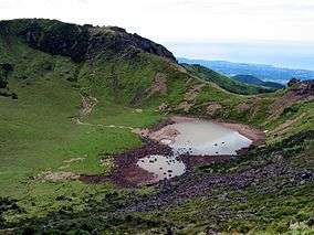 Crater lakes on the volcano Hallasan | |
| Coordinates | 33°22′N 126°32′E |
| Area | 153.11 km2 (59.12 sq mi) |
| Established | 24 March 1970 |
| Governing body | Jeju Special Self-Governing Province |
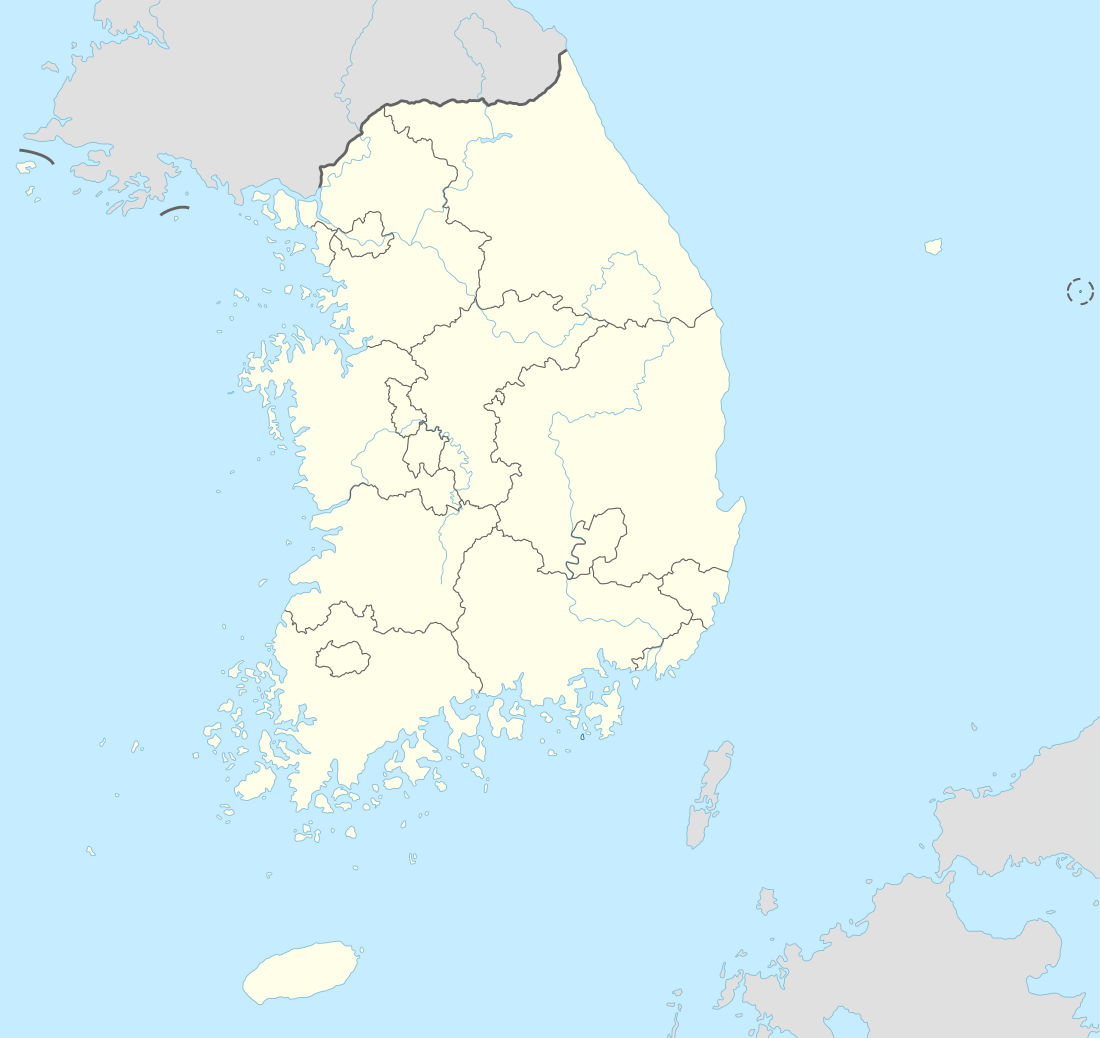
Land-based parks are in red and marine parks are in blue.
Hallasan National Park is managed by Jeju Special Self-Governing Province. It is the only out of 22 national parks that is not managed by the Korea National Park Service.[3]
Trails
Hallasan has 7 trails: Eorimok Trail (6.8 km), Yeongsil Trail (5.8 km), Seongpanak Trail (9.6 km), Seokgulam Trail (1.5 km), Gwaneumsa Trail (8.7 km), Donnaeko Trail (7 km), and Eoseungsaengak Trail (1.3 km). The longest trail is Seongpanak Trail which takes about 4.5 hours.[4]
- Eorimok Trail(어리목 탐방로) (6.8 km): Eorimok Trail Starts from Hallasan National Park’s Visitors center (altitude 970 m) and finishes at the South cliff junction (altitude 1.600 m). It takes about 3 hours for a one way trip.
- Yeongsil Trail (영실 탐방로) (5.8 km): Yeongsill Trail starts from Yeongsil Management Office (altitude 1.000 m) to South cliff junction. It takes about 3 hours 15 minutes for a one way trip.
- Seongpanak Trail (성판악 탐방로) (9.6 km): Seongpanak Trail starts from visitor center to Hallasan Baengnokdam Lake Summit. It takes about 4.5 hours for a one way trip.
- Seokgulam Trail (석굴암 탐방로) (1.5 km)
- Gwaneumsa Trail (관음사 탐방로) (8.7 km): Gwaneumsa Trail starts from Gwaneumsa Campground to Hallasan Baengnokdam Lake Summit. It takes 5 hours for a one way trip.
- Donnaeko Trail (돈내코 탐방로) (7 km): Donnaeko Trail starts from the Visitor Center(altitude 500m) to the South Cliff Junction. It takes 3.5 hours for a one way trip.
- Eoseungsaengak Trail (어승생악 탐방로) (1.3 km): Eoseungsaengak Trail starts from Hallasan National Park Visitor Center to Eoseungsaeng-oreum Summit. It takes 30 minutes for a one way trip.
Topography
Hallasan comprises 153.112 km2 of the Jeju Island. It rises 1.950 m above the sea level which means the highest mountain in South Korea. This mountain was formed in the fourth Cenozoic era by outburst of volcano.[5] It is mostly composed of basalts. It is extending east and west, and it has high and gradual descent. On the other hand, the south part of the mountain is steep. In the summit, there is a crater lake called “Baekrokdam.”[6]
Since the mountain has high altitude, there are a number of alpine plants and animals. 1800 kinds of plants, including 400 kinds of specimen plants and 50 kinds of special plants, are living in Hallasan.[7] So the Jeju island is designated by Biosphere Reserve in 2002 and Hallasan National Park is one of the region of Jeju Bioshere.[8]
References
- "MAB Biosphere Reserves Directory: Jeju Island". UNESCO. 13 December 2007. Retrieved 18 September 2010.
- "Jeju Volcanic Island and Lava Tubes". UNESCO. Retrieved 18 September 2010.
- "National Parks: About the Korea National Park Service". Korea National Park Service. Retrieved 18 September 2010.
- "Mountain Information: Trail Guide". Hallasan National Park. Retrieved 10 December 2011.
- "Park Introduction". Hallasan National Park. Retrieved 10 December 2011.
- "Myungsan(명산)". Jeju Special Self-Governing Province. Retrieved 10 December 2011.
- "생태계의 보고>식물". Hallasan National Park. Retrieved 10 December 2011.
- "Biosphere Reserve". World Natural Heritage Jeju. Retrieved 10 December 2011.