Haiming, Tyrol
Haiming is a municipality in the district of Imst in the Austrian state of Tyrol.
Haiming | |
|---|---|
 Coat of arms | |
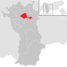 Location in the district | |
 Haiming Location within Austria | |
| Coordinates: 47°15′12″N 10°52′53″E | |
| Country | Austria |
| State | Tyrol |
| District | Imst |
| Government | |
| • Mayor | Josef Leitner (ÖVP) |
| Area | |
| • Total | 40.21 km2 (15.53 sq mi) |
| Elevation | 670 m (2,200 ft) |
| Population (2018-01-01)[2] | |
| • Total | 4,659 |
| • Density | 120/km2 (300/sq mi) |
| Time zone | UTC+1 (CET) |
| • Summer (DST) | UTC+2 (CEST) |
| Postal code | 6425 |
| Area code | 05266 |
| Vehicle registration | IM |
| Website | www.haiming.tirol.gv.at |
Geography
Haiming is located 11 km east of Imst. Haiming possesses 8 village parts.
Climate
| Climate data for Haiming, Tyrol (1971–2000) | |||||||||||||
|---|---|---|---|---|---|---|---|---|---|---|---|---|---|
| Month | Jan | Feb | Mar | Apr | May | Jun | Jul | Aug | Sep | Oct | Nov | Dec | Year |
| Record high °C (°F) | 19.2 (66.6) |
18.7 (65.7) |
23.4 (74.1) |
25.6 (78.1) |
30.8 (87.4) |
33.9 (93.0) |
38.3 (100.9) |
35.7 (96.3) |
31.1 (88.0) |
24.7 (76.5) |
21.7 (71.1) |
16.8 (62.2) |
38.3 (100.9) |
| Average high °C (°F) | 2.8 (37.0) |
5.7 (42.3) |
11.1 (52.0) |
14.7 (58.5) |
20.0 (68.0) |
22.4 (72.3) |
25.0 (77.0) |
24.4 (75.9) |
20.5 (68.9) |
15.0 (59.0) |
7.2 (45.0) |
2.8 (37.0) |
14.3 (57.7) |
| Daily mean °C (°F) | −2.9 (26.8) |
−1.1 (30.0) |
3.7 (38.7) |
7.3 (45.1) |
12.7 (54.9) |
15.4 (59.7) |
17.6 (63.7) |
16.9 (62.4) |
12.8 (55.0) |
7.4 (45.3) |
1.3 (34.3) |
−2.3 (27.9) |
7.4 (45.3) |
| Average low °C (°F) | −6.8 (19.8) |
−5.4 (22.3) |
−1.7 (28.9) |
1.3 (34.3) |
5.9 (42.6) |
9.1 (48.4) |
11.1 (52.0) |
11.0 (51.8) |
7.4 (45.3) |
2.7 (36.9) |
−2.4 (27.7) |
−5.8 (21.6) |
2.2 (36.0) |
| Record low °C (°F) | −25.4 (−13.7) |
−19.0 (−2.2) |
−16.8 (1.8) |
−6.8 (19.8) |
−3.8 (25.2) |
−0.8 (30.6) |
3.1 (37.6) |
1.5 (34.7) |
−3.3 (26.1) |
−9.1 (15.6) |
−17.8 (0.0) |
−22.4 (−8.3) |
−25.4 (−13.7) |
| Average precipitation mm (inches) | 35.8 (1.41) |
31.5 (1.24) |
40.7 (1.60) |
35.4 (1.39) |
64.1 (2.52) |
96.1 (3.78) |
110.4 (4.35) |
103.1 (4.06) |
64.0 (2.52) |
42.9 (1.69) |
47.7 (1.88) |
45.0 (1.77) |
716.7 (28.22) |
| Average snowfall cm (inches) | 19.2 (7.6) |
25.1 (9.9) |
7.8 (3.1) |
0.8 (0.3) |
0.3 (0.1) |
0.0 (0.0) |
0.0 (0.0) |
0.0 (0.0) |
0.0 (0.0) |
0.0 (0.0) |
8.5 (3.3) |
17.4 (6.9) |
79.1 (31.1) |
| Average precipitation days (≥ 1.0 mm) | 6.3 | 5.2 | 6.6 | 6.9 | 10.1 | 12.2 | 12.4 | 12.6 | 8.3 | 6.3 | 7.4 | 7.4 | 101.7 |
| Average relative humidity (%) (at 14:00) | 65.4 | 52.0 | 40.2 | 39.1 | 40.6 | 44.1 | 44.5 | 46.2 | 47.0 | 49.8 | 60.5 | 70.8 | 50.0 |
| Source: Central Institute for Meteorology and Geodynamics[3] | |||||||||||||
Population
| Historical population | ||
|---|---|---|
| Year | Pop. | ±% |
| 1869 | 1,275 | — |
| 1880 | 1,250 | −2.0% |
| 1890 | 1,211 | −3.1% |
| 1900 | 1,185 | −2.1% |
| 1910 | 1,206 | +1.8% |
| 1923 | 1,270 | +5.3% |
| 1934 | 1,386 | +9.1% |
| 1939 | 1,467 | +5.8% |
| 1951 | 2,761 | +88.2% |
| 1961 | 2,447 | −11.4% |
| 1971 | 2,976 | +21.6% |
| 1981 | 3,263 | +9.6% |
| 1991 | 3,463 | +6.1% |
| 2001 | 3,901 | +12.6% |
| 2011 | 4,349 | +11.5% |
Economy
Its main source of income is summer tourism.
References
- "Dauersiedlungsraum der Gemeinden Politischen Bezirke und Bundesländer - Gebietsstand 1.1.2018". Statistics Austria. Retrieved 10 March 2019.
- "Einwohnerzahl 1.1.2018 nach Gemeinden mit Status, Gebietsstand 1.1.2018". Statistics Austria. Retrieved 9 March 2019.
- "Klimadaten von Österreich 1971–2000 – Tirolh-Haiming" (in German). Central Institute for Meteorology and Geodynamics. Archived from the original on 12 October 2019. Retrieved 20 October 2019.
| Wikimedia Commons has media related to Haiming (Tirol). |
This article is issued from Wikipedia. The text is licensed under Creative Commons - Attribution - Sharealike. Additional terms may apply for the media files.