Gwanda
Gwanda is a town in Zimbabwe located 126 kilometers south east of the city of Bulawayo, Zimbabwe's second largest city. It is the capital of the province of Matabeleland South, one of the 10 administrative provinces in the country. Gwanda's largest and oldest suburb Jahunda derives its name from the original Kalanga speaking inhabitants of the region who were known as Majaunda, a name derived from the words "Ja" meaning to eat and "Unda" meaning to move or go; a reference to their nomadic pastoral way of living as observed by later inhabitants. Towns and districts surrounding Gwanda include Mbalabala, West Nicholson, Filabusi, Esigodini and Matobo.
Gwanda | |
|---|---|
Town | |
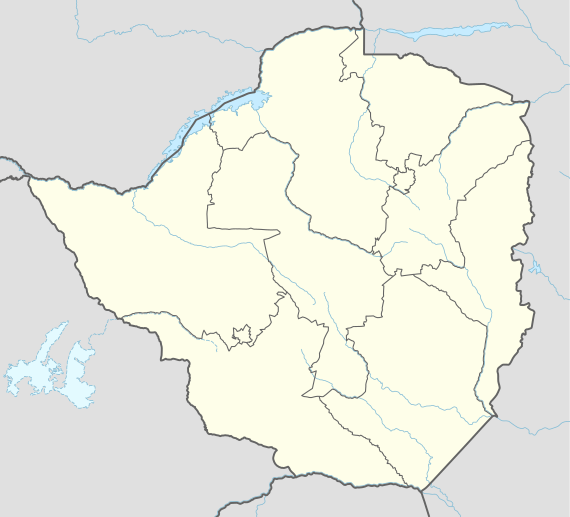 Gwanda Location in Zimbabwe | |
| Coordinates: 20°56′42″S 29°01′30″E | |
| Country | |
| Province | Matabeleland South |
| Districts of Zimbabwe | Gwanda District |
| Municipality | Municipality of Gwanda |
| Elevation | 1,001 m (3,284 ft) |
| Population (2012) | |
| • Total | 20,227 |
| Time zone | UTC+2 (CAT) |
| Climate | BSh |
Location
It is located approximately 126 kilometres (78 mi), by road, southeast of Bulawayo, Zimbabwe's second largest city.[1] This location lies on the Bulawayo-Beitbridge road and railway. The town of Beitbridge, at Zimbabwe's border with the Republic of South Africa, lies approximately 220 kilometres (140 mi), further southeast on Highway A-6.[2] The coordinates of Gwanda, Zimbabwe are: 20° 56' 42.00"S, 29° 01' 30.00"E (Latitude: 20.9450; Longitude: 29.0250). Gwanda sits at an average elevation of 3,284 feet (1,001 m) above sea level.[3]
Overview
Gwanda was founded in 1900 as a settlement of European gold miners and prospectors. Gwanda is administratively run by the Municipality of Gwanda, whose jurisdiction covers 10 wards across the town. It is also home to the Matabeleland South provincial offices of various government departments which are mainly located at the government complex along 3rd Avenue between Queen Street and Khartoum Street. The town has a provincial hospital, Gwanda Provincial Hospital, which serves as a referral centre for nearby smaller mission and district hospitals. Services provided include emergency medicine, paediatrics, maternity, eye surgery, minor orthopaedic surgery, general surgery and an expanded immunisation program. The town is the chief centre for south-western Zimbabwe's cattle district and also trades in agricultural produce. There are asbestos, chrome and gold mines around Gwanda.[4]
Gwanda's residential suburbs include Jahunda, Denneys, Mt. Cazalet, Hampden, Jacaranda, Spitzkop Medium, Spitzkop North Extension, Spitzkop, Phakama, Senondo, Hlalani Kuhle, Geneva, Marriage, Pelandaba, USAID, Jahunda Ultra High, Doelfontein, Judds and New Sablevale. Gwanda has five primary schools: (a) Jahunda Primary School (b) St. Christopher's Primary School (c) Mount Cazalet Primary School (d) Senondo Primary School and (e) Gwanda Adventist Primary School. The two secondary schools are: (i) Gwanda High School and (ii) Gwanda Government Secondary School. There is a nursing school; Gwanda School of Nursing, affiliated with the provincial hospital. Gwanda's tertiary education is provided by the Joshua Mqabuko Nkomo Polytechnic College. The main stadium is called Phelandaba Stadium. It was home to the former Zimbabwe Premier Soccer League team, Njube Sundowns.
The financial services sector includes banks such as ZB Bank Limited, CBZ Bank, AgriBank, POSB and CABS.[5]
Population
According to the 1982 Population Census, the town had a population of 4,874. The town chiefs refused to acknowledge the results of the 1992 census as they felt they had been undercounted. Officially, that disputed figure was 10,565. In 2004, the population of the town was estimated at 14,450.[6] As at the census of 2012 Gwanda has a population of 20,227.
Notable people
The former president of Zambia, Rupiah Banda, was born in this town, in a place called Miko.
Professor Thomas Tlou of the University of Botswana, former Botswana Ambassador to the U.N., was born in Gwanda. He was also co-author with Alec Campbell of History of Botswana.[7]
See also
External links
- Location of Gwanda At Google Maps
- Municipality of Gwanda - the local authority that governs the town of Gwanda
References
- Road Distance Between Bulawayo And Gwanda With Map
- Map Showing Gwanda And Beitbridge With Distance Marker
- Elevation of Gwanda
- Overview of Gwanda At Britannica.com
- "ZB Bank Opened Gwanda Branch In September 2011". Archived from the original on 17 June 2012. Retrieved 17 June 2012.
- Population of Gwanda, Zimbabwe In 2004
- Tlou, Thomas; Campbell, Alec (1984). History of Botswana. Gaborone, Botswana: Macmillan. ISBN 9789991278087.