Gullfaks oil field
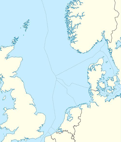
Gullfaks is an oil and gas field in the Norwegian sector of the North Sea operated by Equinor. It was discovered in 1978, in block 34/10, at a water depth of 130-230 meters.[1] The initial recoverable reserve is 2.1 billion barrels (330×106 m3), and the remaining recoverable reserve in 2004 is 234 million barrels (37.2×10⁶ m3). This oil field reached peak production in 2001 at 180,000 barrels per day (29,000 m3/d). It has satellite fields Gullfaks South, Rimfaks, Skinfaks and Gullveig.[2]
| Gullfaks | |
|---|---|
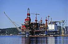 Gullfaks A being completed in Stord | |
 | |
| Country | Norway |
| Location | North Sea |
| Block | 34/10 |
| Offshore/onshore | offshore |
| Coordinates | 61°12′53.80″N 2°16′25.93″E |
| Operator | Equinor |
| Partners | Petoro |
| Field history | |
| Discovery | 1978 |
| Start of production | 1986 |
| Peak of production | 180,000 barrels per day (29,000 m3/d) |
| Peak year | 2001 |
| Production | |
| Current production of oil | 39,000 barrels per day (~1.9×10⁶ t/a) |
| Year of current production of oil | 2013 |
| Estimated oil in place | 73 million barrels (~1.0×10⁷ t) |
Platforms
The project consists of three production platforms Gullfaks A (1986), Gullfaks B (1988), and Gullfaks C (1989).[1] Gullfaks C sits 217 metres (712 ft) below the waterline. The height of the total structure measured from the sea floor is 380 metres (1,250 ft),[3] making it taller than the Eiffel Tower. Gullfaks C produces 250,000 barrels per day (40,000 m3/d) of oil. The Tordis field, which is located 11 kilometres (6.8 mi) south east of Gullfaks C, has a subsea separation manifold installed in 2007 which is tied-back to the existing Gullfaks infrastructure.[4][2]
Incidents
Between November 2009 and May 2010 a well being drilled from Gullfaks C experienced multiple well control incidents which were investigated by Petroleum Safety Authority Norway and summarized in a report released on 19 November 2010. The report stated that only chance prevented the final and most serious incident on 19 May 2010 from becoming a full-scale disaster.[5]
Geology
The reservoir consists of delta sandstones from the Middle Jurassic Brent Group, shallow-marine Lower Jurassic Cook Formation sandstones, and the fluvial-channel and delta-plain Lower Jurassic Statfjord Formation.[1]
See also
- 2016 Turøy helicopter crash
References
- Petterson, O., Storli, A., Ljosland, E., Nygaard, O., Massie, I., and Carlsen, H., The Gullfaks Field, 1992, in Giant Oil and Gas Fields of the Decade, 1978-1988, AAPG Memoir 54, Halbouty, M.T., editor, Tulsa: American Association of Petroleum Geologists, ISBN 0891813330, pp. 429-446
- Statoil
- Structures
- Amazing Structures, author Michael Pollard Page 34,35
- "summary letter in English" (PDF). Archived from the original (PDF) on 2011-07-26. Retrieved 2011-11-14.
External links

- Gullfaks (Statoil website)
- Gullfaks facts and interactive map
- Gullfaks C at Structurae
- Offshore Technology