Gubrimmaddera
Gubrimmaddera (Irish derived place name, Gob Dhroim Mhadra, meaning ‘The Headland of the Ridge of Dogs or Foxes’) is a townland in the civil parish of Kinawley, barony of Tullyhaw, County Cavan, Ireland.[1]
Geography
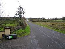
Gubrimmaddera is bounded on the west by Gubnafarna and Knockranny townlands and on the east by Cornalon and Gorteennaglogh townlands. Its chief geographical features are the River Cladagh (Swanlinbar), mountain streams, a spring well and a dug well. Gubrimmaddera is traversed by minor public roads and rural lanes. The townland covers 67 statute acres.[2]
History
The Tithe Applotment Books 1834 spell the name as Gubramadariff.[3]
The Gubrimmaddera Valuation Office Field books are available for 1838.[4]
Griffith's Valuation lists four landholders in the townland.[5]
The landlord of Gubrimmaddera in the 19th century was the Crofton Estate. The Crofton Estate papers are in the National Library of Ireland, MS 20,773-20,806 & D 26,886-27,010.
Census
| Year | Population | Males | Females | Total Houses | Uninhabited |
|---|---|---|---|---|---|
| 1841 | 22 | 10 | 12 | 4 | 0 |
| 1851 | 22 | 10 | 12 | 4 | 0 |
| 1861 | 21 | 12 | 9 | 4 | 0 |
| 1871 | 23 | 11 | 12 | 4 | 0 |
| 1881 | 16 | 6 | 10 | 4 | 0 |
| 1891 | 11 | 5 | 6 | 4 | 0 |
In the 1901 census of Ireland, there were five families listed in the townland.[6]
In the 1911 census of Ireland, there were six families listed in the townland.[7]
Antiquities
- Stepping-stones over the river
References
- "Placenames Database of Ireland". Retrieved 29 February 2012.
- "IreAtlas". Retrieved 29 February 2012.
- "004625688/004625688_00053.pdf" (PDF). 4 July 2012. Retrieved 25 May 2019.
- "Griffith's Valuation". askaboutireland.ie. Retrieved 25 May 2019.
- "National Archives: Census of Ireland 1901". census.nationalarchives.ie. Retrieved 25 May 2019.
- "National Archives: Census of Ireland 1911". census.nationalarchives.ie. Retrieved 25 May 2019.
External links
Places in County Cavan | ||
|---|---|---|
| Towns |  | |
| Villages |
| |
| Townlands | ||
| ||