Gualmatán
Gualmatán (full name, San Francisco del Líbano de Gualmatán), is a town and municipality in the Nariño Department, Colombia.
Gualmatán | |
|---|---|
Municipality and town | |
.svg.png) Flag  Seal | |
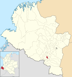 Location of the municipality and town of Gualmatán in the Nariño Department of Colombia. | |
| Country | |
| Department | Nariño Department |
| Area | |
| • Total | 36 km2 (14 sq mi) |
| Elevation | 2,830 m (9,280 ft) |
| Population | |
| • Total | 6,200 |
| • Density | 172.22/km2 (446.0/sq mi) |
| Time zone | UTC-5 (Colombia Standard Time) |
| Website | http://www.gualmatan-narino.gov.co |
Climate
Gualmatán has a subtropical highland climate (Cfb) with moderate rainfall year-round.
| Climate data for Gualmatán | |||||||||||||
|---|---|---|---|---|---|---|---|---|---|---|---|---|---|
| Month | Jan | Feb | Mar | Apr | May | Jun | Jul | Aug | Sep | Oct | Nov | Dec | Year |
| Average high °C (°F) | 16.7 (62.1) |
16.6 (61.9) |
16.7 (62.1) |
16.9 (62.4) |
16.8 (62.2) |
16.0 (60.8) |
15.5 (59.9) |
15.9 (60.6) |
16.5 (61.7) |
17.1 (62.8) |
17.0 (62.6) |
16.8 (62.2) |
16.5 (61.8) |
| Daily mean °C (°F) | 11.8 (53.2) |
11.8 (53.2) |
12.0 (53.6) |
12.2 (54.0) |
12.0 (53.6) |
11.4 (52.5) |
10.8 (51.4) |
10.9 (51.6) |
11.3 (52.3) |
12.0 (53.6) |
12.0 (53.6) |
12.1 (53.8) |
11.7 (53.0) |
| Average low °C (°F) | 6.9 (44.4) |
7.1 (44.8) |
7.3 (45.1) |
7.5 (45.5) |
7.3 (45.1) |
6.8 (44.2) |
6.2 (43.2) |
6.1 (43.0) |
6.2 (43.2) |
6.9 (44.4) |
7.0 (44.6) |
7.4 (45.3) |
6.9 (44.4) |
| Average rainfall mm (inches) | 63.0 (2.48) |
78.3 (3.08) |
104.2 (4.10) |
99.9 (3.93) |
93.8 (3.69) |
56.9 (2.24) |
48.0 (1.89) |
39.3 (1.55) |
61.6 (2.43) |
94.5 (3.72) |
97.2 (3.83) |
86.2 (3.39) |
922.9 (36.33) |
| Average rainy days | 12 | 13 | 15 | 15 | 17 | 14 | 14 | 14 | 12 | 15 | 16 | 15 | 172 |
| Source 1: [1] | |||||||||||||
| Source 2: [2] | |||||||||||||
References
- "Data". www.ideam.gov.co. Retrieved 2020-06-23.
- https://en.climate-data.org/south-america/colombia/narino/gualmatan-49603/
This article is issued from Wikipedia. The text is licensed under Creative Commons - Attribution - Sharealike. Additional terms may apply for the media files.