Guadalupe Victoria, Puebla
Guadalupe Victoria Municipality is a municipality in the Mexican state of Puebla. According to the National Statistics Institute (INEGI), it had a population of 15,041 inhabitants in the 2005 census. Its total area is 239.83 km². It is named after Guadalupe Victoria, the first president of Mexico.
Guadalupe Victoria Municipality | |
|---|---|
Municipality | |
 Seal | |
Guadalupe Victoria Municipality | |
| Coordinates: 19°17′00″N 97°20′00″W | |
| Country | |
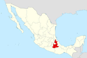
| State | Puebla |
| Area | |
| • Total | 239.83 km2 (92.60 sq mi) |
| Population (2005)Municipality | |
| • Total | 15,041 |
| Time zone | UTC-6 (Central (US Central)) |
| • Summer (DST) | UTC-5 (Central) |
| Website | (in Spanish) |
Its geographical coordinates are 19° 17′ North, and 97° 20′ West. Its average altitude is 2,440 metres (8,005 ft) above sea level. Its highest elevation is the rhyolitic twin dome volcano Las Derrumbadas (3480 m).
External links
This article is issued from Wikipedia. The text is licensed under Creative Commons - Attribution - Sharealike. Additional terms may apply for the media files.