Grimmer Parish, New Brunswick
Grimmer is a Canadian parish in Restigouche County, New Brunswick. Most of the parish was administered as the local service district of the parish of Grimmer until 2012, when it amalgamated with the village of Kedgwick to form the rural community of Kedgwick; a small area along Route 17 on the border with Eldon Parish remains part of the local service district of White's Brook. The civil parish continues to exist, as the Interpretation Act states that parishes include all municipalities within their boundaries.[2]
Grimmer | |
|---|---|
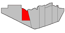 Location within Restigouche County. | |
| Coordinates: 47.67°N 67.45°W | |
| Country | |
| Province | |
| County | Restigouche |
| Established | 1916 |
| Area | |
| • Land | 653.48 km2 (252.31 sq mi) |
| Population (2011)[1] | |
| • Total | 1,096 |
| • Density | 1.7/km2 (4/sq mi) |
| • Pop 2006-2011 | |
| • Dwellings | 469 |
| Time zone | UTC-4 (AST) |
| • Summer (DST) | UTC-3 (ADT) |
Delineation
Grimmer Parish is defined in the Territorial Division Act[3] as being bounded:
- Southerly by the southern boundary line of lot number twenty-five, granted to Paul Berube, in Range 6, Rang-Double-Sud,[lower-alpha 1] and the prolongation of said boundary line easterly to the Parish of Eldon, and westerly to a point on the bank or shore of the Restigouche River. West by a straight line drawn due north astronomically from the said last-mentioned point to the southern boundary line of the Province of Quebec. Northerly by said Province and easterly by the Parish of Eldon.
Communities
Parish population total does not include incorporated municipalities (in bold).
|
|
Demographics
Population
| Canada census – Grimmer Parish, New Brunswick community profile | |||
|---|---|---|---|
| 2011 | 2006 | ||
| Population: | 1,096 (-0.8% from 2006) | 1,105 (-5.0% from 2001) | |
| Land area: | 653.48 km2 (252.31 sq mi) | 653.48 km2 (252.31 sq mi) | |
| Population density: | 1.7/km2 (4.4/sq mi) | 1.7/km2 (4.4/sq mi) | |
| Median age: | 41.8 (M: 42.5, F: 41.3) | 39.7 (M: 39.6, F: 39.8) | |
| Total private dwellings: | 469 | 531 | |
| Median household income: | $.N/A | $37,213 | |
| Notes: 2011 income data for this area has been suppressed for data quality or confidentiality reasons. – References: 2011[1] 2006[4] earlier[5] | |||
| Historical Census Data - Grimmer Parish, New Brunswick[6] | ||||||||||||||||||||||||||
|---|---|---|---|---|---|---|---|---|---|---|---|---|---|---|---|---|---|---|---|---|---|---|---|---|---|---|
|
|
| ||||||||||||||||||||||||
Language
| Canada Census Mother Tongue - Grimmer Parish, New Brunswick[6] | ||||||||||||||||||
|---|---|---|---|---|---|---|---|---|---|---|---|---|---|---|---|---|---|---|
| Census | Total | French |
English |
French & English |
Other | |||||||||||||
| Year | Responses | Count | Trend | Pop % | Count | Trend | Pop % | Count | Trend | Pop % | Count | Trend | Pop % | |||||
2011 |
1,090 |
1,060 | 97.25% | 25 | 2.29% | 0 | 0.00% | 5 | 0.46% | |||||||||
2006 |
1,095 |
1,080 | 98.63% | 15 | 1.37% | 0 | 0.00% | 0 | 0.00% | |||||||||
2001 |
1,165 |
1,120 | 96.14% | 25 | 2.14% | 20 | 1.72% | 0 | 0.00% | |||||||||
1996 |
1,100 |
1,065 | n/a | 96.82% | 25 | n/a | 2.27% | 10 | n/a | 0.91% | 0 | n/a | 0.00% | |||||
Access Routes
Highways and numbered routes that run through the parish, including external routes that start or finish at the parish limits:[7]
Footnotes
- Stewart Settlement.
References
- "2011 Community Profiles". 2011 Canadian Census. Statistics Canada. July 5, 2013. Retrieved 2014-03-21.
- "Interpretation Act". Province of New Brunswick. December 16, 2015. Retrieved 5 January 2016.
- "Territorial Division Act (R.S.N.B. 1973, c. T-3)". Government of New Brunswick website. Retrieved 23 August 2016.
- "2006 Community Profiles". 2006 Canadian Census. Statistics Canada. March 30, 2011. Retrieved 2014-03-21.
- "2001 Community Profiles". 2001 Canadian Census. Statistics Canada. February 17, 2012.
- Statistics Canada: 1996, 2001, 2006, 2011 census
- Atlantic Canada Back Road Atlas ISBN 978-1-55368-618-7 Pages 4, 12
Places adjacent to Grimmer Parish, New Brunswick | ||||||||||
|---|---|---|---|---|---|---|---|---|---|---|
| ||||||||||
| Subdivisions |
|
|---|---|
| Cities | |
| Counties | |
| |