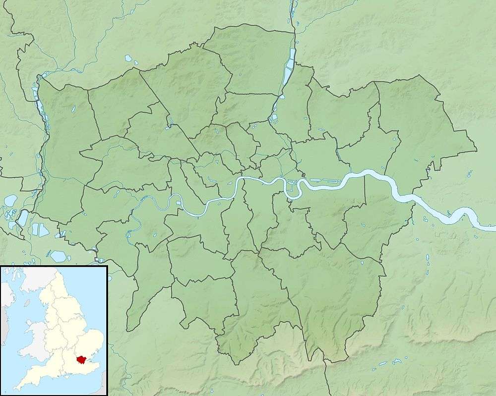
Grim's Ditch (Harrow)
Grim's Ditch or Grim's Dyke or Grimes Dike is an earthwork in the London Borough of Harrow (before 1965 in Middlesex) and lends its name to the gentle escarpment it crowns, marking Hertfordshire's border. It extended east-west about 3 miles (4.8 km) from the edge of Stanmore where an elevated neighbourhood of London, Stanmore Hill, adjoins Bushey Heath to the far north of Pinner Green. Today the remaining earthworks start mid-way at Harrow Weald Common.[1] It takes its name from the prehistoric earthwork which is one of seven Grim's Ditches, a few of which have two or three rows, in central southern England.
| Grim's Ditch | |
|---|---|
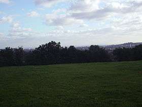 View towards Harrow from near summit of Grim's Ditch | |
| Highest point | |
| Elevation | 144 m (472 ft) |
| Geography | |
| Parent range | The Grim's Ditches |
| OS grid | TQ138928 |
| Topo map | OS Explorer 173 |
| Climbing | |
| Access | |
Attributes
Paths
A high path, Old Redding, an old high way passes through the centre of the trail and includes a map-marked viewpoint. Nearest roads are Oxhey Lane and Bushey Heath. Extensive views through breaks in trees are a few hundred yards further up the "high road".
North Basin high point
The immediate London basin resembles the administrative shape of London: three boroughs furthest south reach into the North Downs broad escarpment; those opposing take as their northern edge a broken ridge, low in the north-east, high in the north-west, namely the Grim's Ditch. The two highest ridges in London run along southern borders of London (namely with Westerham, Kent and Woodmansterne, Surrey). The next highest point is Stanmore Hill along the Grim's Ditch, where London adjoins Bushey, Hertfordshire.
Views
- Many parts of Central London can be seen, including the Shard London Bridge, which exceeds the height of all hills in London and the Home Counties.
- Beyond Harrow on the Hill to the south, Leith Hill can be seen (and its 20-metre-high tower through binoculars).
To the north and west are the Chilterns, and in particular Coombe Hill, Buckinghamshire can be seen.
The highest point of the trail, which is close to the county top of Middlesex, is above Grim's Dyke Golf Club on the 'Bushey Heath Walk' footpath. The walk reaches a small wood with a BT microwave aerial prominent. Close to the aerial's enclosure is a Stone Marker created by the Harrow Heritage Trust that reads:
This ancient earthwork once stretched through Harrow for some six miles from Cuckoo Hill, Pinner to Pear Wood, Stanmore, but now only parts remain. Named after Grim (another name for the English King of the gods (also the god of death), Woden).'
Hotel and film location
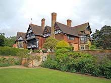

In the woods stands Grim's Dyke, a house designed in 1870 by Norman Shaw for the Victorian painter Frederick Goodall. Later, it was the country home of W. S. Gilbert (of Savoy opera fame) – he suffered a heart attack and drowned while trying to save a swimmer in the lake in the grounds. It is now an hotel and is often used as a film location. The house and its gatehouse are both listed buildings.[2]
History
Grim's Dyke had generally been dated as fifth to sixth century AD, but an excavation in 1979 produced a radiocarbon date of 50 AD +- 80 years, which while not conclusive suggests a much earlier date.[3] It may have been built by the Catuvellauni tribe as a defence against the Romans.[2]
Trivia
The earthwork also gave its name to the telephone exchange serving Stanmore a legacy being the first three distinctive numbers of many local dialling codes.[n 1]
References
- Notes
- GRImsdyke (as it was normally written) translates to 474 as a traditional number for outer London this is today preceded by (0)208
- References
- "Harrow Weald Common, Grim's Dyke Open Space, The City Open Space". London Parks & Gardens Trust. 2011.
- "Grim's Dyke Hotel". London Parks & Gardens Trust. 2012.
- Excavations at Grim’s Dyke, Harrow, 1979, London & Middlesex Archaeological Society, 1979