Greenview, California
Greenview is a census-designated place (CDP) in Siskiyou County, California, United States. The population was 201 at the 2010 census, a population increase of 1 from the 2000 census population of 200.
Greenview, California | |
|---|---|
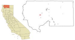 Location in Siskiyou County and the state of California | |
 Greenview, California Location in the United States | |
| Coordinates: 41°32′58″N 122°55′14″W | |
| Country | |
| State | |
| County | |
| Area | |
| • Total | 1.379 sq mi (3.573 km2) |
| • Land | 1.295 sq mi (3.354 km2) |
| • Water | 0.084 sq mi (0.219 km2) 6.12% |
| Elevation | 2,812 ft (857 m) |
| Population (2010) | |
| • Total | 201 |
| • Density | 150/sq mi (56/km2) |
| Time zone | UTC-8 (Pacific (PST)) |
| • Summer (DST) | UTC-7 (PDT) |
| ZIP code | 96037 |
| Area code(s) | 530 |
| FIPS code | 06-31134 |
| GNIS feature ID | 0260875 |
Geography
Greenview is located at 41°32′58″N 122°55′14″W (41.549515, -122.920420).[2]
According to the United States Census Bureau, the CDP has a total area of 1.4 square miles (3.6 km2), 93.88% of it land and 6.12% of it water.
Climate
This region experiences warm (but not hot) and dry summers, with no average monthly temperatures above 71.6 °F. According to the Köppen Climate Classification system, Greenview has a warm-summer Mediterranean climate, abbreviated "Csb" on climate maps.[3]
Demographics
| Historical population | |||
|---|---|---|---|
| Census | Pop. | %± | |
| U.S. Decennial Census[4] | |||
2010
At the 2010 census Greenview had a population of 201. The population density was 145.7 people per square mile (56.3/km²). The racial makeup of Greenview was 161 (80.1%) White, 0 (0.0%) African American, 10 (5.0%) Native American, 1 (0.5%) Asian, 0 (0.0%) Pacific Islander, 8 (4.0%) from other races, and 21 (10.4%) from two or more races. Hispanic or Latino of any race were 19 people (9.5%).[5]
The whole population lived in households, no one lived in non-institutionalized group quarters and no one was institutionalized.
There were 88 households, 18 (20.5%) had children under the age of 18 living in them, 51 (58.0%) were opposite-sex married couples living together, 8 (9.1%) had a female householder with no husband present, 3 (3.4%) had a male householder with no wife present. There were 4 (4.5%) unmarried opposite-sex partnerships, and 1 (1.1%) same-sex married couples or partnerships. 21 households (23.9%) were one person and 9 (10.2%) had someone living alone who was 65 or older. The average household size was 2.28. There were 62 families (70.5% of households); the average family size was 2.65.
The age distribution was 32 people (15.9%) under the age of 18, 13 people (6.5%) aged 18 to 24, 37 people (18.4%) aged 25 to 44, 80 people (39.8%) aged 45 to 64, and 39 people (19.4%) who were 65 or older. The median age was 52.6 years. For every 100 females, there were 97.1 males. For every 100 females age 18 and over, there were 94.3 males.
There were 100 housing units at an average density of 72.5 per square mile, of the occupied units 65 (73.9%) were owner-occupied and 23 (26.1%) were rented.The homeowner vacancy rate was 1.5%; the rental vacancy rate was 4.0%. 155 people (77.1% of the population) lived in owner-occupied housing units and 46 people (22.9%) lived in rental housing units.
2000
At the 2000 census there were 200 people, 88 households, and 60 families in the CDP. The population density was 143.0 people per square mile (55.2/km²). There were 99 housing units at an average density of 70.8 per square mile (27.3/km²). The racial makeup of the CDP was 89.00% White, 4.00% Native American, 0.50% Asian, and 6.50% from two or more races. Hispanic or Latino of any race were 0.50%.[6]
Of the 88 households 22.7% had children under the age of 18 living with them, 59.1% were married couples living together, 8.0% had a female householder with no husband present, and 31.8% were non-families. 26.1% of households were one person and 11.4% were one person aged 65 or older. The average household size was 2.27 and the average family size was 2.77.
The age distribution was 22.5% under the age of 18, 3.5% from 18 to 24, 21.0% from 25 to 44, 33.5% from 45 to 64, and 19.5% 65 or older. The median age was 46 years. For every 100 females, there were 108.3 males. For every 100 females age 18 and over, there were 93.8 males.
The median household income was $36,667 and the median family income was $41,591. Males had a median income of $35,625 versus $17,917 for females. The per capita income for the CDP was $19,918. None of the families and 1.0% of the population were living below the poverty line.
Politics
In the state legislature Greenview is in the 1st Senate District, represented by Republican Brian Dahle,[7] and the 1st Assembly District, represented by Republican Megan Dahle.[8]
Federally, Greenview is in California's 1st congressional district, represented by Republican Doug LaMalfa.[9]
References
- U.S. Census Archived 2012-01-25 at the Wayback Machine
- "US Gazetteer files: 2010, 2000, and 1990". United States Census Bureau. 2011-02-12. Retrieved 2011-04-23.
- Climate Summary for Greenview, California
- "Census of Population and Housing". Census.gov. Retrieved June 4, 2016.
- "2010 Census Interactive Population Search: CA - Greenview CDP". U.S. Census Bureau. Archived from the original on July 15, 2014. Retrieved July 12, 2014.
- "U.S. Census website". United States Census Bureau. Retrieved 2008-01-31.
- "Senators". State of California. Retrieved March 10, 2013.
- "Members Assembly". State of California. Retrieved March 2, 2013.
- "California's 1st Congressional District - Representatives & District Map". Civic Impulse, LLC. Retrieved March 1, 2013.
Municipalities and communities of Siskiyou County, California, United States | ||
|---|---|---|
| Cities | 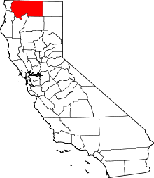 Siskiyou County map | |
| CDPs | ||
| Unincorporated communities | ||
| Indian reservation | ||
| Ghost towns | ||
| Footnotes | ‡This populated place also has portions in an adjacent county or counties | |