Greenethorpe
Greenethorpe is a town in the Central West region of New South Wales, Australia. The town is located in the Weddin Shire local government area, 345 kilometres (214 mi) west of the state capital, Sydney. At the 2011 census, Greenethorpe and the surrounding area had a population of 320.[1]
| Greenethorpe New South Wales | |
|---|---|
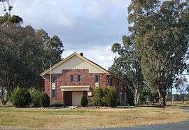 War memorial hall | |
Greenethorpe | |
| Coordinates | 33°59′47″S 148°24′09″E |
| Population | 320 (2011 census)[1] |
| Established | 1908 |
| Postcode(s) | 2809 |
| Location | |
| LGA(s) | Weddin Shire |
| State electorate(s) | Cootamundra |
| Federal Division(s) | Hume |
The village, with the associated "Mount Oriel" homestead (known locally as Iandra Castle), is a rare example in Australia of the manorial system, "the likes of which may not exist elsewhere in the state or nation".[2]
History
Greenethorpe is a purpose-built town, established in 1908 to house sharefarmers who worked on Iandra, the nearby pastoral station owned by George Henry Greene.[3][4] The village, built adjacent to a rail siding on the Grenfell railway line, was originally named Iandra Siding but to avoid confusion between the pastoral station and the train station, the Post Office agreed to change the name to Greenthorpe. Shortly after, the spelling was again changed, this time to Greenethorpe from the Greene family name.[5] Greenethorpe Public School was first established in 1903 as a Provisional School and named Iandra Siding. The school was renamed in 1909.[6]
Iandra Siding Post Office opened on 20 January 1908 and was renamed Greenethorpe in September that year.[7]
The village itself was based on the English manorial system, with tenant farms—generally 640 acres (260 ha) each—distributed around the central homestead.[2] The sharefarming system began in 1892 and a rail siding constructed in 1903.[2] In the early years of the twentieth century, Iandra set a record for the largest ever yield of wheat from a single property, and by 1911 there were fifty sharefarmers working over 18,000 acres (7,300 ha) there—the farmers supplying the machinery and labour and Greene providing seed and clearing ground suitable for ploughing.[3] Around 1914, the property began to be broken up and most tenants were offered an option to purchase the land they had farmed.[2]
The main dwelling in the Iandra homestead is an ornate mansion built from reinforced concrete in the Federation Romanesque style with Tudor influences. Consisting of 57 rooms on two storeys, it is referred to locally as "The Castle" in reference to its striking design and its semi-feudal role in the community. The homestead, built by pioneering engineer, Edward Giles Stone, also includes a blacksmith, manager's residence, stables, and a small Gothic chapel.[2]
Heritage listings
Greenethorpe has a number of heritage-listed sites, including:
- Iandra Road: Iandra Castle[2]
Today
Facilities in the town include a general store cum post office, a hotel, a public school and a police station. The town is also home to an art gallery.[4] The town does not have a mail delivery service; mail must be collected from the post office. The post office also carries a small collection of books from the Weddin Shire library service.[8] Greenethorpe Public School still uses the existing 1903 building for two classrooms, a library and a computer laboratory with the art room, kitchen and the administration located in adjacent buildings. The school is fully air-conditioned.[9]
To address problems related to a declining population—including declining school enrolments—in 2009 the Greenethorpe community adapted a farmhouse rental scheme used earlier at nearby Cumnock. The scheme entails offering farmhouses for rent at $1 per week to attract families to move to the area.[10] The first two families attracted by the offer moved into the town soon after.[11]
Since 1991, the Grenfell rail line—carrying grain only—has terminated in Greenethorpe.[12] In November 2008, the New South Wales government announced that it was considering closing the branch line to Greenethorpe, leading to protest meetings in the town.[13] However grain was still being freighted by rail from Greenethorpe in June 2009.[14]
References
- Australian Bureau of Statistics (31 October 2012). "Greenethorpe (State Suburb)". 2011 Census QuickStats. Retrieved 2 April 2015.

- "Iandra Homestead Pastoral Estate". New South Wales State Heritage Register. Office of Environment and Heritage. H01723. Retrieved 18 May 2018.
- Carnell, I. G. (1983). "Greene, George Henry (1838–1911)". Australian Dictionary of Biography, Online Edition. Australian National University. Retrieved 15 July 2009.
- "Greenethorpe". Revive Greenethorpe committee. 2009. Archived from the original on 8 July 2011. Retrieved 15 July 2009.
- "History of Greenethorpe". Revive Greenethorpe committee. 2009. Archived from the original on 8 July 2011. Retrieved 16 July 2009.
- "History". Greenethorpe Public School. Archived from the original on 31 August 2007. Retrieved 16 July 2009.
- Premier Postal History. "Post Office List". Premier Postal Auctions. Retrieved 26 May 2011.
- "Greenethorpe Post Office". Revive Greenethorpe committee. 2009. Archived from the original on 8 July 2011. Retrieved 16 July 2009.
- "Principal's message". Greenethorpe Public School. Archived from the original on 18 July 2008. Retrieved 16 July 2009.
- Hough, Cassandra (25 April 2009). "Greenethorpe needs you". The Land. Archived from the original on 3 June 2009. Retrieved 15 July 2009.
- "New families settle down to life at Greenethorpe – in farmhouses for $1 a week". Cowra Community News. 15 June 2009. Retrieved 16 July 2009.
- "Grenfell Branch". NSWrail.net. Retrieved 16 July 2009.
- Hough, Cassandra (16 April 2009). "Freight frustrations at Greenethorpe". The Land. Archived from the original on 4 October 2011. Retrieved 16 July 2009.
- Green, Steve (1 July 2009). "Trains run on Greenethorpe line". Young Witness. Archived from the original on 16 October 2009. Retrieved 15 December 2017.
External links
![]()