Great Allegheny Passage
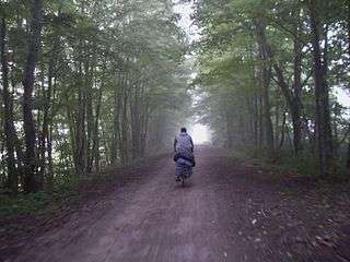
The Great Allegheny Passage (GAP) is a rail trail system in Maryland and Pennsylvania—the central trail of a network of long-distance hiker-biker trails throughout the Allegheny region of the Appalachian Mountains, connecting Washington, D.C. to Pittsburgh, Pennsylvania. It consists of several smaller trails including the Allegheny Highlands Trail of Maryland, the Allegheny Highlands Trail of Pennsylvania and the Youghiogheny River Trail.
| Great Allegheny Passage | |
|---|---|
 | |
| Length | 150 mi (241 km) |
| Location | Western Pennsylvania and Maryland |
| Designation | |
| Trailheads | Cumberland, Maryland 39.64863°N 78.76210°W Pittsburgh, Pennsylvania 40.43504°N 79.99611°W |
| Use | Hiking, cycling |
| Elevation | |
| Elevation change | western: 1,066 feet (325 m); eastern 1,786 feet (544 m) |
| Highest point | Eastern Continental Divide just east of Deal, Pennsylvania, 2,392 ft (729 m) |
| Lowest point | east end: 606 feet (185 m) at Cumberland, Maryland; west end: 720 feet (220 m) at Point State Park, Pittsburgh, Pennsylvania |
| Grade | 2% maximum |
| Hiking details | |
| Trail difficulty | Easy |
| Hazards | Severe weather, Traffic (Pittsburgh) |
| Surface | Crushed limestone |
| Right of way | Baltimore and Ohio Railroad Pittsburgh and Lake Erie Railroad Union Railroad Western Maryland Railway |
The GAP's first 9-mile (14 km) section near Ohiopyle, Pennsylvania, opened in 1986.[3] The 9-mile (14 km) section between Woodcock Hollow and Cumberland opened on December 13, 2006.[4] In June 2013, thirty-five years after construction first began, the final GAP section was completed (from West Homestead to Pittsburgh) at an overall cost of $80 million[5] and gave Pennsylvania the "most open trail miles in the nation"[6] (900 miles, with 1,110 miles under development).[7] The completion project was titled The Point Made, because it was now possible to reach Point State Park in Pittsburgh from Washington, D.C. Celebrations took place on June 15, 2013.
The multi-use trail, suitable for biking and walking, uses defunct corridors of the Baltimore and Ohio Railroad, Pittsburgh and Lake Erie Railroad, Union Railroad and the Western Maryland Railway—extending 150 miles (240 km) from Cumberland, Maryland to Point State Park in downtown Pittsburgh, and includes the 52-mile (84 km) branch (Montour Trail) to the Pittsburgh International Airport.
Completing a continuous, non-motorized corridor from Point State Park 335 miles (539 km) to Washington, D.C., the GAP connects with the Chesapeake and Ohio Canal towpath trail, which runs 184.5 miles (296.9 km) between Cumberland and Washington, D.C.
The Allegheny Trail Alliance (ATA)—a coalition of seven trail organizations related to the GAP (Friends of the Riverfront, Steel Valley Trail, Regional Trail Corporation, Ohiopyle State Park, and Mountains Maryland) maintains the 150–mile GAP, which is also a segment of the Potomac Heritage National Scenic Trail, one of eight nationally designated scenic trails.[8]
The trail's formal name, the Great Allegheny Passage, was selected in 2001 by the ATA "after six years and more than 100 proposals" as "a name evocative of the geography and historical heritage" of the trail,[7] having been suggested by Bill Metzger, editor of the ATA newsletter.[7] The trail used a temporary name, the "Cumberland and Pittsburgh Trail", before its official name was adopted.[7] The second runner-up title for the trail was the "Allegheny Frontier Trail".[7]
Landmarks
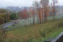
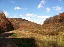
The route is traversed by "through-travelers" including hikers, backpackers and cyclists—in portion or entirety. Notable landmarks along the trail include:
- Point State Park in downtown Pittsburgh, where the Allegheny River meets the Monongahela River to form the Ohio River
- Carrie Furnace, part of the Steel Valley Heritage Trail, along the Monongahela River.
- Kennywood amusement park near Duquesne, Pennsylvania; this section of the trail was restricted during September 2013 due to a landslide.[9]
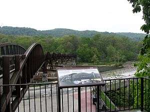
- Riverton Bridge over the Monongahela River between Duquesne, Pennsylvania and McKeesport, Pennsylvania.
- Dead Man's Hollow, former site of the Union Sewer Pipe Company located outside of McKeesport, Pennsylvania, now a 440-acre nature preserve and spur trail
- Dravo Cemetery, originally the Seneca tribe's village known as Cyrie, later the home of the Dravo Methodist Church and Cemetery. Now a popular camping area and rest spot near Buena Vista, Pennsylvania.
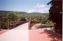
- Connellsville trestles, 2 long bridges near Connellsville, PA
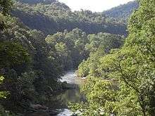
- Ohiopyle State Park, bisected by the Youghiogheny, the most popular whitewater destination on the east coast.
- Fallingwater, a national architectural landmark designed by Frank Lloyd Wright. Located very close to the trail, but not accessible from it.
- Pinkerton Trestles and Tunnel, a trestle, 849 feet (259 m) long tunnel (unlighted; reopened in 2015) and trestle between the Markleton and Fort Hill trailheads[10]
- Salisbury Viaduct, 1,908 feet (0.4 mi; 0.6 km), up to 100 feet (30 m) high across the Casselman River valley
- Meyersdale, Pennsylvania Museum
- Keystone Viaduct, east of Meyersdale, Pa.
- Bollman Truss Bridge in Meyersdale, one of the two surviving cast-iron truss bridges in North America
- the Eastern Continental Divide, the highest point of the trail, passes through a short tunnel with murals of the area's history and a map of the trail's elevation contours.
- Big Savage Tunnel, 3,295 feet (0.6 mi; 1.0 km), the lit tunnel, carries the trail through Big Savage Mountain two miles east of the Eastern Continental Divide with a scenic vista just east of the tunnel—closed December 1 to April 1 in protection from seasonal snow and ice.
- Mason–Dixon line: where the trail crosses the Pennsylvania - Maryland state border
- Borden Tunnel: 957 feet (292 m) long, unlighted.
- Western Maryland Scenic Railroad, a working steam railroad operating next to the trail from Cumberland, Maryland to the college town of Frostburg, Maryland (and return), along the original trackage of the Western Maryland Railway.
- Brush Tunnel: 914 feet (279 m) long, lighted; the trail and the Western Maryland Scenic Railroad share this tunnel and pass through it side-by-side.
- Cumberland Bone Cave: (two or three miles west of Cumberland, Maryland: an archeological site containing bones of saber-toothed cats and other extinct animals, discovered during construction of the railroad.
- Canal Place, the head of the Chesapeake and Ohio Canal (C&O) in Cumberland, Maryland, where the C&O meets the former Western Maryland Railway (WM) and rail-trail.
Sections
Allegheny Highlands Trail of Maryland
Allegheny Highlands Trail of Pennsylvania
Youghiogheny River Trail
| Youghiogheny River Trail | |
|---|---|
| Length | 71 mi (114 km) |
| Location | Allegheny / Fayette / Westmoreland counties, Pennsylvania, USA |
| Designation | National Scenic Trail |
| Trailheads | Confluence, Pennsylvania McKeesport, Pennsylvania |
| Use | Hiking, Biking |
| Hiking details | |
| Hazards | Severe Weather |
| Surface | Crushed limestone |


The Yough River Trail is a non-motorized multi-use rail trail that stretches 71 miles (114 km) between McKeesport and Confluence, Pennsylvania. It is part of the Great Allegheny Passage that allows cyclists to bike from Pittsburgh to Washington, D.C. The north section of the trail runs 43 miles (69 km) between McKeesport and Connellsville, Pennsylvania, and the south section runs 28 miles (45 km) between Connellsville and Confluence.
It is named after and runs along the Youghiogheny River. The trail surface is composed of crushed limestone.
Along the trail are scenic points and fishing opportunities. The route forms a part of U.S. Bicycle Route 50 and BicyclePA Route S.
Access areas
There are 9 access areas[11] on the Yough River Trail, all are free of charge; only the Cedar Creek Access Area offers secure overnight parking.
| Access Area Name | Town Name | Amenities/Information |
|---|---|---|
| McKeesport | McKeesport, PA | |
| Boston | Elizabeth Township, PA | Parking for 100 vehicles, sanitary toilets, and drinking water |
| Buena Vista | Elizabeth Township, PA | Parking for 16 vehicles, sanitary toilets, picnic pavilion, cooking grill, and boat launch |
| Sutersville | Sutersville, PA | Parking for 32 vehicles, sanitary toilets |
| West Newton | West Newton, PA | Parking for 44 cars, sanitary toilets, visitor center, drinking water, bike racks |
| Cedar Creek Park | Rostraver Township, PA | Parking for 150 cars, sanitary toilets, bike rentals, food concession |
| Smithton | South Huntingdon Township, PA | |
| Whitsett | Perry Township, Fayette County, PA | Parking for several cars, sanitary toilets |
| Connellsville | Connellsville, PA | Parking for several cars, sanitary toilets, drinking water |
Overnight use
Overnight use on the YRT is restricted to designated campgrounds, these are free-of-charge and can be only one (1) night. All designated campgrounds are equipped with a sanitary toilet (SST), fire grates, and designated tent pads.[12]
Camping Areas are as follows:
- Dravo's Landing Campground - located 6 miles (9.7 km) south of Boston Access Area and 1.5 miles (2.4 km) north of the Buena Vista Access Area. This campground has a drinking water supply via a well, that is safe for drinking purposes. Several Boy Scout Groups constructed the area as their Eagle Scout projects.
- Cedar Creek Trekker Campground - is located at the southernmost end of Cedar Creek Park in Westmoreland County. This area also has a piped water supply.
- Round Bottom Campground - is located 2.5 miles (4.0 km) south of the Layton Tunnel and 5 miles north of the Dickerson Run Yard. There is a hand pump water supply at this location.
- Connellsville Campsite - is located next to the Connellsville Station in Connellsville. There are two Adirondack shelters and areas for tents as well as a piped water supply.

Steel Valley Trail
Eliza Furnace Trail
This is also known as the Jail Trail.
See also
- Chesapeake and Ohio Canal
- Chesapeake and Ohio Canal National Historical Park
- Montour Trail
- Ohio River Trail
- Three Rivers Heritage Trail
- Erie to Pittsburgh Trail
- List of rail trails
- List of rail trails
- Dravo Cemetery
References
- "Meeting Minutes for October 17, 2013, and Report to SCOH October 18, 2013 (Addendum October 28, 2013)" (PDF). Denver, Colorado: Special Committee on U.S. Route Numbering, American Association of State Highway and Transportation Officials. October 28, 2013. Archived from the original (PDF) on May 5, 2014. Retrieved June 9, 2014.
- http://bicycletimesmag.com/pennsylvania-becomes-25th-state-to-join-u-s-bicycle-route-system/
- Thomson, Candus (2006-12-13). "Trail's opening eyed as path to prosperity". The Baltimore Sun. p. 2. Retrieved 2020-01-23.
- "New bike path portion open for business in Maryland". The Washington Times. 2006-12-15. Retrieved 2006-12-20.
- Jones, Diana Nelson (June 15, 2013). "Riders hit trail as last link in Great Allegheny Passage opens". Pittsburgh Post-Gazette.
- Jones, Diana Nelson (June 16, 2013). "Bicyclists celebrate reaching end of Great Allegheny Passage trail". Pittsburgh Post-Gazette.
- Hopey, Don (January 18, 2001). "150-mile bike trail dubbed the Great Allegheny Passage". Pittsburgh Post-Gazette.
- "Potomac Heritage National Scenic Trail". National Park Service. 2008-12-05. Retrieved 2008-12-17.
- Schmitz, Jon (September 15, 2013). "Repairs to begin Monday at trail landslide near Kennywood". Pittsburgh Post-Gazette. Retrieved 24 January 2020.
- Walsh, Larry (August 29, 2015). "Biking: Pinkerton Tunnel to reopen for bicyclists in mid-September". Pittsburgh Post-Gazette.
- YRT Access Areas
- YRT Camping
External links
| Wikimedia Commons has media related to Great Allegheny Passage. |
External links
| Wikimedia Commons has media related to Youghiogheny River Trail. |
| ||
| Government |  | |
|---|---|---|
| Economy | ||
| Other topics | ||
| ||