Grapeland, Texas
Grapeland is a city in Houston County, Texas, United States. The population was 1,489 as of the 2010 census.
Grapeland, Texas | |
|---|---|
 Location of Grapeland, Texas | |
 | |
| Coordinates: 31°29′30″N 95°28′49″W | |
| Country | United States |
| State | Texas |
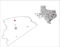
| County | Houston |
| Settled | 1872[1] |
| Established | 1899[1] |
| Area | |
| • Total | 2.0 sq mi (5.1 km2) |
| • Land | 2.0 sq mi (5.1 km2) |
| • Water | 0.0 sq mi (0.0 km2) |
| Elevation | 472 ft (144 m) |
| Population (2010) | |
| • Total | 1,489 |
| • Density | 733.5/sq mi (283.2/km2) |
| Time zone | UTC-6 (Central (CST)) |
| • Summer (DST) | UTC-5 (CDT) |
| ZIP code | 75844 |
| Area code(s) | 936 |
| FIPS code | 48-30632[2] |
| GNIS feature ID | 1358288[3] |
Geography
Grapeland is located at 31°29′30″N 95°28′49″W (31.491726, -95.480213).[4]
According to the United States Census Bureau, the city has a total area of 2.0 square miles (5.2 km2), of which, 2.0 square miles (5.2 km2) of it is land and 0.50% is water.
History
The site of Grapeland started to become a destination for pioneers around 1872, due to the establishment of the Houston and Great Northern Railroad Company. In particular, it became a crossroads between routes from Trinity to Augusta, and from Palestine to Crockett. Originally, the town was called "Grapevine," referring to the vines that had to be cut to make way for the railway tracks.[1]
Demographics
| Historical population | |||
|---|---|---|---|
| Census | Pop. | %± | |
| 1880 | 88 | — | |
| 1930 | 1,027 | — | |
| 1940 | 1,327 | 29.2% | |
| 1950 | 1,358 | 2.3% | |
| 1960 | 1,113 | −18.0% | |
| 1970 | 1,211 | 8.8% | |
| 1980 | 1,634 | 34.9% | |
| 1990 | 1,450 | −11.3% | |
| 2000 | 1,451 | 0.1% | |
| 2010 | 1,489 | 2.6% | |
| Est. 2018 | 1,428 | [6] | −4.1% |
| U.S. Decennial Census[7] | |||
As of the census[2] of 2000, there were 1,451 people, 583 households, and 377 families residing in the city. The population density was 733.5 people per square mile (282.9/km²). There were 726 housing units at an average density of 367.0 per square mile (141.6/km²). The racial makeup of the city was 63.27% White, 34.94% African American, 0.62% Native American, 0.07% Asian, 0.07% Pacific Islander, 0.83% from other races, and 0.21% from two or more races. Hispanic or Latino of any race were 1.65% of the population.
There were 583 households out of which 27.8% had children under the age of 18 living with them, 43.1% were married couples living together, 19.2% had a female householder with no husband present, and 35.2% were non-families. 34.3% of all households were made up of individuals and 20.6% had someone living alone who was 65 years of age or older. The average household size was 2.39 and the average family size was 3.08.
In the city, the population was spread out with 26.4% under the age of 18, 7.1% from 18 to 24, 21.2% from 25 to 44, 20.7% from 45 to 64, and 24.6% who were 65 years of age or older. The median age was 42 years. For every 100 females, there were 79.8 males. For every 100 females age 18 and over, there were 71.7 males.
The median income for a household in the city was $22,361, and the median income for a family was $30,250. Males had a median income of $26,964 versus $18,906 for females. The per capita income for the city was $13,736. About 20.4% of families and 23.5% of the population were below the poverty line, including 29.2% of those under age 18 and 19.0% of those age 65 or over.
Education
The City of Grapeland is served by the Grapeland Independent School District and home of the Grapeland Sandies.
Notable people
- Ruth J. Simmons, former President of Brown University and Smith College
- Tony Jones, NFL player for Houston Oilers 1990
See also
- Pleasant Hill, a ghost town near Grapeland
Climate
The climate in this area is characterized by hot, humid summers and generally mild to cool winters. According to the Köppen Climate Classification system, Grapeland has a humid subtropical climate, abbreviated "Cfa" on climate maps.[8]
References
- "The History of Grapeland, Texas". grapeland.com. Retrieved 19 August 2015.
- "U.S. Census website". United States Census Bureau. Retrieved 2008-01-31.
- "US Board on Geographic Names". United States Geological Survey. 2007-10-25. Retrieved 2008-01-31.
- "US Gazetteer files: 2010, 2000, and 1990". United States Census Bureau. 2011-02-12. Retrieved 2011-04-23.
- Lomax, John Nova. "Texas Tweakers." Houston Press. Wednesday November 16, 2011. 8. Retrieved on November 19, 2011.
- "Population and Housing Unit Estimates". Retrieved January 19, 2020.
- "Census of Population and Housing". Census.gov. Retrieved June 4, 2015.
- "Grapeland, Texas Köppen Climate Classification (Weatherbase)". Weatherbase. Retrieved 19 August 2015.
External links
| Wikimedia Commons has media related to Grapeland, Texas. |
Municipalities and communities of Houston County, Texas, United States | ||
|---|---|---|
| Cities |  Houston County map | |
| Unincorporated communities |
| |
| Ghost towns | ||
| Footnotes | ‡This populated place also has portions in an adjacent county or counties | |
| Authority control |
|---|