Granger, Wyoming
Granger is a town in Sweetwater County, Wyoming, United States. The population was 139 at the 2010 census. It is located near the confluence of the Blacks Fork and the Hams Fork rivers. The geography of the area is flat with semi-arid scrub.
Granger, Wyoming | |
|---|---|
 Granger stage station, built in 1856, on Old U.S. Route 30 | |
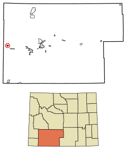 Location of Granger in Sweetwater County, Wyoming. | |
 Granger, Wyoming Location in the United States | |
| Coordinates: 41°35′39″N 109°58′0″W | |
| Country | United States |
| State | Wyoming |
| County | Sweetwater |
| Area | |
| • Total | 2.53 sq mi (6.54 km2) |
| • Land | 2.53 sq mi (6.54 km2) |
| • Water | 0.00 sq mi (0.00 km2) |
| Elevation | 6,273 ft (1,912 m) |
| Population | |
| • Total | 139 |
| • Estimate (2018)[3] | 131 |
| • Density | 51.84/sq mi (20.02/km2) |
| Time zone | UTC-7 (Mountain (MST)) |
| • Summer (DST) | UTC-6 (MDT) |
| ZIP code | 82934 |
| Area code(s) | 307 |
| FIPS code | 56-32870[4] |
| GNIS feature ID | 1589030[5] |
Early history: 1834–1868
Although the population has always been small, the site is located at the intersection of the Oregon Trail and the Overland Stage Trail and it was chosen for a stage coach station.[6] The station, which was built of stone and adobe in 1856, was in operation when Mark Twain passed through, and still stands today.[7] The Pony Express used this station[8] as a stopover in 1861-62. Later, in 1868, it became a stop on the railroad, which was when it started to be called Granger.[7]
The area of what is present-day Granger had significance to the mountain men who trapped in the early years of the American West. It was chosen as the site of their annual rendezvous in 1834[8] (the rendezvous was still somewhat spread out, as each supplier set up camp at different location along the river).[9] The American Fur Company, among other suppliers, were present, and American Indians and trappers traded furs for goods. Several weeks were spent recounting events from the previous year and reveling in assorted amusements, while lubricated with liquor. The records show that the event occurred at the junction of the Hams Fork and Blacks Fork rivers.[9]
Geography
Granger is located at 41°35′39″N 109°58′0″W (41.594036, -109.966607).[10]
According to the United States Census Bureau, the town has a total area of 2.53 square miles (6.55 km2), all of it land.[11]
Demographics
| Historical population | |||
|---|---|---|---|
| Census | Pop. | %± | |
| 1920 | 136 | — | |
| 1930 | 135 | −0.7% | |
| 1940 | 163 | 20.7% | |
| 1950 | 122 | −25.2% | |
| 1960 | 159 | 30.3% | |
| 1970 | 137 | −13.8% | |
| 1980 | 177 | 29.2% | |
| 1990 | 126 | −28.8% | |
| 2000 | 146 | 15.9% | |
| 2010 | 139 | −4.8% | |
| Est. 2018 | 131 | [3] | −5.8% |
| U.S. Decennial Census[12] | |||
2010 census
At the 2010 census there were 139 people, 57 households, and 38 families living in the town. The population density was 54.9 inhabitants per square mile (21.2/km2). There were 72 housing units at an average density of 28.5 per square mile (11.0/km2). The racial makeup of the town was 88.5% White, 0.7% African American, 9.4% from other races, and 1.4% from two or more races. Hispanic or Latino of any race were 15.1%.[2]
Of the 57 households 24.6% had children under the age of 18 living with them, 54.4% were married couples living together, 3.5% had a female householder with no husband present, 8.8% had a male householder with no wife present, and 33.3% were non-families. 21.1% of households were one person and 5.3% were one person aged 65 or older. The average household size was 2.44 and the average family size was 2.82.
The median age in the town was 39.5 years. 25.2% of residents were under the age of 18; 5.7% were between the ages of 18 and 24; 23.8% were from 25 to 44; 38.1% were from 45 to 64; and 7.2% were 65 or older. The gender makeup of the town was 54.7% male and 45.3% female.
2000 census
At the 2000 census there were 146 people, 54 households, and 40 families living in the town. The population density was 59.0 people per square mile (22.8/km²). There were 76 housing units at an average density of 30.7 per square mile (11.9/km²). The racial makeup of the town was 82.19% White, 8.22% from other races, and 9.59% from two or more races. Hispanic or Latino of any race were 22.60%.[4]
Of the 54 households 35.2% had children under the age of 18 living with them, 68.5% were married couples living together, 5.6% had a female householder with no husband present, and 25.9% were non-families. 24.1% of households were one person and 5.6% were one person aged 65 or older. The average household size was 2.70 and the average family size was 3.18.
The age distribution was 28.8% under the age of 18, 10.3% from 18 to 24, 18.5% from 25 to 44, 33.6% from 45 to 64, and 8.9% 65 or older. The median age was 38 years. For every 100 females, there were 100.0 males. For every 100 females age 18 and over, there were 116.7 males.
The median household income was $46,563 and the median family income was $52,083. Males had a median income of $45,750 versus $19,375 for females. The per capita income for the town was $17,764. There were 10.5% of families and 12.3% of the population living below the poverty line, including 5.7% of under eighteens and 21.1% of those over 64.
Education
Public education in the town of Granger is provided by Sweetwater County School District #2.
Granger has a public library, a branch of the Sweetwater County Library System.[13]
References
- "2018 U.S. Gazetteer Files". United States Census Bureau. Retrieved Feb 16, 2020.
- "U.S. Census website". United States Census Bureau. Retrieved 2012-12-14.
- "Population and Housing Unit Estimates". Retrieved June 4, 2019.
- "U.S. Census website". United States Census Bureau. Retrieved 2008-01-31.
- "US Board on Geographic Names". United States Geological Survey. 2007-10-25. Retrieved 2008-01-31.
- "About Granger". Untraveled Road.
- "Granger Stage Station Historic Site". Wyoming State Parks. Archived from the original on 2014-08-23. Retrieved 2012-12-23.
- Official State Highway Map of Wyoming (Map). Wyoming Department of Transportation. 2014.
|access-date=requires|url=(help) - "Mountain Man Rendezvous Sites". furtrapper.com. Archived from the original on 2012-11-15.
- "US Gazetteer files: 2010, 2000, and 1990". United States Census Bureau. 2011-02-12. Retrieved 2011-04-23.
- "US Gazetteer files 2010". United States Census Bureau. Archived from the original on 2012-01-25. Retrieved 2012-12-14.
- "Census of Population and Housing". Census.gov. Retrieved June 4, 2015.
- "Wyoming Public Libraries". PublicLibraries.com. Retrieved 14 June 2019.
Municipalities and communities of Sweetwater County, Wyoming, United States | ||
|---|---|---|
| Cities | 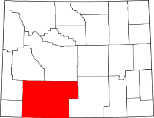 | |
| Towns | ||
| CDPs | ||
| Unincorporated communities | ||
| Ghost towns | ||
| Footnotes | ‡This populated place also has portions in an adjacent state | |
| Authority control |
|
|---|