Grade I listed buildings in North East Lincolnshire
There are over 9,000 Grade I listed buildings in England. This page is a list of these buildings in the district of North East Lincolnshire in Lincolnshire.
North East Lincolnshire
| Name | Location | Type | Completed [note 1] | Date designated | Grid ref.[note 2] Geo-coordinates |
Entry number [note 3] | Image |
|---|---|---|---|---|---|---|---|
| Church of St. Lawrence | Aylesby, North East Lincolnshire | Church | 13th century | 4 January 1967 | TA2028907589 53°33′04″N 0°11′09″W |
1161566 | 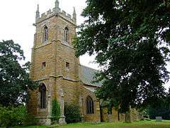 Church of St. Lawrence |
| Church of Saint Helen | Barnoldby Le Beck, North East Lincolnshire | Parish Church | 13th century | 4 January 1967 | TA2355103311 53°30′43″N 0°08′18″W |
1103486 | 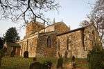 Church of Saint Helen |
| Church of St Nicolas | Great Coates, Great Coates, North East Lincolnshire | Parish Church | c. 1200 | 4 January 1967 | TA2332809784 53°34′13″N 0°08′21″W |
1379843 | 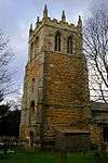 Church of St Nicolas |
| Church of St Mary | Hatcliffe, North East Lincolnshire | Parish Church | 12th century | 4 January 1967 | TA2131900704 53°29′21″N 0°10′23″W |
1103493 | 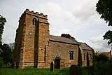 Church of St Mary |
| Church of St. Andrew | Immingham, North East Lincolnshire | Church | 12th century | 4 January 1967 | TA1752015081 53°37′09″N 0°13′29″W |
1310011 | 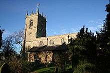 Church of St. Andrew |
| Church of Saint Andrew | Irby, North East Lincolnshire | Parish Church | 12th century | 4 January 1967 | TA1959104958 53°31′40″N 0°11′50″W |
1161130 | 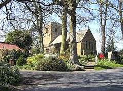 Church of Saint Andrew |
| Church of Saint Margaret | Laceby, North East Lincolnshire | Parish Church | 12th century | 4 January 1967 | TA2143706530 53°32′29″N 0°10′08″W |
1346952 | 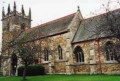 Church of Saint Margaret |
| Church of St Giles | Scartho, North East Lincolnshire | Parish Church | 11th century | 6 June 1951 | TA2673806363 53°32′19″N 0°05′21″W |
1379408 | 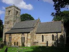 Church of St Giles |
| Church of St James | Grimsby, North East Lincolnshire | Parish Church | 13th century | 6 June 1951 | TA2664009169 53°33′50″N 0°05′22″W |
1379386 | |
| Church of St Michael | Little Coates, North East Lincolnshire | Church | 15th century | 6 June 1951 | TA2413909020 53°33′47″N 0°07′38″W |
1379845 | 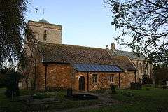 Church of St Michael |
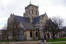
| Church of the Holy Trinity and Holy Mary the Virgin | Old Clee, North East Lincolnshire | Parish Church | 11th century | 6 June 1951 | TA2899808458 53°33′25″N 0°03′15″W |
1379405 | 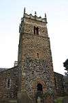 Church of the Holy Trinity and Holy Mary the Virgin |
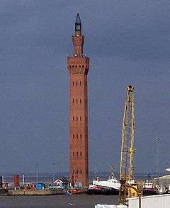
| The Dock Tower | The Docks, North East Lincolnshire | Tower | 1851-1852 | 28 April 1972 | TA2784411348 53°34′59″N 0°04′13″W |
1379870 |
Notes
- The date given is the date used by Historic England as significant for the initial building or that of an important part in the structure's description.
- Sometimes known as OSGB36, the grid reference is based on the British national grid reference system used by the Ordnance Survey.
- The "List Entry Number" is a unique number assigned to each listed building and scheduled monument by Historic England.
External links
![]()
This article is issued from Wikipedia. The text is licensed under Creative Commons - Attribution - Sharealike. Additional terms may apply for the media files.