Goltry, Oklahoma
Goltry is a town in Alfalfa County, Oklahoma, United States. The population was 249 at the 2010 census.[6] Goltry shares the Timberlake school district with the nearby town of Helena.
Goltry | |
|---|---|
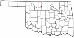 Location of Goltry, Oklahoma | |
 Goltry Location of Goltry, Oklahoma  Goltry Goltry (the United States) | |
| Coordinates: 36°31′57″N 98°09′06″W | |
| Country | United States |
| State | Oklahoma |
| County | Alfalfa |
| Area | |
| • Total | 0.38 sq mi (0.97 km2) |
| • Land | 0.38 sq mi (0.97 km2) |
| • Water | 0.00 sq mi (0.00 km2) |
| Elevation | 1,381[2] ft (421 m) |
| Population | |
| • Total | 249 |
| • Estimate (2018)[4] | 253 |
| • Density | 674.67/sq mi (260.40/km2) |
| Time zone | UTC-6 (Central (CST)) |
| • Summer (DST) | UTC-5 (CDT) |
| ZIP code | 73739 |
| Area code(s) | 580 |
| FIPS code | 40-29900[5] |
| GNIS feature ID | 1093241[2] |
Geography
Goltry is located at 36°31′57″N 98°09′06″W (36.5325320, -98.1517334).[2] Situated in far southeastern Alfalfa County, it lies along State Highway 45.[7] Goltry lies midway between the county seat of Cherokee, and the nearest city, Enid, Oklahoma, via the aforementioned State Highway 45.[8]
According to the United States Census Bureau, the town has a total area of 0.375 square miles (0.97 km2), all of it land.[9]
History
Part of the Cherokee Outlet, the area was not open to non-Indian settlement until September 1893. It was part of the then larger Woods County, until the creation of Alfalfa County at the time of statehood in 1907. Many of the early settlers were Germans from Russia, in addition to a number from the then German state of Bohemia and from Switzerland.[8] At one time, Goltry was home to two German Mennonite churches. The remaining Mennonite church, the Pleasant View Church of God in Christ Mennonite, was organized in 1905, by settlers who began to arrive in 1900.[10][11] As late as 2000, one-third of the town's residents claimed German ancestry.[8] Birthplace of Wally Parks in 1913, the founder of the National Hot Rod Association.[12]
Demographics
| Historical population | |||
|---|---|---|---|
| Census | Pop. | %± | |
| 1910 | 320 | — | |
| 1920 | 287 | −10.3% | |
| 1930 | 346 | 20.6% | |
| 1940 | 330 | −4.6% | |
| 1950 | 277 | −16.1% | |
| 1960 | 313 | 13.0% | |
| 1970 | 282 | −9.9% | |
| 1980 | 305 | 8.2% | |
| 1990 | 297 | −2.6% | |
| 2000 | 268 | −9.8% | |
| 2010 | 249 | −7.1% | |
| Est. 2018 | 253 | [4] | 1.6% |
| U.S. Decennial Census[3] | |||
As of the census[5] of 2000, there were 268 people, 120 households, and 72 families residing in the town. The population density was 731.9 people per square mile (279.7/km²). There were 146 housing units at an average density of 398.7 per square mile (152.4/km²). The racial makeup of the town was 92.54% White, 4.10% Native American, and 3.36% from two or more races.
There were 120 households out of which 25.8% had children under the age of 18 living with them, 52.5% were married couples living together, 6.7% had a female householder with no husband present, and 39.2% were non-families. 36.7% of all households were made up of individuals and 20.8% had someone living alone who was 65 years of age or older. The average household size was 2.23 and the average family size was 2.95.
In the town, the population was spread out with 25.0% under the age of 18, 3.0% from 18 to 24, 26.1% from 25 to 44, 21.6% from 45 to 64, and 24.3% who were 65 years of age or older. The median age was 42 years. For every 100 females, there were 90.1 males. For every 100 females age 18 and over, there were 82.7 males.
The median income for a household in the town was $30,000, and the median income for a family was $31,979. Males had a median income of $27,500 versus $16,696 for females. The per capita income for the town was $12,182. About 13.8% of families and 18.1% of the population were below the poverty line, including 23.3% of those under the age of 18 and 14.5% of those 65 or over.
References
- "2018 U.S. Gazetteer Files". United States Census Bureau. Retrieved Feb 12, 2020.
- "Feature Detail Report for: Goltry". Geographic Names Information System(GNIS). United States Geological Survey. December 18, 1979. Retrieved August 29, 2016.
- "Census of Population and Housing". Census.gov. Retrieved June 4, 2015.
- "Population and Housing Unit Estimates". Retrieved June 4, 2019.
- "U.S. Census website". United States Census Bureau. Retrieved 2008-01-31.
- "Geographic Identifiers: 2010 Demographic Profile Data (G001): Goltry town, Oklahoma". U.S. Census Bureau, American Factfinder. Archived from the original on February 12, 2020. Retrieved July 15, 2013.
- Oklahoma 2009-2010 Official State Map (PDF) (Map) (2009-2010 ed.). Oklahoma Department of Transportation. Retrieved September 1, 2016.
- Everett, Dianna. "Encyclopedia of Oklahoma History and Culture - Goltry". Encyclopedia of Oklahoma History and Culture. Oklahoma History Center. Retrieved August 29, 2016.
- "US Gazetteer files: 2010 (Oklahoma)". United States Census Bureau. February 12, 2011. Retrieved September 1, 2016.
- Koehn, Reuben J (1959). "Pleasant View Church of God in Christ Mennonite Church (Goltry, Oklahoma, USA)". Global Anabaptist Mennonite Encyclopedia Online. GAMEO. Retrieved August 29, 2016.
- Bergen, J. W. (1955). "Alfalfa County (Oklahoma, USA)". Global Anabaptist Mennonite Encyclopedia Online. GAMEO. Retrieved August 29, 2016.
- NHRA.com
External links
Municipalities and communities of Alfalfa County, Oklahoma, United States | ||
|---|---|---|
| City | 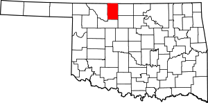 Alfalfa County map | |
| Towns | ||
| CDP | ||
| Other unincorporated communities | ||