Goat Mountain (Blaine County, Idaho)
Goat Mountain, at 11,913 feet (3,631 m) above sea level is the second highest peak in the Pioneer Mountains of Idaho. The peak is located on the border of Sawtooth and Salmon-Challis National Forests as well as Blaine and Custer counties. It is the 16th highest peak in Idaho and less than 2 mi (3.2 km) north-northwest of Hyndman Peak.[2][3][4]
| Goat Mountain | |
|---|---|
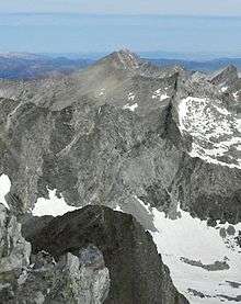 Goat Mountain at center viewed from Hyndman Peak | |
| Highest point | |
| Elevation | 11,918 ft (3,633 m) NAVD 88[1] |
| Prominence | 814 ft (248 m) [1] |
| Coordinates | 43°46′27″N 114°08′31″W |
| Geography | |
| Parent range | Pioneer Mountains |
| Topo map | USGS Phi Kappa Mountain |
| Climbing | |
| Easiest route | Simple scrambling, class 3 |

References
- "Goat Mountain, Idaho". Peakbagger.com. Retrieved 2013-01-14.
- "The 100 Highest Peaks". Idaho: A Climbing Guide. Retrieved January 1, 2013.
- Sawtooth National Forest (Map) (1998 ed.). Sawtooth National Forest, U.S. Forest Service.
- "Goat Mountain (Kane Peak)". SummitPost.org. Retrieved January 1, 2013.
This article is issued from Wikipedia. The text is licensed under Creative Commons - Attribution - Sharealike. Additional terms may apply for the media files.