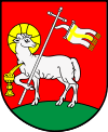
Gmina Biała, Łódź Voivodeship
Gmina Biała is a rural gmina (administrative district) in Wieluń County, Łódź Voivodeship, in central Poland. Its seat is the village of Biała, which lies approximately 11 kilometres (7 mi) north-west of Wieluń and 92 km (57 mi) south-west of the regional capital Łódź.
Gmina Biała Biała Commune | |
|---|---|
 Coat of arms | |
| Coordinates (Biała): 51°15′59″N 18°26′21″E | |
| Country | |
| Voivodeship | Łódź |
| County | Wieluń |
| Seat | Biała |
| Area | |
| • Total | 74.99 km2 (28.95 sq mi) |
| Population (2006) | |
| • Total | 5,503 |
| • Density | 73/km2 (190/sq mi) |
| Website | http://gminabiala.pl/ [1][2] |
The gmina covers an area of 74.99 square kilometres (29.0 sq mi), and as of 2006 its total population is 5,503.
Villages
Gmina Biała contains the villages and settlements of Biała Parcela, Biała Pierwsza, Biała Rządowa, Biała-Kopiec, Brzoza, Huby, Janowiec, Klapka, Kopydłów, Łyskornia, Młynisko, Naramice, Radomina, Rososz, Śmiecheń, Wiktorów and Zabłocie.
Neighbouring gminas
Gmina Biała is bordered by the gminas of Czarnożyły, Czastary, Łubnice, Lututów, Skomlin, Sokolniki and Wieluń.
References
- "Gmina Biała - BIP". www.biala.finn.pl. Archived from the original on 18 January 2016. Retrieved 25 June 2016.
- "BIP: Urząd Gminy Biała". www.bip.gov.pl. Archived from the original on 20 September 2011. Retrieved 25 June 2016.
This article is issued from Wikipedia. The text is licensed under Creative Commons - Attribution - Sharealike. Additional terms may apply for the media files.
