Glonn (Mangfall)
Its source is in Glonn in the Ebersberg district and it flows in south-east direction via Beyharting (Tuntenhausen) to Bad Aibling, where it flows into the Mangfall.
| Glonn | |
|---|---|
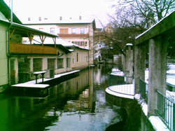 The Glonn in Bad Aibling | |
| Location | |
| Country | Germany |
| States | Bavaria |
| Physical characteristics | |
| Mouth | |
• location | Mangfall |
• coordinates | 47.8536°N 12.0170°E |
| Length | 28.7 km (17.8 mi) [1] |
| Basin size | 145 km2 (56 sq mi) [1] |
| Basin features | |
| Progression | Mangfall→ Inn→ Danube→ Black Sea |
Glonn is a river of Bavaria, Germany.
The Glonn has a length of about 29 kilometres (18 miles). Its name originates from "Glana", "the clear one" (female) in Celtic languages.
See also
References
- Complete table of the Bavarian Waterbody Register by the Bavarian State Office for the Environment (xls, 10.3 MB)
External links

This article is issued from Wikipedia. The text is licensed under Creative Commons - Attribution - Sharealike. Additional terms may apply for the media files.