Ghent, New York
Ghent is a town in Columbia County, New York, United States, with a ZIP code of 12075. The population was 5,402 at the 2010 census.[3] Ghent is centrally located in the county and is northeast of the city of Hudson.
Ghent, New York | |
|---|---|
Town | |
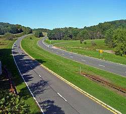 Taconic State Parkway in Ghent | |
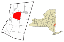 Location of Ghent, New York | |
| Coordinates: 42°18′56″N 73°38′57″W | |
| Country | United States |
| State | New York |
| County | Columbia |
| Government | |
| • Type | Town Council |
| • Town Supervisor | Michael Benvenuto (R) |
| • Town Council | Members' List
|
| Area | |
| • Total | 45.40 sq mi (117.58 km2) |
| • Land | 45.13 sq mi (116.89 km2) |
| • Water | 0.27 sq mi (0.69 km2) |
| Elevation | 404 ft (123 m) |
| Population (2010) | |
| • Total | 5,402 |
| • Estimate (2016)[2] | 5,181 |
| • Density | 114.80/sq mi (44.32/km2) |
| Time zone | UTC-5 (Eastern (EST)) |
| • Summer (DST) | UTC-4 (EDT) |
| ZIP code | 12075 |
| Area code(s) | 518 |
| FIPS code | 36-021-28871 |
| GNIS feature ID | 0979000 |
| Website | townofghent |
History
Around 1735, early settlers, exploiting areas cleared by the natives, moved into the area. In 1818, the town of Ghent was founded from parts of the towns of Chatham, Claverack and Kinderhook. The name has its origin in the Belgian city Ghent. Located at Ghent is the historic Van Valkenburgh-Isbister Farm, added to the National Register of Historic Places in 2006.[4]
Geography
According to the United States Census Bureau, the town has a total area of 45.4 square miles (117.6 km2), of which 45.1 square miles (116.9 km2) is land and 0.27 square miles (0.7 km2), or 0.59%, is water.[3]
The Taconic State Parkway crosses the southeast corner of the town.
Demographics
| Historical population | |||
|---|---|---|---|
| Census | Pop. | %± | |
| 1820 | 2,379 | — | |
| 1830 | 2,790 | 17.3% | |
| 1840 | 2,558 | −8.3% | |
| 1850 | 2,293 | −10.4% | |
| 1860 | 2,803 | 22.2% | |
| 1870 | 2,886 | 3.0% | |
| 1880 | 2,953 | 2.3% | |
| 1890 | 2,903 | −1.7% | |
| 1900 | 2,693 | −7.2% | |
| 1910 | 2,819 | 4.7% | |
| 1920 | 2,451 | −13.1% | |
| 1930 | 2,818 | 15.0% | |
| 1940 | 2,948 | 4.6% | |
| 1950 | 3,173 | 7.6% | |
| 1960 | 3,485 | 9.8% | |
| 1970 | 3,729 | 7.0% | |
| 1980 | 4,636 | 24.3% | |
| 1990 | 4,812 | 3.8% | |
| 2000 | 5,272 | 9.6% | |
| 2010 | 5,402 | 2.5% | |
| Est. 2016 | 5,181 | [2] | −4.1% |
| U.S. Decennial Census[5] | |||
At the 2000 census,[6] there were 5,276 people, 2,020 households and 1,397 families residing in the town. The population density was 116.8 per square mile (45.1/km2). There were 2,244 housing units at an average density of 49.7 per square mile (19.2/km²). The racial makeup was 96.93% White, 1.10% Black or African American, 0.23% Native American, 0.19% Asian, 0.28% from other races and 1.27% from two or more races. Hispanic or Latino of any race were 1.35% of the population.
There were 2,020 households of which 32.0% had children under the age of 18 living with them, 55.8% were married couples living together, 9.5% had a female householder with no husband present, and 30.8% were non-families. 25.9% of all households were made up of individuals and 11.5% had someone living alone who was 65 years of age or older. The average household size was 2.50 and the average family size was 2.98.
24.2% of the population were under the age of 18, 5.7% from 18 to 24, 27.1% from 25 to 44, 25.8% from 45 to 64, and 17.2% who were 65 years of age or older. The median age was 40.8 years. For every 100 females, there were 94.6 males. For every 100 females age 18 and over, there were 89.5 males.
The median household income was $43,529 and the median family income was $52,096. The median house value was $114,000. Males had a median income of $32,191 and females $23,958. The per capita income was $21,365. About 2.2% of families and 4.6% of the population were below the poverty line, including 4.0% of those under age 18 and 8.8% of those age 65 or over.
Communities and locations in Ghent
- Arnolds Mill – a hamlet in the northeast corner of the town, northeast of Ghent village.
- Buckleyville – a hamlet in the northeast part of the town, northeast of Ghent village
- Chatham – the southern half of the village of Chatham is in the northeast corner of Ghent, on the north town line
- Columbia County Airport (1B1) – an airport in the southwest part of the town.
- Ghent – the hamlet of Ghent is on Route 66 in the northeast part of the town of Ghent; he Bartlett House was added to the National Register of Historic Places in 2012[7]
- Omi – a hamlet in the northwest part of the town, east of West Ghent on County Road 22
- Pulvers – a hamlet in the south part of the town
- West Ghent – a hamlet in the northwest part of the town on Route 9H
Education
High schools in Ghent include Columbia Christian Academy and Hawthorne Valley Waldorf School.
Notable people
- Stephen Metcalf, writer, critic and podcaster[8]
- Kristanna Loken, actress
- Henry Hogeboom (1809-1872), New York State Supreme Court Judge[9]
- Morris Levy, American music executive
- William Wegman, American artist famous for compositions including dogs, particularly Weimaraners.[10]
References
- "2016 U.S. Gazetteer Files". United States Census Bureau. Retrieved July 4, 2017.
- "Population and Housing Unit Estimates". Retrieved June 9, 2017.
- "Geographic Identifiers: 2010 Demographic Profile Data (G001): Ghent town, Columbia County, New York". U.S. Census Bureau, American Factfinder. Archived from the original on February 12, 2020. Retrieved December 10, 2014.
- "National Register Information System". National Register of Historic Places. National Park Service. March 13, 2009.
- "Census of Population and Housing". Census.gov. Retrieved June 4, 2015.
- "U.S. Census website". United States Census Bureau. Retrieved January 31, 2008.
- "National Register of Historic Places Listings". Weekly List of Actions Taken on Properties: 5/07/12 through 5/11/12. National Park Service. May 18, 2012.
- Ralph Gardner (16 July 2013). "Author Koethi Zan's Thriller of a Turnaround - WSJ". WSJ. Retrieved September 6, 2015.
- "Biography of Hon. Henry Hogeboom". Retrieved 6 September 2015.
- Drohojowska, Hunter (13 December 1992). "Out of the Doghouse : William Wegman has been painting and taking photos of, gasp, people. But he always finds a way back to his Weimaraners". Los Angeles Times. Retrieved May 24, 2019.
External links
Municipalities and communities of Columbia County, New York, United States | ||
|---|---|---|
| City | 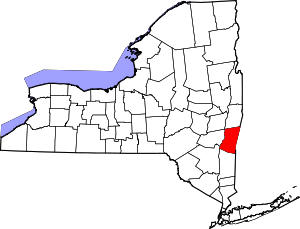 | |
| Towns | ||
| Villages | ||
| CDPs | ||
| Other hamlets | ||
| Footnotes | ‡This populated place also has portions in an adjacent county or counties | |