Gerlache Island
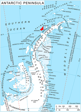
Gerlache Island is the largest of the Rosenthal Islands lying off Gerlache Point[1] on the west coast of Anvers Island, in the Palmer Archipelago of Antarctica. It was first roughly charted and named "Pointe de Gerlache" by the French Antarctic Expedition, 1903–05, under Jean-Baptiste Charcot, for Lieutenant Adrien de Gerlache. As a result of surveys by the Falkland Islands Dependencies Survey in 1956–58, this island is considered to be the feature named by Charcot; there is no prominent point in this vicinity which would be visible from seaward.[2]
Important Bird Area
A small (41 ha) islet lying about 4.5 km to the south of Gerlache, and 500 m off the west coast of Anvers, has been identified as an Important Bird Area (IBA) by BirdLife International because it supports a breeding colony of gentoo penguins, with about 3000 pairs recorded there in 1987. It lies within ASMA 7 - Southwest Anvers Island and Palmer Basin.[3]
References
- Punta de Gerlache. SCAR Composite Antarctic Gazetteer.
- "Gerlache Island". Geographic Names Information System. United States Geological Survey. Retrieved 2012-04-22.
- "Islet south of Gerlache Island, Palmer Archipelago". BirdLife data zone: Important Bird Areas. BirdLife International. 2013. Archived from the original on 2007-07-10. Retrieved 2013-01-09.
![]()