Gembloux
Gembloux (French pronunciation: [ʒɑ̃.blu]; in Walloon: Djiblou; in Dutch: Gembloers) is a Walloon municipality located in the Belgian province of Namur, on the axis Brussels–Namur.
Gembloux | |
|---|---|
.jpg) Town hall with belfry in the background | |
 Flag .svg.png) Coat of arms | |
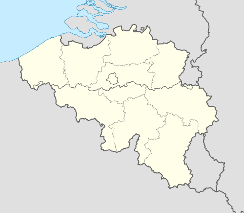 Gembloux Location in Belgium
Location of Gembloux in the province of Namur 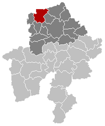 | |
| Coordinates: 50°34′N 04°41′E | |
| Country | Belgium |
| Community | French Community |
| Region | Wallonia |
| Province | Namur |
| Arrondissement | Namur |
| Government | |
| • Mayor | Benoît Dispa (Bailli) |
| • Governing party/ies | Bailli, Ecolo |
| Area | |
| • Total | 95.86 km2 (37.01 sq mi) |
| Population (2018-01-01)[1] | |
| • Total | 25,933 |
| • Density | 270/km2 (700/sq mi) |
| Postal codes | 5030-5032 |
| Area codes | 081 |
| Website | www.gembloux.be |
On 1 January 2006 the municipality had 21,964 inhabitants. The total area is 95.86 km², yielding a population density of 229 inhabitants per km². The mayor, who was elected on 8 October 2006, is Benoît Dispa.
This city is well known for its Agricultural University and for its cutlery. The university is housed in the historical Abbey of Gembloux, which dates from the tenth century.
Gembloux's belfry belongs to the set of belfries of Belgium and France inscribed on UNESCO's World Heritage List in 2005.
History
The town grew around the Gembloux Abbey, founded in the tenth century. In the vicinity of the town, in 1578, the Battle of Gembloux was fought during the Eighty Years' War. In May 1940 the Battle of Hannut and the Battle of the Gembloux Gap took place nearby, tank battles during the larger Battle of France.
Sections
Gembloux is composed by the sections of Gembloux, Beuzet, Bossière, Bothey, Corroy-le-Château, Ernage, Grand-Leez, Grand-Manil, Isnes, Lonzée, Mazy & Sauvenière.
Notable inhabitants
- The Marquess of Trazegnies d'Ittre
- Christophe Szpajdel, sketch artist (born 1970)
Twin towns
Gembloux is twinned with


Gallery
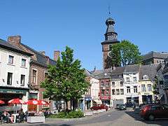 Gembloux town hall square and belfry
.jpg) University Faculty of agronomic sciences
University Faculty of agronomic sciences.jpg) Tour du Guet fortification
Tour du Guet fortification.jpg) Castle of Corroy-le-Château
Castle of Corroy-le-Château
References
- "Wettelijke Bevolking per gemeente op 1 januari 2018". Statbel. Retrieved 9 March 2019.
External links
| Wikimedia Commons has media related to Gembloux. |
- Gembloux official site (in French)
Places adjacent to Gembloux | ||||||||||
|---|---|---|---|---|---|---|---|---|---|---|
| ||||||||||
Municipalities in the Province of Namur | ||
|---|---|---|
| Dinant |  | |
| Namur | ||
| Philippeville | ||