Gasan, Marinduque
Gasan, officially the Municipality of Gasan, is a 3rd class municipality in the province of Marinduque, Philippines. According to the 2015 census, it has a population of 34,828 people.[3]
Gasan | |
|---|---|
| Municipality of Gasan | |
 Skyline of Gasan from St. Joseph the Worker Parish | |
 Seal | |
| Nicknames: Cultural Nerve Center of Marinduque Crafts Capital of Marinduque | |
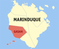 Map of Marinduque with Gasan highlighted | |
| |
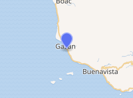
.svg.png) Gasan Location within the Philippines | |
| Coordinates: 13°19′N 121°51′E | |
| Country | |
| Region | Mimaropa (Region IV-B) |
| Province | Marinduque |
| District | Lone district of Marinduque |
| Founded | 1609 |
| Barangays | 25 (see Barangays) |
| Government | |
| • Type | Sangguniang Bayan |
| • Mayor | Victoria L. Lim |
| • Vice Mayor | Yudel A. Sosa |
| • Congressman | Lord Allan Jay Q. Velasco |
| • Electorate | 22,856 voters (2019) |
| Area | |
| • Total | 100.88 km2 (38.95 sq mi) |
| Elevation | 9.2 m (30.2 ft) |
| Population (2015 census)[3] | |
| • Total | 34,828 |
| • Density | 350/km2 (890/sq mi) |
| • Households | 7,997 |
| Demonym(s) | Gaseños |
| Economy | |
| • Income class | 3rd municipal income class |
| • Poverty incidence | 14.88% (2015)[4] |
| • Revenue (₱) | 95,365,916.35 (2016) |
| Time zone | UTC+8 (PST) |
| ZIP code | 4905 |
| PSGC | |
| IDD : area code | +63 (0)42 |
| Climate type | tropical climate |
| Native languages | Tagalog |
The municipality is bounded by the provincial capital, Boac, to the north and east, by Buenavista to the southeast and by the Sibuyan Sea to the south and west. It is the second-oldest municipality in Marinduque, after Boac. Residents of Gasan are called Gaseños.
The Tres Reyes Islands off the coast of Marinduque are under the jurisdiction of Gasan, part of the municipality's Barangay Pinggan.
Etymology
The origin of the name of Gasan came from the term Gasang or Gasang-Gasang, a type of coral once abundant around the town's shoreline. Legend has it that when the Spaniards discovered the town, they found an old woman near the banks of today's Matandang Gasan River. When asked in Spanish what was the name of the town, she interpreted it as if they were asking about what was the name of the corals growing around the area, with the Spaniards interpreting her answer as the name of the town. Over time, the term Gasang-Gasang was shortened to Gasang before being shortened further to Gasan.
Barangays
Gasan is politically subdivided into 25 barangays. [2]
All barangays in Gasan are bounded in part by coastline, except the mountainous barangays of Bachao Ilaya, Cabugao, Dawis, Mangiliol, Matandang Gasan, Tabionan, Tapuyan, and Tiguion, though Barangay Dawis is claiming that the coastline of Bukana, which is now controlled by Pinggan, belongs to them as well as the place itself.
Climate
| Climate data for Gasan, Marinduque | |||||||||||||
|---|---|---|---|---|---|---|---|---|---|---|---|---|---|
| Month | Jan | Feb | Mar | Apr | May | Jun | Jul | Aug | Sep | Oct | Nov | Dec | Year |
| Average high °C (°F) | 26 (79) |
27 (81) |
29 (84) |
31 (88) |
30 (86) |
30 (86) |
29 (84) |
29 (84) |
29 (84) |
29 (84) |
28 (82) |
26 (79) |
29 (83) |
| Average low °C (°F) | 22 (72) |
22 (72) |
22 (72) |
23 (73) |
24 (75) |
24 (75) |
24 (75) |
24 (75) |
24 (75) |
24 (75) |
23 (73) |
23 (73) |
23 (74) |
| Average precipitation mm (inches) | 83 (3.3) |
55 (2.2) |
44 (1.7) |
37 (1.5) |
90 (3.5) |
123 (4.8) |
145 (5.7) |
125 (4.9) |
135 (5.3) |
166 (6.5) |
163 (6.4) |
152 (6.0) |
1,318 (51.8) |
| Average rainy days | 15.1 | 10.8 | 11.9 | 11.4 | 19.9 | 23.7 | 26.3 | 23.9 | 23.9 | 22.1 | 20.2 | 18.6 | 227.8 |
| Source: Meteoblue [5] | |||||||||||||
History
In 1942, during World War II, the Japanese Imperial forces landed in Gasan, Marinduque.
In 1945, the combined United States and Allied Philippine Commonwealth forces landed in Gasan, Marinduque. The 5th Infantry Division of the Philippine Commonwealth Army was participated in the battle to attacking Japanese forces, during which hundreds of Japanese troops were taken prisoner at the town of Gasan, Marinduque. This became known as the Battle of Marinduque.
In 1957, barrio Banto-anin was renamed as Bukal and barrio Hinubuan was renamed as Antipolo.[6][7]
Demographics
| Population census of Gasan | ||
|---|---|---|
| Year | Pop. | ±% p.a. |
| 1903 | 8,270 | — |
| 1918 | 10,771 | +1.78% |
| 1939 | 10,794 | +0.01% |
| 1948 | 10,052 | −0.79% |
| 1960 | 14,508 | +3.10% |
| 1970 | 19,827 | +3.17% |
| 1975 | 20,596 | +0.77% |
| 1980 | 23,185 | +2.40% |
| 1990 | 25,236 | +0.85% |
| 1995 | 26,944 | +1.23% |
| 2000 | 29,799 | +2.18% |
| 2007 | 33,772 | +1.74% |
| 2010 | 33,402 | −0.40% |
| 2015 | 34,828 | +0.80% |
| Source: Philippine Statistics Authority[3][8][9][10] | ||
In the 2015 census, the population of Gasan, Marinduque, was 34,828 people,[3] with a density of 350 inhabitants per square kilometre or 910 inhabitants per square mile.
Religion
- Catholic Church (Latin Rite)
- Philippine Independent Church
- Various Protestant groups
Transportation
The Marinduque Ring Road passes through Gasan and is known as San Jose Street in downtown Gasan. Tricycles and jeepneys can be used to navigate the town, while jeepneys can also be used to go to other towns. Taxis are available to and from major transportation terminals. Buses also stop in downtown Gasan to go to Lucena City and further on to Metro Manila. Many roads are paved.
Marinduque Airport, the island's only airport, is located in Barangay Masiga. Zest Air (now AirAsia Zest) was the first airline to resume scheduled flights to Marinduque in 2008 after its closure for four consecutive years.
Tourism
Gasan is home to some of Marinduque's best-known tourist spots:
- Guingona Park: This park located in Barangay Uno is where Gasan's cenaculos are played during the Moriones Festival.
- Reyes Park: Reyes Park in Barangay Dos serves as the Gasan boardwalk. This park is about to demolish as the present administration under Victoria Lao Lim pursue her intention of building a Commercial Sports Complex that according to her may generate funds for GASUAF. Fairs are conducted in the park, and a wooden footbridge leading to nearby Barangay Dili can be seen (and crossed). The bridge is a landmark of Barangay Dili.
- Talao Cave: Talao Cave in Barangay Tiguion is a series of twelve caves accessible from three mountain trails that can only be crossed on foot. The caves are located in the midst of a rain forest.
- Tres Reyes Islands: The Tres Reyes Islands in Barangay Pinggan, named after the Three Kings of the Nativity, are a potential tourist destination. True to its name, the island chain consists of three islands named Gaspar, Melchor and Baltazar and are visible from any point of the Gasan coastline. Reaching the islands takes about 30–45 minutes by boat.
Festivals
There are three main festivals celebrated in Gasan, two of which are unique to the municipality:
- Araw ng Gasan: The Araw ng Gasan commemorates the town's founding nearly 400 years ago as a Spanish pueblo by Father Juan Rosado in honor of Saint Bernard of Marinduque.
- Gasang-Gasang Festival: The Gasang-Gasang Festival celebrates the origins of the name "Gasan". Sponsored by the Gasan Culture and Arts Foundation (GASCUAF)with a certain contributions from 25 Barangays coming from their Barangay Budget, and held after the Moriones Festival, the festival features a live dance competition where several barangays have competed in the competition held in downtown Gasan. In 2006, however, the festival was held instead at the open-air tiangge area of Barangay Libtangin due to objections from the mayor over the festival being held downtown.
- Moriones Festival: Like all other municipalities in Marinduque, Gasan celebrates the Moriones Festival during the Holy Week. A parade of "morions", or Roman soldiers, is conducted in downtown Gasan, as well as the Gasan cenaculo at Guingona Park on Good Friday.
Barangay landmarks
In a recent tourist campaign known as "Parine na bayâ!", the municipal government promoted individual barangays' products and landmarks in a bid to showcase Gasan as a tourist destination. Some include the following:
- Antipolo: Fish products
- Bachao Ibaba and Bachao Ilaya: Wooden handicrafts
- Bacong-Bacong: Watermelons
- Bangbang: Wicker handicrafts
- Banot: Banot Beach Park
- Bognuyan: Fish
- Cabugao: Gemilina plantation
- Dili: Wooden footbridge
- Libtangin: Open-air tiangge
- Mahunig: Gasan Cemetery
- Mangiliol: Arrowroot
- Masiga: Patis
- Pangi: Butterfly farm
- Pinggan: Tres Reyes Islands
- Tabionan: Tabionan River
- Tapuyan: Nito
- Tiguion: Talao Cave
- Dawis: Pamaypay, Pastilyas
Educational institutions
Tertiary
- Marinduque Midwest College
- ESTI
- St. Mary's College
- Marinduque State College - College of Fisheries
Secondary
- Bangbang National High School
- Bognuyan National High School
- Paciano A. Sena Memorial High School
- Tapuyan National High School
- Tiguion National High School
- Marinduque Christian Academy
- Marinduque Midwest College (High School Department)
Primary
- Antipolo Elementary School
- Bachao Elementary School
- Bacongbacong Elementary School
- Bahi Elementary School
- Bangbang Elementary School
- Banot-Mahunig Elementary School
- Banuyo Elementary School
- Bognuyan Elementary School
- Cabugao Elementary School
- Dawis Elementary School
- Gasan Central School
- Gaspar Elementary School
- Libtangin Public School
- Mangiliol Elementary School
- Masiga Elementary School
- Matandang Gasan Public School
- Pangi Elementary School
- Pinggan Elementary School
- Quatiz Elementary School
- Tabionan Elementary School
- Talao Elementary School
- Tapuyan Elementary School
- Tiguion Elementary School
References
- "Municipality". Quezon City, Philippines: Department of the Interior and Local Government. Retrieved 31 May 2013.
- "Province: Marinduque". PSGC Interactive. Quezon City, Philippines: Philippine Statistics Authority. Retrieved 12 November 2016.
- Census of Population (2015). "Region IV-B (Mimaropa)". Total Population by Province, City, Municipality and Barangay. PSA. Retrieved 20 June 2016.
- "PSA releases the 2015 Municipal and City Level Poverty Estimates". Quezon City, Philippines. Retrieved 12 October 2019.
- "Gasan: Average Temperatures and Rainfall". Meteoblue. Retrieved 28 April 2020.
- "An Act to Change the Name of Barrio Hinubuan, Municipality of Gasan, Province of Marinduque, to Antipolo". LawPH.com. Retrieved 2011-04-12.
- "An Act to Change the Name of Barrio Banto-anin, Municipality of Gasan, Province of Marinduque, to Barrio Bukal". LawPH.com. Retrieved 2011-04-12.
- Census of Population and Housing (2010). "Region IV-B (Mimaropa)". Total Population by Province, City, Municipality and Barangay. NSO. Retrieved 29 June 2016.
- Censuses of Population (1903–2007). "Region IV-B (Mimaropa)". Table 1. Population Enumerated in Various Censuses by Province/Highly Urbanized City: 1903 to 2007. NSO.
- "Province of Marinduque". Municipality Population Data. Local Water Utilities Administration Research Division. Retrieved 17 December 2016.
External links
| Wikimedia Commons has media related to Gasan, Marinduque. |

- Gasan Profile at PhilAtlas.com
- Philippine Standard Geographic Code
- Philippine Census Information
- Local Governance Performance Management System
Places adjacent to Gasan, Marinduque | |
|---|---|
Boac (capital) | |
| Municipalities | |