Garryfliugh
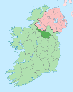
Garryfliugh (from Irish: Garraidh fliuch, meaning- The Wet Garden) is a townland in the civil parish of Drumreilly, barony of Tullyhaw, County Cavan, Ireland.
.jpg)
Geography
Garryfliugh is bounded on the west by Doon (Drumreilly), Knockfin and Seltanahunshin townlands and on the east by Ardmoneen, Corraleehanbeg and Drumderg townlands. Its chief geographical features are Sliabh an Iarainn mountain on whose eastern slope it lies, reaching a height of 1,250 feet, a waterfall, forestry plantations, woods, mountain streams and dug wells. It is traversed by minor public roads and rural lanes. The townland covers 304 statute acres.[1]
History
The Battle of Magh Slecht took place in the townland in 1256 between the O’Rourkes and the O’Reillys. Dead bodies from the battle are sometimes discovered buried in the townland.[2]
The landlord of Garryfliugh in the 19th century was the Beresford Estate.
The Tithe Applotment Books for 1834 spells the name as Garfullagh and list five tithepayers in the townland.[3]
Griffith's Valuation of 1857 lists eleven landholders in the townland.[4]
Census
| Year | Population | Males | Females | Total Houses | Uninhabited |
|---|---|---|---|---|---|
| 1841 | 79 | 44 | 35 | 12 | 0 |
| 1851 | 43 | 19 | 24 | 8 | 0 |
| 1861 | 61 | 27 | 34 | 8 | 0 |
| 1871 | 61 | 29 | 32 | 10 | 0 |
| 1881 | 58 | 31 | 27 | 10 | 0 |
| 1891 | 28 | 14 | 14 | 7 | 0 |
In the 1901 census of Ireland, there were ten families listed in the townland.[5]
In the 1911 census of Ireland, there were ten families listed in the townland.[6]
Antiquities
- Stone bridges over the streams
- Stepping-stones over the stream
References
- "IreAtlas". Retrieved 29 February 2012.
- "National Archives: Census of Ireland 1901". Census.nationalarchives.ie. Retrieved 16 March 2019.
- "National Archives: Census of Ireland 1911". Census.nationalarchives.ie. Retrieved 16 March 2019.
