Gambier, Ohio
Gambier is a village in Knox County, Ohio, United States. The population was 2,391 at the 2010 census.
Gambier, Ohio | |
|---|---|
.jpg) Middle Path | |
 Location of Gambier, Ohio | |
 Location of Gambier in Knox County | |
| Coordinates: 40°22′35″N 82°23′48″W | |
| Country | United States |
| State | Ohio |
| County | Knox |
| Government | |
| • Mayor | Leeman Kessler |
| Area | |
| • Total | 0.94 sq mi (2.43 km2) |
| • Land | 0.94 sq mi (2.43 km2) |
| • Water | 0 sq mi (0 km2) |
| Elevation | 1,079 ft (329 m) |
| Population | |
| • Total | 2,391 |
| • Estimate (2019[4]) | 2,486 |
| • Density | 2,543.6/sq mi (982.1/km2) |
| Time zone | UTC-5 (Eastern (EST)) |
| • Summer (DST) | UTC-4 (EDT) |
| ZIP code | 43022 |
| Area code(s) | 740 |
| FIPS code | 39-29246[5] |
| GNIS feature ID | 1056293[2] |
| Website | http://www.villageofgambier.org/ |
Gambier is the home of Kenyon College. A major feature is a gravel path running the length of the village, fondly referred to as "Middle Path". This path has become a piece of Gambier's history, as it is used by college students and residents alike as a way through the community.
History
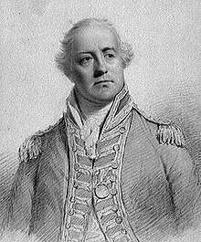
Gambier was laid out in 1824.[6] The village was named after one of Kenyon College's early benefactors, Lord Gambier.[7][8] In the 1960s, Japanese writer Junzo Shono spent several years in Gambier, culminating in the writing of the book A Sojourn in Gambier, which would prove to be quite popular in Japan.[9]
Geography
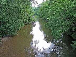
Gambier is located at 40°22′35″N 82°23′48″W (40.376400, -82.396570),[10] along the Kokosing River.
According to the United States Census Bureau, the village has a total area of 0.94 square miles (2.43 km2), all land.[1]
Demographics
| Historical population | |||
|---|---|---|---|
| Census | Pop. | %± | |
| 1850 | 280 | — | |
| 1860 | 575 | 105.4% | |
| 1870 | 581 | 1.0% | |
| 1880 | 576 | −0.9% | |
| 1890 | 660 | 14.6% | |
| 1900 | 751 | 13.8% | |
| 1910 | 537 | −28.5% | |
| 1920 | 433 | −19.4% | |
| 1930 | 498 | 15.0% | |
| 1940 | 470 | −5.6% | |
| 1950 | 1,037 | 120.6% | |
| 1960 | 1,148 | 10.7% | |
| 1970 | 1,571 | 36.8% | |
| 1980 | 2,056 | 30.9% | |
| 1990 | 2,073 | 0.8% | |
| 2000 | 1,871 | −9.7% | |
| 2010 | 2,391 | 27.8% | |
| Est. 2019 | 2,486 | [4] | 4.0% |
| U.S. Decennial Census[11] | |||
2010 census
At the 2010 census there were 2,391 people, 343 households, and 126 families living in the village. The population density was 2,543.6 inhabitants per square mile (982.1/km2). There were 375 housing units at an average density of 398.9 per square mile (154.0/km2). The racial makeup of the village was 90.5% White, 2.8% African American, 0.2% Native American, 2.0% Asian, 0.8% from other races, and 3.7% from two or more races. Hispanic or Latino of any race were 2.8%.[3]
Of the 343 households 15.2% had children under the age of 18 living with them, 30.6% were married couples living together, 4.7% had a female householder with no husband present, 1.5% had a male householder with no wife present, and 63.3% were non-families. 33.5% of households were one person and 11.4% were one person aged 65 or older. The average household size was 2.39 and the average family size was 2.76.
The median age in the village was 21.2 years. 4% of residents were under the age of 18; 79.6% were between the ages of 18 and 24; 5.1% were from 25 to 44; 6.7% were from 45 to 64; and 4.5% were 65 or older. The gender makeup of the village was 47.3% male and 52.7% female.
2000 census
At the 2000 census there were 1,871 people, 278 households, and 142 families living in the village. The population density was 1,998.5 people per square mile (768.5/km²). There were 305 housing units at an average density of 325.8 per square mile (125.3/km²). The racial makeup of the village was 94.07% White, 2.51% African American, 1.28% Asian, 0.05% Pacific Islander, 0.43% from other races, and 1.66% from two or more races. Hispanic or Latino of any race were 1.66%.[5]
Of the 278 households 22.3% had children under the age of 18 living with them, 43.9% were married couples living together, 6.5% had a female householder with no husband present, and 48.9% were non-families. 39.9% of households were one person and 12.2% were one person aged 65 or older. The average household size was 2.03 and the average family size was 2.77.
The age distribution was 5.8% under the age of 18, 73.1% from 18 to 24, 7.3% from 25 to 44, 9.0% from 45 to 64, and 4.9% 65 or older. The median age was 21 years. For every 100 females there were 82.7 males. For every 100 females age 18 and over, there were 81.6 males.
The median household income was $51,964 and the median family income was $71,477. Males had a median income of $40,500 versus $29,327 for females. The per capita income for the village was $9,661. About 2.5% of families and 8.0% of the population were below the poverty line, including 5.2% of those under age 18 and 2.6% of those age 65 or over.
Education
Mount Vernon City Schools operates Wiggin Street Elementary in the village.[12]
Kenyon College, an Episcopal institution, has been in operation in Gambier since 1824.[13]
Gambier has a public library, a branch of The Public Library of Mount Vernon & Knox County.[14]
Notable people
- Margaret L. Bodine, photographer
- Philander Chase, founder of Kenyon College, Bishop of Ohio and Illinois, Sixth Presiding Bishop of the National Episcopal church
- P. F. Kluge, author of Biggest Elvis: A Novel
- Robie Macauley, newspaperman and author
- Herbert T. Perrin, U.S. Army officer
- Joan Slonczewski, biologist
References
- "US Gazetteer files 2010". United States Census Bureau. Archived from the original on 2012-07-02. Retrieved 2013-01-06.
- "US Board on Geographic Names". United States Geological Survey. 2007-10-25. Retrieved 2008-01-31.
- "U.S. Census website". United States Census Bureau. Retrieved 2013-01-06.
- "Population and Housing Unit Estimates". Retrieved May 21, 2020.
- "U.S. Census website". United States Census Bureau. Retrieved 2008-01-31.
- Overman, William Daniel (1958). Ohio Town Names. Akron, OH: Atlantic Press. p. 49.
- Biography of Philander Chase at Kenyon College website. Retrieved on October 3, 2006.
- Gannett, Henry (1905). The Origin of Certain Place Names in the United States. Govt. Print. Off. pp. 134.
- "Treasures from Kenyon's Archives - Kenyon Alumni Magazine". bulletin.kenyon.edu. Retrieved Mar 7, 2020.
- "US Gazetteer files: 2010, 2000, and 1990". United States Census Bureau. 2011-02-12. Retrieved 2011-04-23.
- "Census of Population and Housing". Census.gov. Retrieved June 4, 2015.
- "Wiggin Street Elementary". Mount Vernon City Schools. Retrieved 26 February 2018.
- "Our History & Tradition". Kenyon College. Retrieved 26 February 2018.
- "Branches". The Public Library of Mount Vernon & Knox County. Retrieved 26 February 2018.
External links
- Village website


Municipalities and communities of Knox County, Ohio, United States | ||
|---|---|---|
| City |  Map of Ohio highlighting Knox County | |
| Villages | ||
| Townships | ||
| CDPs | ||
| Unincorporated communities | ||
| Ghost town | ||
| Footnotes | ‡This populated place also has portions in an adjacent county or counties | |
| Authority control |
|
|---|