Gägelow
Gägelow is a municipality in the Nordwestmecklenburg district, in Mecklenburg-Vorpommern, Germany.
Gägelow | |
|---|---|
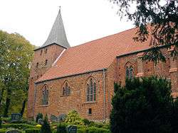 The church in the village of Gressow | |
 Coat of arms | |
Location of Gägelow within Nordwestmecklenburg district 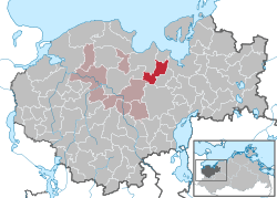 | |
 Gägelow  Gägelow | |
| Coordinates: 53°53′56″N 11°22′54″E | |
| Country | Germany |
| State | Mecklenburg-Vorpommern |
| District | Nordwestmecklenburg |
| Municipal assoc. | Grevesmühlen-Land |
| Government | |
| • Mayor | Uwe Wandel |
| Area | |
| • Total | 22.61 km2 (8.73 sq mi) |
| Elevation | 19 m (62 ft) |
| Population (2018-12-31)[1] | |
| • Total | 2,600 |
| • Density | 110/km2 (300/sq mi) |
| Time zone | CET/CEST (UTC+1/+2) |
| Postal codes | 23968 |
| Dialling codes | 03841 |
| Vehicle registration | NWM |
| Website | Amt Grevesmühlen |
Geography
Hamlets of Gägelow
| Name | Coordinates |
|---|---|
| Gressow | 53°51′53″N 11°19′48″E |
| Jamel | 53°52′25″N 11°18′16″E |
| Neu Weitendorf | 53°54′25″N 11°21′17″E |
| Proseken | 53°54′20″N 11°22′10″E |
| Sternkrug | 53°51′42″N 11°18′22″E |
| Stofferstorf | 53°53′23″N 11°21′37″E |
| Voßkuhl | 53°52′38″N 11°21′09″E |
| Weitendorf | 53°53′46″N 11°21′15″E |
| Wolde | 53°53′01″N 11°20′51″E |
Coat of Arms
The coat of arms of Gägelow were designed by Michael Zapfe of Wismar and approved by the Ministry of the Interior on the 4th of November, 1996.
Photogallery
 The village church of Proseken
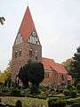
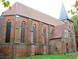 The village church of Gressow
References
- "Statistisches Amt M-V – Bevölkerungsstand der Kreise, Ämter und Gemeinden 2018". Statistisches Amt Mecklenburg-Vorpommern (in German). July 2019.
- Popp, Maximilian (January 3, 2011). "The Village Where the Neo-Nazis Rule". Der Spiegel. Retrieved January 5, 2011.
External links
![]()
This article is issued from Wikipedia. The text is licensed under Creative Commons - Attribution - Sharealike. Additional terms may apply for the media files.