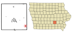
Fremont, Iowa
Fremont is a city in Mahaska County, Iowa, United States. The population was 743 at the 2010 census.
Fremont, Iowa | |
|---|---|
 | |
 Location of Fremont, Iowa | |
| Coordinates: 41°12′44″N 92°26′6″W | |
| Country | United States |
| State | Iowa |
| County | Mahaska |
| Area | |
| • Total | 1.03 sq mi (2.67 km2) |
| • Land | 1.03 sq mi (2.67 km2) |
| • Water | 0 sq mi (0 km2) |
| Elevation | 837 ft (255 m) |
| Population | |
| • Total | 743 |
| • Estimate (2018)[3] | 718 |
| • Density | 721/sq mi (278.5/km2) |
| Time zone | UTC-6 (Central (CST)) |
| • Summer (DST) | UTC-5 (CDT) |
| ZIP code | 52561 |
| Area code(s) | 641 |
| FIPS code | 19-29190 |
| GNIS feature ID | 0456761 |
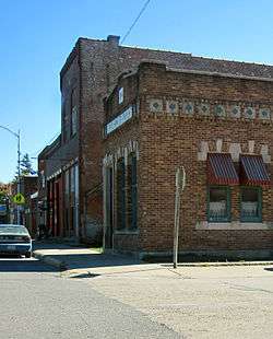
History
The Burlington and Western, a narrow gauge railroad and its competitor, the Iowa Central Railway, arrived here 1882 as they built parallel tracks toward Oskaloosa. The Burlington and Western was widened to Standard Gauge in 1902 and taken over by the Chicago, Burlington and Quincy the next year, and the Minneapolis and St. Louis took over the Iowa Central around the same time. The Burlington line was abandoned in 1934.[4]
Geography
Fremont is located at 41°12′44″N 92°26′6″W (41.212321, -92.435106).[5]
According to the United States Census Bureau, the city has a total area of 1.03 square miles (2.67 km2), all of it land.[1]
Demographics
| Historical populations | ||
|---|---|---|
| Year | Pop. | ±% |
| 1880 | 143 | — |
| 1900 | 542 | +279.0% |
| 1910 | 501 | −7.6% |
| 1920 | 544 | +8.6% |
| 1930 | 450 | −17.3% |
| 1940 | 490 | +8.9% |
| 1950 | 471 | −3.9% |
| 1960 | 461 | −2.1% |
| 1970 | 480 | +4.1% |
| 1980 | 730 | +52.1% |
| 1990 | 701 | −4.0% |
| 2000 | 704 | +0.4% |
| 2010 | 743 | +5.5% |
| 2018 | 718 | −3.4% |
| Source:"U.S. Census website". United States Census Bureau. Retrieved 2020-03-28. and Iowa Data Center Source: | ||
2010 census
As of the census[2] of 2010, there were 743 people, 300 households, and 208 families living in the city. The population density was 721.4 inhabitants per square mile (278.5/km2). There were 327 housing units at an average density of 317.5 per square mile (122.6/km2). The racial makeup of the city was 98.7% White, 0.1% African American, 0.7% Asian, and 0.5% from two or more races. Hispanic or Latino of any race were 0.4% of the population.
There were 300 households of which 33.0% had children under the age of 18 living with them, 55.0% were married couples living together, 10.0% had a female householder with no husband present, 4.3% had a male householder with no wife present, and 30.7% were non-families. 26.7% of all households were made up of individuals and 11.7% had someone living alone who was 65 years of age or older. The average household size was 2.48 and the average family size was 2.98.
The median age in the city was 37.5 years. 26.6% of residents were under the age of 18; 7% were between the ages of 18 and 24; 25.2% were from 25 to 44; 25.2% were from 45 to 64; and 16% were 65 years of age or older. The gender makeup of the city was 51.1% male and 48.9% female.
2000 census
As of the census[7] of 2000, there were 704 people, 283 households, and 198 families living in the city. The population density was 682.7 people per square mile (263.9/km²). There were 300 housing units at an average density of 290.9 per square mile (112.5/km²). The racial makeup of the city was 99.43% White, 0.14% from other races, and 0.43% from two or more races. Hispanic or Latino of any race were 0.28% of the population.
There were 283 households out of which 33.2% had children under the age of 18 living with them, 62.2% were married couples living together, 6.4% had a female householder with no husband present, and 29.7% were non-families. 25.1% of all households were made up of individuals and 14.5% had someone living alone who was 65 years of age or older. The average household size was 2.49 and the average family size was 2.95.
26.6% are under the age of 18, 9.2% from 18 to 24, 25.0% from 25 to 44, 21.0% from 45 to 64, and 18.2% who were 65 years of age or older. The median age was 36 years. For every 100 females, there were 92.3 males. For every 100 females age 18 and over, there were 91.5 males.
The median income for a household in the city was $39,583, and the median income for a family was $44,167. Males had a median income of $33,333 versus $26,250 for females. The per capita income for the city was $16,925. About 5.9% of families and 8.9% of the population were below the poverty line, including 12.6% of those under age 18 and 5.5% of those age 65 or over.
Education
It is within the Eddyville-Blakesburg-Fremont Community School District, formed by the 2012 merger of the Fremont Community School District and the Eddyville-Blakesburg Community School District.[8]
Notable people
- Steve Bales — Flight Control engineer for NASA's Apollo 11 mission
- Ivan D. Combe - Founder of Combe, Inc., creator of Clearasil, Odor Eaters, and leader in the Consumer Health Care industry[9]
- Herschel C. Loveless - 34th Governor of Iowa [10]
References
- "US Gazetteer files 2010". United States Census Bureau. Archived from the original on 2012-07-02. Retrieved 2012-05-11.
- "U.S. Census website". United States Census Bureau. Retrieved 2012-05-11.
- "Population and Housing Unit Estimates". Retrieved March 3, 2020.
- David Lotz and Charles Franzen, 'Rails to a County Seat', The Print Shop, Washington Iowa, 1989; pages 37, 47-52.
- "US Gazetteer files: 2010, 2000, and 1990". United States Census Bureau. 2011-02-12. Retrieved 2011-04-23.
- "Census of Population and Housing". Census.gov. Retrieved June 4, 2015.
- "U.S. Census website". United States Census Bureau. Retrieved 2008-01-31.
- "REORGANIZATION & DISSOLUTION ACTIONS SINCE 1965-66." Iowa Department of Education. Retrieved on January 14, 2019.
- https://www.nytimes.com/2000/01/17/business/ivan-d-combe-88-marketer-of-clearasil-and-just-for-men.html
- https://web.archive.org/web/20110629134400/http://www.nga.org/portal/site/nga/menuitem.29fab9fb4add37305ddcbeeb501010a0/?vgnextoid=b42d224971c81010VgnVCM1000001a01010aRCRD
External links
Municipalities and communities of Mahaska County, Iowa, United States | ||
|---|---|---|
| Cities | Map of Iowa highlighting Mahaska County | |
| Unincorporated communities | ||
| Footnotes | ‡This populated place also has portions in an adjacent county or counties | |