Freedom, California
Freedom is a census-designated place (CDP) in Santa Cruz County, California, United States. The population was 3,070 at the 2010 census.

Freedom | |
|---|---|
 Location in Santa Cruz County and the state of California | |
 Freedom Location in the United States | |
| Coordinates: 36°56′26″N 121°47′22″W | |
| Country | |
| State | |
| County | Santa Cruz |
| Area | |
| • Total | 1.104 sq mi (2.859 km2) |
| • Land | 1.104 sq mi (2.859 km2) |
| • Water | 0 sq mi (0 km2) 0% |
| Elevation | 125 ft (38 m) |
| Population (2010) | |
| • Total | 3,070 |
| • Density | 2,800/sq mi (1,100/km2) |
| Time zone | UTC-8 (PST) |
| • Summer (DST) | UTC-7 (PDT) |
| ZIP code | 95019 |
| Area code(s) | 831 |
| FIPS code | 06-25576 |
| GNIS feature ID | 1658576 |
Geography
Freedom is located at 36°56′26″N 121°47′22″W (36.940452, -121.789376).[3] According to the United States Census Bureau, the CDP has a total area of 1.1 square miles (2.8 km2), all of it land. It is adjacent to and blends with the incorporated city of Watsonville.
Demographics
| Historical population | |||
|---|---|---|---|
| Census | Pop. | %± | |
| U.S. Decennial Census[4] | |||
2010
At the 2010 census Freedom had a population of 3,070. The population density was 2,780.8 people per square mile (1,073.7/km²). The racial makeup of Freedom was 1,452 (47.3%) White, 44 (1.4%) African American, 31 (1.0%) Native American, 100 (3.3%) Asian, 1,285 (41.9%) from other races, and 158 (5.1%) from two or more races. Hispanic or Latino of any race were 2,170 persons (70.7%).[5]
The census reported that 99.8% of the population lived in households and 0.2% were institutionalized.
There were 776 households, 394 (50.8%) had children under the age of 18 living in them, 445 (57.3%) were opposite-sex married couples living together, 124 (16.0%) had a female householder with no husband present, 73 (9.4%) had a male householder with no wife present. There were 63 (8.1%) unmarried opposite-sex partnerships, and 11 (1.4%) same-sex married couples or partnerships. 102 households (13.1%) were one person and 44 (5.7%) had someone living alone who was 65 or older. The average household size was 3.95. There were 642 families (82.7% of households); the average family size was 4.12.
The age distribution was 904 people (29.4%) under the age of 18, 347 people (11.3%) aged 18 to 24, 891 people (29.0%) aged 25 to 44, 655 people (21.3%) aged 45 to 64, and 273 people (8.9%) who were 65 or older. The median age was 30.2 years. For every 100 females, there were 103.0 males. For every 100 females age 18 and over, there were 101.7 males.
There were 806 housing units at an average density of 730.1 per square mile (281.9/km²), of which 65.6% were owner-occupied and 34.4% were occupied by renters. The homeowner vacancy rate was 1.4%; the rental vacancy rate was 2.2%. 60.9% of the population lived in owner-occupied housing units and 38.9% lived in rental housing units.
2000
At the 2000 census there were 6,000 people, 1,596 households, and 1,182 families in the CDP. The population density was 4,480.0 people per square mile (1,728.8/km²). There were 1,619 housing units at an average density of 1,208.9 per square mile (466.5/km²). The racial makeup of the CDP was 44.42% White, 0.48% African American, 1.87% Native American, 3.35% Asian, 0.22% Pacific Islander, 43.72% from other races, and 5.95% from two or more races. Hispanic or Latino of any race were 69.42%.[6]
Of the 1,596 households 41.7% had children under the age of 18 living with them, 54.8% were married couples living together, 12.5% had a female householder with no husband present, and 25.9% were non-families. 21.1% of households were one person and 14.8% were one person aged 65 or older. The average household size was 3.75 and the average family size was 4.23.
The age distribution was 30.8% under the age of 18, 11.5% from 18 to 24, 29.8% from 25 to 44, 17.1% from 45 to 64, and 10.9% 65 or older. The median age was 30 years. For every 100 females, there were 102.4 males. For every 100 females age 18 and over, there were 102.3 males.
The median household income was $40,600 and the median family income was $43,056. Males had a median income of $27,083 versus $23,056 for females. The per capita income for the CDP was $13,690. About 12.9% of families and 17.4% of the population were below the poverty line, including 22.3% of those under age 18 and 8.2% of those age 65 or over.
Government
In the California State Legislature, Freedom is in the 17th Senate District, represented by Democrat Bill Monning, and in the 30th Assembly District, represented by Democrat Robert Rivas.[7]
In the United States House of Representatives, Freedom is in California's 20th congressional district, represented by Democrat Jimmy Panetta.[8]
See also
- List of census-designated places in California
- KPIG-FM
References
- "2010 Census U.S. Gazetteer Files – Places – California". United States Census Bureau.
- "Freedom". Geographic Names Information System. United States Geological Survey. Retrieved October 13, 2014.
- "US Gazetteer files: 2010, 2000, and 1990". United States Census Bureau. 2011-02-12. Retrieved 2011-04-23.
- "Census of Population and Housing". Census.gov. Retrieved June 4, 2016.
- "2010 Census Interactive Population Search: CA - Freedom CDP". U.S. Census Bureau. Archived from the original on July 15, 2014. Retrieved July 12, 2014.
- "U.S. Census website". United States Census Bureau. Retrieved 2008-01-31.
- "Statewide Database". UC Regents. Archived from the original on February 1, 2015. Retrieved December 30, 2014.
- "California's 20th Congressional District - Representatives & District Map". Civic Impulse, LLC.
External links
| Wikimedia Commons has media related to Freedom, California. |
Municipalities and communities of Santa Cruz County, California, United States | ||
|---|---|---|
| Cities | 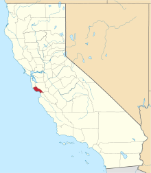 Santa Cruz County map | |
| CDPs | ||
| Unincorporated communities | ||
| Ghost town | ||
| Counties |  | |
|---|---|---|
| Cities and towns 100k-250k | ||
| Cities and towns 25k-100k | ||
| Cities and towns 10k-25k | ||
| Sub-regions |
| |
Counties in italics sometimes included in the definition of the Central Coast | ||
| Authority control |
|
|---|