Fort Portal–Kasese–Mpondwe Road
The Fort Portal–Kasese–Mpondwe Road also Fort Portal–Mpondwe Road, is a road in the Western Region of Uganda, connecting the towns of Fort Portal, Hima, Kasese, Kikorongo and the border town of Mpondwe.
| Fort Portal–Kasese–Mpondwe Road | |
|---|---|
| Route information | |
| Length | 83 mi (134 km) |
| Major junctions | |
| East end | Fort Portal |
| Rwimi Hima Kasese Kikorongo | |
| West end | Mpondwe |
| Highway system | |
| Roads in Uganda | |
Location
The road starts at Fort Portal, the headquarters of Kabarole District. It travels southwestwards through Rwimi, Hima, Kasese and Kikorongo. At Kiorongo, the road makes a 90 degree turn westwards to end at Mpondwe, at the international border with the Democratic Republic of the Congo, a total distance of about 134 kilometres (83 mi).[1] The coordinates of the road at Kikorongo are:0°00'00.0"N, 29°59'55.0"E (Latitude:0.000003; 29.998607).[2]
Upgrade to bituminous surface
This road was improved to class II bituminous surface before 2013.[3]
Points of interest
The following lie along or near this road
- Virika Hospital, located in Fort Portal's central business district.[4]
- The town of Rwimi, about 44 kilometres (27 mi), south of Fort Portal.[5]
- Hima, lies about 54 kilometres (34 mi) south of Fort Portal.[6]
- Kasese Airport, in the middle Kasese town.
- Kasese Cobalt Company Limited lies in Kasese, south of the Central business district.
- Kikorongo is a town in Kasese District, about 25 kilometres (16 mi), south of Kasese.[7]
- At Katojo Village a road branches off this road and proceeds south to Katwe Village and Mweya Safari Lodge inside Queen Elizabeth National Park.[8]
References
- GFC (20 May 2016). "Distance between Lugard Monument, Fort Portal, Western Region, Uganda and Mpondwe lhubiriha Market, Kasese, Western Region, Uganda". Globefeed.com (GFC). Retrieved 20 May 2016.
- Google (20 May 2016). "Location of Fort Portal–Kasese–Mpondwe Road" (Map). Google Maps. Google. Retrieved 20 May 2016.
- Rwanyekiro, Isaiah (12 February 2013). "Uganda's Road Network has improved significantly". New Vision. Kampala. Retrieved 20 May 2016.
- Google (20 May 2016). "Location of Virika Hospital, Fort Portal, Uganda" (Map). Google Maps. Google. Retrieved 20 May 2016.
- GFC (20 May 2016). "Distance between Lugard Monument, Fort Portal, Western Region, Uganda and Rwimi All Saints Church of Uganda, Bunyangabu, Western Region, Uganda". Globefeed.com (GFC). Retrieved 20 May 2016.
- GFC (20 May 2016). "Distance between Lugard Monument, Fort Portal, Western Region, Uganda and Hima Primary School, Hima, Western Region, Uganda". Globefeed.com (GFC). Retrieved 20 May 2016.
- (GFC) (20 May 2016). "Distance between Kasese Airport, Kasese, Western Region, Uganda and Kikorongo Junction, Fort Portal–Mpondwe Road, Kasese, Western Region, Uganda". Globefeed.com (GFC). Retrieved 20 May 2016.
- Google (20 May 2016). "Location of Katojo Village Where Road to Katwe Village And Mweya Safari Lodge Branches off Fort Portal–Kasese–Mpondwe Road" (Map). Google Maps. Google. Retrieved 20 May 2016.
External links
- Webpage of Uganda National Road Authority
- Photograph of Fort Portal–Kasese–Mpondwe Road At Flickr.com
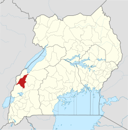
Capital: Kabarole | ||
| Counties and sub-counties |
|  |
| Towns and villages |
| |
| Geography | ||
| Economy | ||
| Notable landmarks | ||
| Health | ||
| Education | ||
| Energy | ||
| Transport | ||
| Notable people |
| |
Capital: Kasese | ||
| Towns and villages | 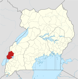 | |
| Economy |
| |
| Transport | ||
| Energy |
| |
| Notable landmarks | ||
| Health | ||
| Notable people | ||