Flippin, Kentucky
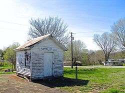
Flippin [nb 1] is an unincorporated community located in Monroe County, Kentucky, United States. A small residential village is located on Highway 249, approximately 3.6 miles (5.8 km) south of the Monroe-Barren County line. The village and community surround the intersection of Highway 249, Highway 678, and Highway 100. Flippin is situated northwest of Gamaliel, west of Tompkinsville, and east of Fountain Run.
Flippin | |
|---|---|
 Flippin, Kentucky 42132 | |
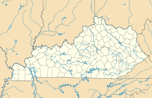 Flippin Location within the state of Kentucky  Flippin Flippin (the United States) | |
| Coordinates: 36°43′13″N 85°52′27″W | |
| Country | United States |
| State | Kentucky |
| County | Monroe |
| Elevation | 735 ft (224 m) |
| Time zone | UTC-6 (Central (CST)) |
| • Summer (DST) | UTC-5 (CDT) |
| ZIP Codes | 42167, 42133 |
| Area code(s) | 270 |
| GNIS feature ID | 492255[1] |
The two forks of Indian Creek, a tributary of the Barren River, merge at these crossroads in Flippin.
History
Pikesville
Before 1858, this community was known as “Pikesville”, or the “forks of Indian Creek”. The “town of Pikesville” was incorporated with this spelling by Barren County, Kentucky Court in August, 1818. The alternate spelling of “Pikeville” is also found in public records and on maps. The 75-acre (30 ha) town site in a 353-acre (143 ha) tract was located on Pikesville Branch of Indian Creek, on the land of Thomas Flippin (ca.1740–1830), approximately 1.25 miles north of present-day Flippin on Highway 249. Thomas Flippin operated a grist mill, store, and tavern. He also served as court commissioner, justice of the peace, and sheriff of Barren County. Barren County Deeds, 1818–1820, described Pikesville as a town with ten named streets, a town square, and 189 town “Lots.” Three different taverns were licensed to operate in Pikesville during this period.[6][7][8] Pikesville competed in the election (1819) for county seat of the new county of Monroe (1820), and lost to Tompkinsville by a plurality of four votes.[9]
In his series of published (1889) Historical Sketches of Monroe County, the great-grandson of Thomas Flippin remembered a “three-story hotel, many houses that had been residences, stores, shops and barns when the town was at its zenith.” [10] When interviewed (1943) for a news article, some older residents of the Pikesville community remembered a town with six stores, grist mill, blacksmith shop, tan yard, and race track.[11] Nothing of the town remains today. “Pike(s)ville Branch”—variously spelled—has remained on maps as a landmark. A school at Pikesville continued well into the 20th century, after Pikesville School #1 (1855–1929) a.k.a. Common School #41 was replaced, until Pike(s)ville School #2 (1929–1951) was consolidated.[12][13]
Flippin
In 1858, a new postal name, “Flippin, Kentucky,” was established in this community to avoid confusion with “Pikeville” in Pike County, Kentucky. The new post office was located near the forks of Indian Creek on the property of James McAdoo Flippin, grandson of Thomas Flippin. James McAdoo Flippin was the father of Manlius Thompson Flippin (1841-1899): teacher, orator, poet, lawyer, legislator, and judge.[14][10][15] According to Post Office records in the National Archives, Flippin had a post office from 1858 to 1964, except for a brief interval, 1870–72, and a postal station from 1964 to 1981.
When the Civil War (1861–1865) began, hundreds of volunteer soldiers from Monroe and surrounding counties were first organized at several “Lincoln camps” in support of the Union, finally to rendezvous at Camp Anderson, on the farm of John M. Fraim, on the south fork of Indian Creek.[16] Major Henry Dunn of the Monroe County Home Guards (US) superintended a drill school for volunteers at Indian Creek Baptist Church. Camp Anderson was located near the intersection of Highways 100 and 1366, about 1.5 miles south of the Church and present-day Flippin. John M. Fraim was instrumental in the formation of the unit that became the 9th Kentucky Volunteer Infantry Regiment when mustered into the U.S. Army, November 20, 1861, at Camp Boyle, Columbia, Kentucky.[17][18][14]
Monroe Normal School (a.k.a. Indian Creek College), located in Flippin, was incorporated by an Act (Chapter 646) of the legislature, March 24, 1888, and was authorized to confer the Bachelor of Arts Degree as a teacher-training academy.[19]
The largest ever recorded old-growth tulip poplar tree grew in the Flippin community, located near the intersection of Highways 100 and 1366. Cut for timber in 1893, the tree measured 10–11 feet (3 to 3.4 m) in diameter at its base; its height was not recorded. A four-foot cross section was transported and displayed at the World's Columbian Exposition, in Chicago.[20][21] A photograph of the tree and a piece of its bark were later donated by descendants of the original landowner to Indian Creek Baptist Church. A Kentucky highway historical marker in Flippin commemorates this “Famous Tree” (Landrum, 1976).
Lumber from this tree was used to rebuild the (third) Baptist Church and also to build part of the new Flippin Methodist Church (1894-1964). The first Baptist Church building of logs (1838–67) was replaced by a frame building (1867–93) that had burned in 1893. This third Baptist Church building burned in 1921, and was replaced by a fourth building (Landrum, 1976). This fourth building has since been abandoned due to flood damage (2010) and replaced by a fifth Baptist Church building located near Neal Cemetery.[22]
Today, Flippin is a small residential village and farming community. Flippin’s elementary, secondary, and post-secondary schools, churches, masonic lodge, bank, hotels, service station, stores, mills, shops, and factories are gone except for two churches: Indian Creek Baptist Church and Flippin Church of Christ.[23][24][14][25]
Notes
- “Johnstonville” has been erroneously attributed in a published reference source[2] as an alternate earlier name for the Flippin community. Collins’ History of Kentucky (1874) mentioned the incorporated town of Johnstonville in Monroe County, without noting its location, but failed to mention either Flippin or Pikesville: “The other small villages and post offices in the county are—Martinsburg, on the Cumberland river, 20 miles from Tompkinsville, Johnstonville (incorporated February 13, 1846), Center Point, Gamaliel, Hilton, Fountain Run, Meshach’s Run, Mud Lick, Rock Bridge, and Sulphur Lick.”[3] However, “PikeV[ille]” was depicted on Collins’ frontispiece map as a place name, geographically located correctly; neither “Johnstonville” nor “Flippin” appeared on the Collins map. “Johnstonville” in Monroe County was incorporated by an Act (Chapter 164, February 13, 1846) of the legislature, and its location on John Black’s land in Monroe County on the south side of Cumberland River was clearly identified.[4] Johnstonville and Pike(s)ville of Monroe County both appear on the map of Kentucky included in the Official Atlas of the Civil War,[5] with Johnstonville correctly located near the Cumberland River. Johnstonville, originally planned as a town near present-day Black’s Ferry, had disappeared from maps by the 20th century.
References
- U.S. Geological Survey Geographic Names Information System: Flippin, Kentucky
- Rennick, Robert M. Kentucky Place Names. The University Press of Kentucky, 2013. pp. 103-4.
- Collins, Lewis, and Richard H. Collins. History of Kentucky. Covington, Ky: Collins & Co, 1874. p. 630.
- Kentucky. Acts of the General Assembly of the Commonwealth of Kentucky. Frankfort, Ky: [publisher not identified], [1846]. Chapter 164, p. 159.
- United States. The Official Atlas of the Civil War. New York: T. Yoseloff, 1958.
- Peden, Eva Coe, Gladys Benedict Wilson, Sandra K. Gorin, and Martha Powell Reneau. Barren County, Kentucky Order Book. Glasgow, Kentucky: S.K.L. Gorin, 1976.
- Gorin, Sandra Kaye Laughery. Barren County, Kentucky, Deed Books. Glasgow, KY (205 Clements Ave., Glasgow 42141-3409): S.K. Gorin, 1991.
- Lemons, Nova A. John McAdoo of Virginia, North Carolina, Tennessee and Kentucky. Dallas, Tex: N.A. Lemons, 1991. pp. 40–44.
- Montell, William Lynwood. Monroe County History, 1820–1970. Tompkinsville, Ky: Tompkinsville Lions Club, 1970. p. 17.
- Flippin, Manlius Thompson. Historical Sketches of Monroe County. Tompkinsville, Ky: The Enterprise, 1889.
- Simmons, Clayton C. "Historical Trip Through East Barren County, Kentucky and the Hamilton Sanderson Murder Trial:" The Glasgow Times December 3, 1942-September 2, 1943. Evansville, Ind: Whipporwill Publications, 1980. pp. 338–40.
- Monroe County Retired Teachers. Early School Days in Monroe County, Kentucky. Utica, KY: McDowell Publications, 2008. pp. 271–73.
- Arterburn, Charles R. A Forgotten Town Remembered: Pikesville of Monroe County, Kentucky. Lexington, Kentucky: C.R. Arterburn, 2014.
- Collins, Lewis, and William Henry Perrin. Monroe County, Kentucky: History and Biographies. Signal Mountain, Tenn: Mountain Press, 2002.
- Flippin, Manlius Thompson. Poems and Addresses. Chicago: American Publishers' Association, 1892.
- United States. The War of the Rebellion, a Compilation of the Official Records of the Union and Confederate Armies. Series 1. Vol. 4. Washington, D.C.: GPO, 1880.
- Woodcock, Marcus, and Kenneth W. Noe. A Southern Boy in Blue: The Memoir of Marcus Woodcock, 9th Kentucky Infantry (U.S.A.). Knoxville: University of Tennessee Press, 1996.
- Kentucky, and Michael L. Cook. Report of the Adjutant General of the State of Kentucky, 1861-1866. Utica, Kentucky: McDowell Publications, 1984.
- Kentucky. Acts Passed at the ... Session of the General Assembly for the Commonwealth of Kentucky. Lexington: J. Bradford, printer to the Commonwealth, [1888]. Chapter 646, pp. 394-95.
- Landrum, Alta. History of Indian Creek Missionary Baptist Church. 1976.
- Rand McNally and Company. Handbook of the World's Columbian Exposition. Chicago: Rand, McNally, 1893. p. 94.
- Kinslow, Gina. "Indian Creek Baptist finds hill for new church building!" Glasgow Daily Times N.p. 1 May 2011. Web. 15 Jan. 2019.
- Montell, William Lynwood. Monroe County History, 1820–1970. Tompkinsville, Ky: Tompkinsville Lions Club, 1970.
- Birdwell, Dayton. The History of Monroe County, Kentucky, 1820–1988. Tompkinsville, Ky: Monroe County Press, 1992.
- Monroe County Retired Teachers. Early School Days in Monroe County, Kentucky. Utica, KY: McDowell Publications, 2008.
External links

Municipalities and communities of Monroe County, Kentucky, United States | ||
|---|---|---|
| Cities | 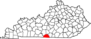 Location of Monroe County, Kentucky | |
| Unincorporated communities | ||
- Pikesville Historical Marker at HMdb.org
- Famous Tree Historical Marker at HMdb.org