Flaming Gorge, Utah
Flaming Gorge is a census-designated place in Daggett County, Utah, United States. The population was 83 at the 2010 census, although, the population could be as high as 85.[4]
Flaming Gorge | |
|---|---|
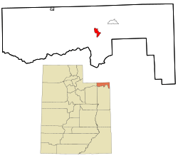 Location within Daggett County and the State of Utah | |
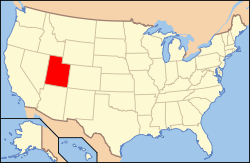 Location of Utah in the United States | |
| Coordinates: 40°53′21″N 109°28′33″W | |
| Country | United States |
| State | Utah |
| County | Daggett |
| Named for | Flaming Gorge National Recreation Area |
| Area | |
| • Total | 2.289 sq mi (5.93 km2) |
| • Land | 2.281 sq mi (5.91 km2) |
| • Water | 0.008 sq mi (0.02 km2) |
| Elevation | 6,919 ft (2,109 m) |
| Population | |
| • Total | 83 |
| • Density | 36/sq mi (14/km2) |
| Time zone | UTC-7 (Mountain (MST)) |
| • Summer (DST) | UTC-6 (MDT) |
| Area code(s) | 435 |
| GNIS feature ID | 2584767[2] |
Demographics
As of the census[3] of 2010, there were 83 people living in the CDP. There were 109 housing units. The racial makeup of the CDP was 97.6% White, 1.2% from some other race, and 1.2% from two or more races. Hispanic or Latino of any race were 4.8% of the population.
Geography
The CDP is located in the Flaming Gorge National Recreation Area, south of Flaming Gorge Reservoir and north of Greendale Junction.
Climate
| Climate data for Flaming Gorge, Utah (1981–2010 normals) | |||||||||||||
|---|---|---|---|---|---|---|---|---|---|---|---|---|---|
| Month | Jan | Feb | Mar | Apr | May | Jun | Jul | Aug | Sep | Oct | Nov | Dec | Year |
| Record high °F (°C) | 59 (15) |
66 (19) |
76 (24) |
82 (28) |
93 (34) |
100 (38) |
102 (39) |
99 (37) |
93 (34) |
84 (29) |
75 (24) |
64 (18) |
102 (39) |
| Average high °F (°C) | 36.9 (2.7) |
40.1 (4.5) |
49.2 (9.6) |
58.0 (14.4) |
68.4 (20.2) |
78.7 (25.9) |
86.6 (30.3) |
84.3 (29.1) |
74.9 (23.8) |
61.7 (16.5) |
46.0 (7.8) |
36.4 (2.4) |
60.1 (15.6) |
| Average low °F (°C) | 10.4 (−12.0) |
12.7 (−10.7) |
21.8 (−5.7) |
28.3 (−2.1) |
36.1 (2.3) |
43.2 (6.2) |
50.1 (10.1) |
49.0 (9.4) |
40.1 (4.5) |
30.3 (−0.9) |
20.2 (−6.6) |
11.6 (−11.3) |
29.5 (−1.4) |
| Record low °F (°C) | −38 (−39) |
−31 (−35) |
−14 (−26) |
−4 (−20) |
14 (−10) |
22 (−6) |
30 (−1) |
26 (−3) |
11 (−12) |
−4 (−20) |
−17 (−27) |
−36 (−38) |
−38 (−39) |
| Average precipitation inches (mm) | 0.43 (11) |
0.60 (15) |
1.09 (28) |
1.31 (33) |
1.40 (36) |
1.22 (31) |
0.91 (23) |
1.31 (33) |
1.25 (32) |
1.33 (34) |
0.64 (16) |
0.51 (13) |
12.02 (305) |
| Average snowfall inches (cm) | 7.5 (19) |
8.4 (21) |
8.6 (22) |
4.3 (11) |
1.1 (2.8) |
0.2 (0.51) |
0.0 (0.0) |
0.0 (0.0) |
0.2 (0.51) |
2.0 (5.1) |
6.9 (18) |
7.8 (20) |
47.0 (119) |
| Source: NOAA[5] | |||||||||||||
References
- "2010 Census U.S. Gazetteer File for Places: Utah". Archived from the original on December 13, 2012. Retrieved March 4, 2013.
- U.S. Geological Survey Geographic Names Information System: Flaming Gorge
- "American FactFinder". United States Census Bureau. Archived from the original on February 12, 2020. Retrieved July 20, 2012.
- "Flaming Gorge, UT | Data USA". datausa.io. Retrieved 2020-03-28.
- "NOWData - NOAA Online Weather Data". National Oceanic and Atmospheric Administration. Retrieved May 4, 2013.
External links
![]()
Municipalities and communities of Daggett County, Utah, United States | ||
|---|---|---|
| Town | 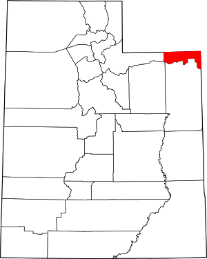 Map of Utah highlighting Daggett County | |
| CDPs | ||
| Ghost towns | ||
| Footnotes | ‡This populated place also has portions in an adjacent state | |
This article is issued from Wikipedia. The text is licensed under Creative Commons - Attribution - Sharealike. Additional terms may apply for the media files.