Feather Falls, California
Feather Falls (formerly Mooretown,[2] Moresville,[2] and Feather River[3]) is a rural unincorporated community in Butte County, California north and east of Lake Oroville. It lies at an elevation of 2982 feet (909 m).[2] It is home to Feather Falls Elementary School, a K-8 facility. It takes its name from nearby Feather Falls, which was recently measured[4][5] to be 410 feet tall. This concurs with the USGS Brush Creek 7½" quadrangle information.[6]
Feather Falls | |
|---|---|
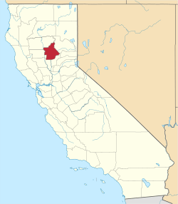
 Feather Falls Location in California  Feather Falls Feather Falls (the United States) | |
| Coordinates: 39°35′36″N 121°15′23″W | |
| Country | United States |
| State | California |
| County | Butte County |
| Elevation | 2,982 ft (909 m) |
There are large forested areas with not many towns on maps of the area. This part of the county is partly inside of Plumas National Forest. Three other small communities are about five miles (8 km) distant in different directions. Camp Eighteen lies 4.9 miles (7.9 km) distant at 61 degrees off true North, straight-line distance. Clipper Mills is about 6.5 miles (10.5 km) at 128 degrees off true North. Forbestown is roughly 5.3 miles (8.5 km) at 188 degrees off true North.
The US Geological Survey defines it as a populated place with a feature ID of 1656010. The community is 2,980 feet (910 m) above mean sea level. The area is inside area code 530. The community's ZIP code is 95940, which is shared with part of Oroville.
History

The Mooretown post office operated from 1888 to 1913. The Feather River post office opened for a time in 1919, and was re-established in 1921. The name was changed to Feather Falls that same year, and moved to its present location in 1938.[3]
In history, the community was called Mooretown and Moresville according to the US Geological Survey.
Other nearby communities to the north and east along Lumpkin Road are named Lumpkin and Rogerville.
The town was the eastern terminus of the Feather River Railway which ran west to Bidwell.
Climate
According to the Köppen Climate Classification system, Feather Falls has a warm-summer Mediterranean climate, abbreviated "Csa" on climate maps.[7]
References
- U.S. Geological Survey Geographic Names Information System: Feather Falls, California
- U.S. Geological Survey Geographic Names Information System: Feather Falls, California,
- Durham, David L. (1998). California's Geographic Names: A Gazetteer of Historic and Modern Names of the State. Clovis, Calif.: Word Dancer Press. p. 234. ISBN 1-884995-14-4.
- http://www.waterfallswest.com/waterfall.php?id=203
- "Archived copy". Archived from the original on 2011-01-28. Retrieved 2012-04-24.CS1 maint: archived copy as title (link)
- http://www.topoquest.com/map.php?lat=39.64294&lon=-121.27441&datum=nad83&zoom=4
- Climate Summary for Feather Falls, California
- U.S. Geological Survey Geographic Names Information System: Feather Falls, California
- US Geological Survey, National Geographic Names Database
- Map: Forbestown, California, 7.5 minute quadrangle, 1994, US Geological Survey.
- Map: Clipper Mills, California, 7.5 minute quadrangle, 1994, US Geological Survey.