Fatick
Fatick (Serer: Fatik[1][2]) is a town in Senegal, located between M'bour and Kaolack and inhabited by the Serer people. Its 2005 population was estimated at 24,243.[3] It is the capital of the Fatick Region and the Fatick Department.
Fatick | |
|---|---|
Town | |
 Fatick | |
| Coordinates: 14°20′0″N 16°24′25″W | |
| Country | |
| Region | Fatick Region |
| Population (2005) | |
| • Total | 24,243 |
| Time zone | UTC+0 (GMT) |
Toponymy
Its name (Fatick), including its region and department take their names from one of the Serer maternal clans (Fatik)—which derives from the Serer term Fati Ubadik ("we have more to go").[4]
History
The city has several ancient sites classified as historical monuments and added to the World heritage list.[5] There is also the site of Mind Ngo Mindiss, located in the Sine River, where libations and offerings are made, the site of Ndiobaye, where traditional ceremonies takes place, and Ndeb Jab, which houses a sacred tree at Ndiaye-Ndiaye. These sites are sacred places in Serer religion.[6] The Xooy ceremony (or Khoy), performed by the Serer high priests and priestesses (the Saltigues), takes place at Fatick once a year.[7]
Geography
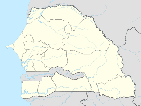
Fatick is located "in the savanna belt of the West African Sahel, a sandy arid region south of the Sahara desert."[8] The nearest towns are Nerane, Pourham, Mbirk Pourham and Tok. Dakar, the capital of Senegal, is located 155 km away.
Climate
Under Köppen-Geiger climate classification system, it has a hot semi-arid climate (BSh).
| Climate data for Fatick | |||||||||||||
|---|---|---|---|---|---|---|---|---|---|---|---|---|---|
| Month | Jan | Feb | Mar | Apr | May | Jun | Jul | Aug | Sep | Oct | Nov | Dec | Year |
| Average high °C (°F) | 32.7 (90.9) |
34.5 (94.1) |
36.5 (97.7) |
37 (99) |
37.1 (98.8) |
35.8 (96.4) |
33.4 (92.1) |
32.1 (89.8) |
32.5 (90.5) |
34.6 (94.3) |
35.4 (95.7) |
32.8 (91.0) |
34.5 (94.2) |
| Daily mean °C (°F) | 23.7 (74.7) |
25 (77) |
27 (81) |
27.8 (82.0) |
28.6 (83.5) |
29.2 (84.6) |
28.3 (82.9) |
27.4 (81.3) |
27.5 (81.5) |
28.1 (82.6) |
27 (81) |
24.3 (75.7) |
27.0 (80.6) |
| Average low °C (°F) | 14.8 (58.6) |
15.6 (60.1) |
17.5 (63.5) |
18.6 (65.5) |
20.2 (68.4) |
22.6 (72.7) |
23.2 (73.8) |
22.8 (73.0) |
22.6 (72.7) |
21.7 (71.1) |
18.7 (65.7) |
15.8 (60.4) |
19.5 (67.1) |
| Average precipitation mm (inches) | 1 (0.0) |
0 (0) |
0 (0) |
0 (0) |
1 (0.0) |
36 (1.4) |
123 (4.8) |
223 (8.8) |
180 (7.1) |
44 (1.7) |
2 (0.1) |
1 (0.0) |
611 (23.9) |
| Source: Climate-Data.org (altitude: 7m)[9] | |||||||||||||
Population
In the censuses of 1988 and 2002, the estimate population figures were 18,416 and 23,149 respectively. In 2007, according to official estimates, the population was 24,855.
Economy
Since the peanut trade is losing momentum, salt marshes are the main local resource.
Notable people from Fatick
- Macky Sall, former Prime Minister and current President of Senegal
- Chérif Ousmane Sarr, footballer
- Alioune Badara M'Bengue, politician
References
- Diouf, Babacar Sedikh, Maad a sinig: Kumba Ndoofeen fa Maak JUUF (Buka-Cilaas), 1853-1871, PAPF (1987), pp. 13, 26, 29
- Dioh, Irénée Guilane, Les hologrammes du seereer: parler de Faajut, Sénégal, Fasal (2009), pp. 108, 111, 112, ISBN 9782912436627
- "Esimation de la Population du Senegal" (PDF) (in French). Government of Senegal. Retrieved 13 January 2009.
- Université Cheikh Anta Diop, Faculté des Lettres et Sciences Humaines, Département d'Histoire, "Ñirohmol, un village déserté du Diokoul (Saloum) (XIVe-XXe siècle) : histoire et archéologie", p 24
- Senegal culture (gov web), retrieved 27 March 2003 "Archived copy". Archived from the original on 7 February 2012. Retrieved 8 June 2008.CS1 maint: archived copy as title (link)
- African Studies Quarterly, Volume 14, Issue 3 (March 2014), "Fed Up: Creating a New Type of Senegal through the Arts", Guest Editors: Enz, Molly Krueger and Bryson, Devin, Published by the Center for African Studies, University of Florida, p. 36 (note 5), ISSN 2152-2448 (Retrieved 4 June 2018)
- Révélation de saltigué : Touba va accueillir la dépouille d’une célébrité venue de Dakar (2001 Xoy) [in] La Sénégalaise, published 6/6/2011, (Retrieved : 13 July 2012)
- Newman & Ratliff (ed.), Paul & Martha (2001). Linguistic Fieldwork. Cambridge: Cambridge University Press. p. 190. Retrieved 29 March 2020.CS1 maint: extra text: authors list (link)
- "Climate: Fatick - Climate graph, Temperature graph, Climate table". Climate-Data.org. Retrieved 30 November 2013.