Fairfax, Minnesota
Fairfax is a city in Renville County, Minnesota, United States. The population was 1,235 at the 2010 census.[6]
Fairfax | |
|---|---|
| Motto(s): "A Good Place To Live" | |
 Location of Fairfax, Minnesota | |
| Coordinates: 44°31′35″N 94°43′12″W | |
| Country | United States |
| State | Minnesota |
| County | Renville |
| Area | |
| • Total | 1.31 sq mi (3.39 km2) |
| • Land | 1.31 sq mi (3.39 km2) |
| • Water | 0.00 sq mi (0.00 km2) |
| Elevation | 1,033 ft (315 m) |
| Population | |
| • Total | 1,235 |
| • Estimate (2018)[3] | 1,138 |
| • Density | 871.76/sq mi (336.67/km2) |
| Time zone | UTC-6 (Central (CST)) |
| • Summer (DST) | UTC-5 (CDT) |
| ZIP code | 55332 |
| Area code(s) | 507 |
| FIPS code | 27-20222[4] |
| GNIS feature ID | 0643498[5] |
| Website | City of Fairfax |
Minnesota State Highways 4 and 19 are two of the main arterial routes in the city.
Fort Ridgely State Park is nearby.
History
Fairfax was platted in 1882, and named after Fairfax County, Virginia.[7] A post office has been in operation at Fairfax since 1882.[8] Fairfax was incorporated in 1888.[7]
Geography
According to the United States Census Bureau, the city has a total area of 1.30 square miles (3.37 km2), all of it land.[9]
Demographics
| Historical population | |||
|---|---|---|---|
| Census | Pop. | %± | |
| 1890 | 351 | — | |
| 1900 | 642 | 82.9% | |
| 1910 | 815 | 26.9% | |
| 1920 | 1,066 | 30.8% | |
| 1930 | 916 | −14.1% | |
| 1940 | 1,116 | 21.8% | |
| 1950 | 1,143 | 2.4% | |
| 1960 | 1,489 | 30.3% | |
| 1970 | 1,432 | −3.8% | |
| 1980 | 1,405 | −1.9% | |
| 1990 | 1,276 | −9.2% | |
| 2000 | 1,295 | 1.5% | |
| 2010 | 1,235 | −4.6% | |
| Est. 2018 | 1,138 | [3] | −7.9% |
| U.S. Decennial Census | |||
2010 census
As of the census[2] of 2010, there were 1,235 people, 513 households, and 327 families living in the city. The population density was 950.0 inhabitants per square mile (366.8/km2). There were 577 housing units at an average density of 443.8 per square mile (171.4/km2). The racial makeup of the city was 92.6% White, 0.2% Native American, 0.2% Asian, 6.3% from other races, and 0.6% from two or more races. Hispanic or Latino of any race were 11.3% of the population.
There were 513 households of which 29.4% had children under the age of 18 living with them, 49.7% were married couples living together, 9.6% had a female householder with no husband present, 4.5% had a male householder with no wife present, and 36.3% were non-families. 32.2% of all households were made up of individuals and 16.5% had someone living alone who was 65 years of age or older. The average household size was 2.29 and the average family size was 2.87.
The median age in the city was 45.3 years. 23.2% of residents were under the age of 18; 6.3% were between the ages of 18 and 24; 20.1% were from 25 to 44; 27.6% were from 45 to 64; and 22.8% were 65 years of age or older. The gender makeup of the city was 49.0% male and 51.0% female.
2000 census
As of the census[4] of 2000, there were 1,295 people, 534 households, and 335 families living in the city. The population density was 1,006.6 people per square mile (387.6/km²). There were 589 housing units at an average density of 457.8 per square mile (176.3/km²). The racial makeup of the city was 92.90% White, 0.23% African American, 0.39% Native American, 0.08% Asian, 5.56% from other races, and 0.85% from two or more races. Hispanic or Latino of any race were 7.64% of the population.
There were 534 households out of which 29.0% had children under the age of 18 living with them, 52.1% were married couples living together, 7.3% had a female householder with no husband present, and 37.1% were non-families. 33.3% of all households were made up of individuals and 22.1% had someone living alone who was 65 years of age or older. The average household size was 2.32 and the average family size was 2.96.
In the city, the population was spread out with 25.9% under the age of 18, 6.6% from 18 to 24, 22.8% from 25 to 44, 17.1% from 45 to 64, and 27.7% who were 65 years of age or older. The median age was 41 years. For every 100 females, there were 86.1 males. For every 100 females age 18 and over, there were 84.3 males.
The median income for a household in the city was $33,700, and the median income for a family was $42,054. Males had a median income of $28,125 versus $19,779 for females. The per capita income for the city was $18,297. About 6.4% of families and 9.2% of the population were below the poverty line, including 10.2% of those under age 18 and 10.5% of those age 65 or over.
Local media
Newspapers
- The Eagle Extra[10][11] - Weekly newspaper, first published on June 21, 2007 as 'The Eagle', then changed to 'The Eagle Extra' on March 6, 2008 due to a naming conflict with The Eagle newspaper in Texas. As of October 2010, The circulation of The Eagle Extra was under 200.[12][13]
- Fairfax Standard/Gazette
References
- "2017 U.S. Gazetteer Files". United States Census Bureau. Retrieved Jan 3, 2019.
- "American FactFinder". United States Census Bureau. Archived from the original on 2020-02-12. Retrieved 2012-11-13.
- "Population and Housing Unit Estimates". Retrieved February 9, 2020.
- "American FactFinder". United States Census Bureau. Archived from the original on 2020-02-12. Retrieved 2008-01-31.
- "US Board on Geographic Names". United States Geological Survey. 2007-10-25. Retrieved 2008-01-31.
- "2010 Census Redistricting Data (Public Law 94-171) Summary File". American FactFinder. United States Census Bureau. Retrieved 27 April 2011.
- Upham, Warren (1920). Minnesota Geographic Names: Their Origin and Historic Significance. Minnesota Historical Society. p. 457.
- "Renville County". Jim Forte Postal History. Archived from the original on 21 January 2016. Retrieved 5 August 2015.
- "US Gazetteer files 2010". United States Census Bureau. Archived from the original on 2012-01-25. Retrieved 2012-11-13.
- "Archived copy". Archived from the original on 2011-02-02. Retrieved 2010-11-03.CS1 maint: archived copy as title (link)
- http://www.cityoffairfax-mn.gov/index.asp?Type=B_BASIC&SEC={970FBCF8-CE9F-48FC-AFBC-01EEDB61D38C}&DE={794543D0-95E2-4A90-BE4A-D7E7E610BB59}
- "Archived copy". Archived from the original on 2011-01-02. Retrieved 2010-11-03.CS1 maint: archived copy as title (link)
- "Archived copy". Archived from the original on 2010-04-12. Retrieved 2010-11-03.CS1 maint: archived copy as title (link)
External links
Municipalities and communities of Renville County, Minnesota, United States | ||
|---|---|---|
| Cities | 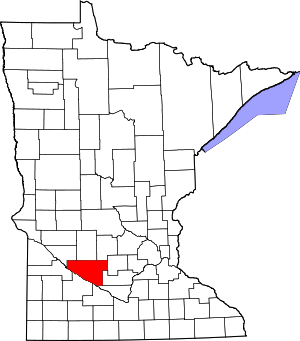 Map of Minnesota highlighting Renville County | |
| Townships | ||
| Unincorporated communities | ||
| Ghost town | ||
| Footnotes | ‡This populated place also has portions in an adjacent county or counties | |
| Authority control |
|---|