Estella, Wisconsin
Estella is a town in Chippewa County in the U.S. state of Wisconsin. The population was 433 at the 2010 census.[3]
Estella, Wisconsin | |
|---|---|
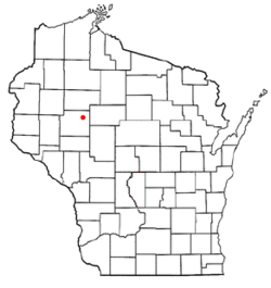 Location of Estella, Wisconsin | |
| Coordinates: 45°10′26″N 91°7′16″W | |
| Country | |
| State | |
| County | Chippewa |
| Area | |
| • Total | 32.0 sq mi (82.9 km2) |
| • Land | 31.4 sq mi (81.4 km2) |
| • Water | 0.6 sq mi (1.6 km2) |
| Elevation | 1,152 ft (351 m) |
| Population (2010) | |
| • Total | 433 |
| • Density | 14/sq mi (5.3/km2) |
| Time zone | UTC-6 (Central (CST)) |
| • Summer (DST) | UTC-5 (CDT) |
| Area code(s) | 715 & 534 |
| FIPS code | 55-24375[2] |
| GNIS feature ID | 1583173[1] |
| PLSS township | Most of T31N R6W and bits of T31N R7W |
Geography
The shape of Estella is irregular. The east end is a rectangle 6 miles (10 km) north to south and 3 miles (5 km) wide. The west end follows the Chippewa River, except for a section which is part of the city of Cornell.
According to the United States Census Bureau, the town has a total area of 32.0 square miles (82.9 km2), of which 31.4 square miles (81.4 km2) is land and 0.62 square miles (1.6 km2), or 1.89%, is water.[3]
History
The general area that would become Estella was first surveyed in 1847 by a crew working for the U.S. government. In 1852 a different crew marked all the section corners of the township, walking through the woods and wading the rivers, measuring with chain and compass.[4][5] When done, the deputy surveyor filed this general description of the six by six mile square which overlays most of the modern township:
This Township contains a number of Cedar & Tamarac swamp, all unfit for cultivation. The Surface generally level(?) and heavily(?) timbered with Pine, Hemlock, Tamarac Sugar Maple & Birch. Soil second to third rate and a part fit for cultivation. Chippewa and Fisher Rivers runs through the NorthWest corner of this Township. The banks of this River are high and generally covered with pine and Hemlock timber.[6]
The town was named for Laura Estella Flint, the wife of Warren S. Flint, a local business owner who became the first postmaster in 1886.[7]
Demographics
| Historical population | |||
|---|---|---|---|
| Census | Pop. | %± | |
| 1990 | 449 | — | |
| 2000 | 469 | 4.5% | |
| 2010 | 433 | −7.7% | |
| Est. 2014 | 443 | 2.3% | |
As of the census[2] of 2000, there were 469 people, 167 households, and 131 families residing in the town. The population density was 14.9 people per square mile (5.7/km²). There were 190 housing units at an average density of 6.0 per square mile (2.3/km²). The racial makeup of the town was 98.93% White, 0.43% Native American, 0.43% Asian, and 0.21% from two or more races.
There were 167 households out of which 37.7% had children under the age of 18 living with them, 69.5% were married couples living together, 4.8% had a female householder with no husband present, and 21.0% were non-families. 18.0% of all households were made up of individuals and 8.4% had someone living alone who was 65 years of age or older. The average household size was 2.81 and the average family size was 3.14.
In the town, the population was spread out with 27.9% under the age of 18, 6.8% from 18 to 24, 27.5% from 25 to 44, 27.9% from 45 to 64, and 9.8% who were 65 years of age or older. The median age was 36 years. For every 100 females, there were 103.9 males. For every 100 females age 18 and over, there were 112.6 males.
The median income for a household in the town was $38,250, and the median income for a family was $42,222. Males had a median income of $28,558 versus $19,667 for females. The per capita income for the town was $14,237. About 4.6% of families and 7.1% of the population were below the poverty line, including 1.5% of those under age 18 and 5.4% of those age 65 or over.
References
- "US Board on Geographic Names". United States Geological Survey. 2007-10-25. Retrieved 2008-01-31.
- "U.S. Census website". United States Census Bureau. Retrieved 2008-01-31.
- "Geographic Identifiers: 2010 Demographic Profile Data (G001): Estella town, Chippewa County, Wisconsin". U.S. Census Bureau, American Factfinder. Retrieved September 16, 2015.
- "Land Survey Information". Board of Commissioners of Public Lands. Retrieved 26 March 2011.
- "Field Notes for T31N R6W". Original Field Notes and Plat Maps, 1833-1866. Board of Commissioners of Public Lands. Retrieved 13 March 2013.
- Harrison, J. M. "Interior Field Notes (1852)". Board of Commissioners of Public Lands. Retrieved 2013-03-13.
- Callary, Edward. Place Names of Wisconsin. Madison, WI: University of Wisconsin Press. pp. 90–91. ISBN 978-0-299-30964-0.
External links
- Estella, Wisconsin from the Dictionary of Wisconsin History
Municipalities and communities of Chippewa County, Wisconsin, United States | ||
|---|---|---|
| Cities | 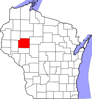 | |
| Villages | ||
| Towns | ||
| CDPs | ||
| Unincorporated communities | ||
| Footnotes | ‡This populated place also has portions in an adjacent county or counties | |