Erraran
Erraran (from Irish: Airearan, meaning "Land bordering a Lake" (i.e. Brackley Lake) is a townland in the civil parish of Templeport, County Cavan, Ireland. It lies in the Roman Catholic parish of Templeport and barony of Tullyhaw.
Geography
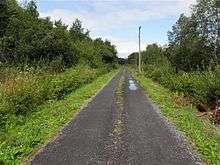
Erraran is bounded on the north by Derrymony and Killyneary townlands, on the west by Tirnawannagh and Gortnacargy townlands in Corlough parish, on the south by Newtown, Templeport and Kilsob townlands and on the east by Bawnboy townland. Its chief geographical features are Brackley Lough, Lough Namoyle (Loch na Maoile = The Lake of the Bare Hill), a stream and dug wells. Erraran is traversed by minor roads and rural lanes. The townland covers 155 statute acres.[1]
History
The 1609 Baronial Map depicts the townland as Brurin.[2]
The 1652 Commonwealth Survey spells the name as Oreren.
The 1665 Down Survey map depicts it as Errierrin.[3]
The 1652 Commonwealth Survey lists the proprietor as being Mr Robert Reece.
In the Hearth Money Rolls of 1662 there were no people paying the Hearth Tax in Erraran.
A grant dated 30 January 1668 was made by King Charles II of England to John French in ye pole of Araron containing 25 acres and 2 roods at an annual rent of £0- 6s-10 1/2d.[4]
A grant dated 9 September 1669 from King Charles II of England to Arthur Annesley, 1st Earl of Anglesey included, inter alia, part of Urrierren containing 53 acres at an annual rent of £0-14s-3 1/2d and in the same 13 acres at £0-3s-6d.[5]
A deed dated 24 December 1720 between Morley Saunders and John Enery includes the lands of Uraran.
A lease dated 10 December 1774 from William Crookshank to John Enery of Bawnboy includes the lands of Urraran.[6] A further deed by John Enery dated 13 December 1774 includes the lands of Frenche's part of Urraran otherwise Urraren.[7]
The 1790 Cavan Carvaghs list spells the name as Uriron.[8]
A rental of the Annesley Estate dated c.1802 where it is spelled Urreran, refers to a Quire Lease from the Annesley estate to the tenant Robert Cross.[9]
The Tithe Applotment Books for 1827 list seven tithepayers in the townland.[10]
In 1833 one person in Erraran was registered as a keeper of weapons- Pat Magauran.[11]
The Erraran Valuation Office Field books are available for September 1839.[12][13]
Griffith's Valuation of 1857 lists seven landholders in the townland.[14]
Census
| Year | Population | Males | Females | Total Houses | Uninhabited |
|---|---|---|---|---|---|
| 1841 | 68 | 41 | 27 | 10 | 0 |
| 1851 | 34 | 17 | 17 | 6 | 0 |
| 1861 | 30 | 14 | 16 | 5 | 0 |
| 1871 | 27 | 11 | 16 | 4 | 0 |
| 1881 | 27 | 14 | 13 | 4 | 0 |
| 1891 | 24 | 14 | 10 | 4 | 0 |
In the 1901 census of Ireland, there are four families listed in the townland [15] and in the 1911 census of Ireland, there are still four families listed in the townland.[16]
Antiquities
There don't appear to be any structures of historical interest in the townland apart from a graphitised iron cauldron which was found near a crannog in multiple fragments.[17]
References
- "IreAtlas". Retrieved 29 February 2012.
- National Archives Dublin
- Trinity College Dublin: The Down Survey of Ireland.
- Rental of a County Cavan Estate, CA.1802 by R. Andrew Pierce, in 'Journal of the Genealogical Society of Ireland', Vol. 6 (2005), No. 4, p. 40.
- and and
- Census of Ireland 1911
External links
Places in County Cavan | ||
|---|---|---|
| Towns |  | |
| Villages |
| |
| Townlands | ||
| ||