Erin, Tennessee
Erin is a city in and the county seat of Houston County, Tennessee, United States.[6] The population was 1,490 at the 2000 census, and 1,324 at the 2010 census.
Erin, Tennessee | |
|---|---|
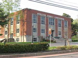 Houston County Courthouse | |
| Nickname(s): Irish Town Tennessee | |
 Location of Erin in Houston County, Tennessee. | |
| Coordinates: 36°19′1″N 87°41′53″W | |
| Country | United States |
| State | Tennessee |
| County | Houston |
| Settled | approx. 1780 |
| Government | |
| • Mayor | Paul Bailey [1] |
| Area | |
| • Total | 3.90 sq mi (10.10 km2) |
| • Land | 3.90 sq mi (10.09 km2) |
| • Water | 0.00 sq mi (0.01 km2) |
| Elevation | 480 ft (146 m) |
| Population (2010) | |
| • Total | 1,324 |
| • Estimate (2018)[3] | 1,292 |
| • Density | 331.62/sq mi (128.03/km2) |
| Time zone | UTC-6 (CST) |
| • Summer (DST) | UTC-5 (CDT) |
| ZIP code | 37061 |
| Area code(s) | 931 |
| FIPS code | 47-24320[4] |
| GNIS feature ID | 1283839[5] |
| Website | www |
Geography
Erin is located at 36°19′1″N 87°41′53″W (36.316998, -87.697946).[8] The elevation is 480 feet above sea level.
According to the United States Census Bureau, the city has a total area of 4.1 square miles (11 km2), all land.
Major roads and highways
- State Route 13
- State Route 49 (Main Street)
- State Route 149
ZIP code
The ZIP code used in the Erin area is 37061.
Area code
Erin uses the area code 931.
Government
- Board of Aldermen & Mayor meets first Tuesday of the month at 6:00 p.m. at Erin City Hall.
- Planning Commission meets on the fourth Monday of the month at 6:00 p.m. at Erin City Hall.
Elected officials
- City Mayor: Paul Bailey
- City Recorder: Angela Neilson
- City Bookkeeper: Cheryl Hollis
- City Clerks: Betty Beard and Farrah Dennis
Aldermen
- Ward 1: Lou Anne Pollard and Wanda Lockhart
- Ward 2: Betsy Ligon (Vice Mayor) and Cecil Baggett
- Ward 3: Linda Owens and Nethla Shires
- Ward 4: Loraine Beechum and Paul J. Gooden
Demographics
| Historical population | |||
|---|---|---|---|
| Census | Pop. | %± | |
| 1880 | 485 | — | |
| 1890 | 789 | 62.7% | |
| 1910 | 943 | — | |
| 1920 | 855 | −9.3% | |
| 1930 | 819 | −4.2% | |
| 1940 | 905 | 10.5% | |
| 1950 | 858 | −5.2% | |
| 1960 | 1,097 | 27.9% | |
| 1970 | 1,165 | 6.2% | |
| 1980 | 1,614 | 38.5% | |
| 1990 | 1,586 | −1.7% | |
| 2000 | 1,490 | −6.1% | |
| 2010 | 1,324 | −11.1% | |
| Est. 2018 | 1,292 | [3] | −2.4% |
| Sources:[9][10] | |||
As of the census[4] of 2000, there were 1,490 people, 588 households, and 355 families residing in the city. The population density was 363.6 people per square mile (140.3/km²). There were 653 housing units at an average density of 159.4 per square mile (61.5/km²). The racial makeup of the city was 86.38% White, 10.40% African American, 0.27% Native American, 0.67% from other races, and 2.28% from two or more races. Hispanic or Latino of any race were 0.94% of the population.
There were 588 households out of which 28.4% had children under the age of 18 living with them, 40.1% were married couples living together, 16.3% had a female householder with no husband present, and 39.5% were non-families. 37.2% of all households were made up of individuals and 21.9% had someone living alone who was 65 years of age or older. The average household size was 2.23 and the average family size was 2.92.
In the city the population was spread out with 22.3% under the age of 18, 7.6% from 18 to 24, 22.4% from 25 to 44, 22.3% from 45 to 64, and 25.4% who were 65 years of age or older. The median age was 43 years. For every 100 females, there were 81.7 males. For every 100 females age 18 and over, there were 74.5 males.
The median income for a household in the city was $23,107, and the median income for a family was $30,833. Males had a median income of $26,484 versus $18,333 for females. The per capita income for the city was $15,281. About 19.2% of families and 23.7% of the population were below the poverty line, including 30.4% of those under age 18 and 25.1% of those age 65 or over.
Schools
Public high schools
- Houston County Adult High School - (Students: 2; Location: 3573 West Main Street; Grades: 11 - 12)
- Houston County High School - (Location: Hwy 149 Street; Grades: 09 - 12)
Public primary/middle schools
- Erin Elementary School - (Students: 456; Location: 6500 State Route 13; Grades: KG - 05)
- Houston County Middle School - (Students: 338; Location: 1241 West Main Street; Grades: 06 - 08)
Major Events
- Irish Day Parade - Held every 3rd Saturday of March.
References
- Erin official website. Accessed 18 October 2015.
- "2018 U.S. Gazetteer Files". United States Census Bureau. Retrieved February 23, 2020.
- "Population and Housing Unit Estimates". United States Census Bureau. June 27, 2019. Retrieved June 4, 2019.
- "U.S. Census website". United States Census Bureau. Retrieved 2008-01-31.
- "US Board on Geographic Names". United States Geological Survey. 2007-10-25. Retrieved 2008-01-31.
- "Find a County". National Association of Counties. Archived from the original on 2011-05-31. Retrieved 2011-06-07.
- Deigman, John (Dec 30, 1891). "Ireland in America". The Canadian Statesman. p. 2. Retrieved 14 October 2015.
- "US Gazetteer files: 2010, 2000, and 1990". United States Census Bureau. 2011-02-12. Retrieved 2011-04-23.
- "Census of Population and Housing: Decennial Censuses". United States Census Bureau. Retrieved 2012-03-04.
- "Incorporated Places and Minor Civil Divisions Datasets: Subcounty Resident Population Estimates: April 1, 2010 to July 1, 2012". Population Estimates. U.S. Census Bureau. Archived from the original on 11 June 2013. Retrieved 11 December 2013.
External links
Municipalities and communities of Houston County, Tennessee, United States | ||
|---|---|---|
| City | ||
| Town | ||
| Unincorporated communities | ||
| Footnotes | ‡This populated place also has portions in an adjacent county or counties | |
| Authority control |
|
|---|