Erath, Louisiana
Erath is a town in Vermilion Parish, Louisiana, United States. The population was 2,114 at the 2010 census. It is part of the Abbeville Micropolitan Statistical Area and home of The Acadian Museum.
Erath, Louisiana | |
|---|---|
Town | |
| Town of Erath | |
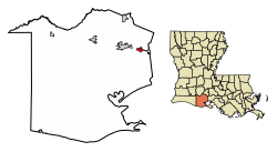 Location of Erath in Vermilion Parish, Louisiana. | |
.svg.png) Location of Louisiana in the United States | |
| Coordinates: 29°57′36″N 92°02′07″W | |
| Country | United States |
| State | Louisiana |
| Parish | Vermilion |
| Government | |
| Area | |
| • Total | 1.76 sq mi (4.55 km2) |
| • Land | 1.76 sq mi (4.55 km2) |
| • Water | 0.00 sq mi (0.00 km2) |
| Elevation | 7 ft (2 m) |
| Population (2010) | |
| • Total | 2,114 |
| • Estimate (2018)[2] | 2,065 |
| • Density | 1,200.34/sq mi (463.52/km2) |
| Time zone | UTC-6 (CST) |
| • Summer (DST) | UTC-5 (CDT) |
| Area code(s) | 337 |
| FIPS code | 22-24180 |
| Website | townoferath |
History
Erath is named after August Erath (18 March 1843 - 11 September 1900)[3] who emigrated from Switzerland to New Orleans in 1860 and was bookkeeper in the breweries. He moved to New Iberia in 1876 and erected a brewery there. Erath was later mayor of New Iberia and began to develop land in the Erath area. Although August Erath never lived in Erath, he was close to railroad officials, which brought forth a great business venture for him.[4] Later, Erath built a seltzer water factory in New Iberia and an ice plant in Abbeville. In 1884, he started a hardware business and purchased land located in this area.[5]
In 2005, the storm surge forced inland by Hurricane Rita flooded most of the town. Water in most parts of town was up to six feet deep. Overall, the cost of the damage total was estimated to have cost approximately $5,000 alone in Erath.
Geography
Erath is located at 29°57′36″N 92°2′7″W (29.959939, -92.035220).[6]
According to the United States Census Bureau, the town has a total area of 1.5 square miles (3.9 km2), all land.
Demographics
| Historical population | |||
|---|---|---|---|
| Census | Pop. | %± | |
| 1900 | 215 | — | |
| 1910 | 575 | 167.4% | |
| 1920 | 713 | 24.0% | |
| 1930 | 895 | 25.5% | |
| 1940 | 1,408 | 57.3% | |
| 1950 | 1,514 | 7.5% | |
| 1960 | 2,019 | 33.4% | |
| 1970 | 2,024 | 0.2% | |
| 1980 | 2,259 | 11.6% | |
| 1990 | 2,428 | 7.5% | |
| 2000 | 2,187 | −9.9% | |
| 2010 | 2,114 | −3.3% | |
| Est. 2018 | 2,065 | [2] | −2.3% |
| U.S. Decennial Census[7] | |||
As of the census[8] of 2000, there were 2,187 people, 819 households, and 580 families residing in the town. The population density was 1,453.7 people per square mile (562.9/km²). There were 884 housing units at an average density of 589.6 per square mile (228.3/km²). The racial makeup of the town was 89.12% White, 6.22% African American, 0.18% Native American, 3.52% Asian, 0.32% from other races, and 0.64% from two or more races. Hispanic or Latino of any race were 0.69% of the population.
There were 819 households out of which 35.0% had children under the age of 18 living with them, 50.7% were married couples living together, 16.1% had a female householder with no husband present, and 29.1% were non-families. 25.9% of all households were made up of individuals and 12.5% had someone living alone who was 65 years of age or older. The average household size was 2.56 and the average family size was 3.09.
In the town, the population was spread out with 26.2% under the age of 18, 10.2% from 18 to 24, 27.0% from 25 to 44, 19.9% from 45 to 64, and 16.6% who were 65 years of age or older. The median age was 36 years. For every 100 females, there were 83.0 males. For every 100 females age 18 and over, there were 77.2 males.
The median income for a household in the town was $27,836, and the median income for a family was $36,204. Males had a median income of $28,750 versus $19,118 for females. The per capita income for the town was $13,327. About 15.5% of families and 18.2% of the population were below the poverty line, including 22.0% of those under age 18 and 24.7% of those age 65 or over.
"Henry" Hub
Erath is home to Henry Hub, an important junction of natural gas pipeline systems. Natural gas prices in North America are more or less set at this junction.
The "Henry" hub is so named for its location in the Henry hamlet of Erath, which was named after the Henry High School that stood there until damage from flooding due to Hurricane Rita forced its closure and demolition. This school was named for its benefactor, William Henry, who originally immigrated from Copenhagen, Denmark as Ludwig Wilhelm Kattentidt, circa 1840,[9] then dropped the surname and used his father's middle 'Heinrich' for his surname of Henry. There are Henry descendants in the area to this day.
It was customary for benefactors to sponsor schools; there were quite a few similarly sponsored schools in Vermilion Parish around that time.[10] Being that long ago and in a rural area, with schools sometimes sponsored even in homes, there was great variation in what was offered to how many, and it often changed over time. Records say that the Henry school was founded in 1877,[10] and apparently became a high school in 1896 because it celebrated its centennial in 1996.[9]
In 1992, the Vermilion Parish school district reorganized the schools.[11] Students transferred to Erath High, and Henry High became an elementary school. Then on September 24, 2005 (less than a month after Hurricane Katrina), Hurricane Rita smashed the parish and ruined the school. The area was also hit hard two years later by Hurricane Ike, and the main building was finally razed around March 2009.[11] Likewise, St. John Catholic Church across the street had its rectory damaged; it is being replaced with a new building elevated to meet new flood standards as of early 2014.
When land for the Henry school was bequeathed, it was stipulated for education into perpetuity, or to be returned to the heirs. The gymnasium was salvaged and is still used by the school district to this day.[12] A Google Earth comparison of, for example, Feb. 28, 2006 to April 23, 2012 at the intersection of Highways 330 and 689 shows a parking lot where the main school was, and the church's rectory gone, but the gymnasium in clear use.
Notable people
- Dudley J. LeBlanc, served in legislature and ran for governor on three occasions
- Doris Leon "D. L." Menard, songwriter, performer, and recording artist
- Randy Romero, Thoroughbred Racing Hall of Fame jockey
- Roy R. Theriot, mayor of Abbeville and Louisiana state comptroller[13]
References
- "2016 U.S. Gazetteer Files". United States Census Bureau. Retrieved Jul 2, 2017.
- "Population and Housing Unit Estimates". Retrieved December 21, 2019.
- https://www.familysearch.org/tree/person/sources/L1CF-PDK
- "Town of Erath named after founder". The Morning Star. June 30, 1982. p. 9.
- "The History of Erath, Louisiana". Archived from the original on 16 October 2014. Retrieved 10 October 2014.
- "US Gazetteer files: 2010, 2000, and 1990". United States Census Bureau. 2011-02-12. Retrieved 2011-04-23.
- "Census of Population and Housing". Census.gov. Retrieved June 4, 2015.
- "U.S. Census website". United States Census Bureau. Retrieved 2008-01-31.
- Perrin, Warren A. (2011). Vermilion Parish. Mt. Pleasant, SC: Arcadia Pub. p. 27. ISBN 9780738582245. Retrieved 29 January 2014.
- Bodin, Stacy. "History of the Erath Schools". Vermilion Parish Schools. Archived from the original on 3 February 2014. Retrieved 29 January 2014.
- "Henry High being torn down". Vermilion Today. 25 March 2009. Archived from the original on 2014-03-08. Retrieved 30 January 2014.
- "Very Special Arts Festival takes place in Vermilion Parish in Henry High gym". Vermilion Today. 25 April 2012. Archived from the original on 2014-03-08. Retrieved 30 January 2014.
- "Roy Theriot". A Dictionary of Louisiana Biography, Vol. 2 (1988), p. 785. Archived from the original on 2010-09-23. Retrieved June 22, 2013.
External links
Municipalities and communities of Vermilion Parish, Louisiana, United States | ||
|---|---|---|
Parish seat: Abbeville | ||
| Cities | 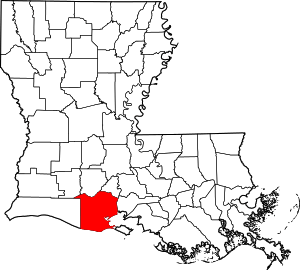 | |
| Town | ||
| Village | ||
| Unincorporated communities | ||
| Footnotes | ‡This populated place also has portions in an adjacent parish or parishes | |